IMAGES FROM CHAPTER 1
please check gray text for attribution and licensing restrictions
images in copyright are not available for download
| FIGURE 1.1 |
| International Map of the World, Hudson River, 1927 | |
| US Geological Survey Public Domain: US government | |
| FIGURE 1.2 |
| International Map of the World adherents as of 1913 | |
| William Rankin Creative Commons BY-NC-SA | |
 | FIGURE 1.3 |
| A map at 1:2,000,000 – “Northern Great Lakes States" from The National Atlas of the United States of America (1970) | |
 |
A map at 1:1,000,000 – International Map of the World, Lake Superior (1966) |
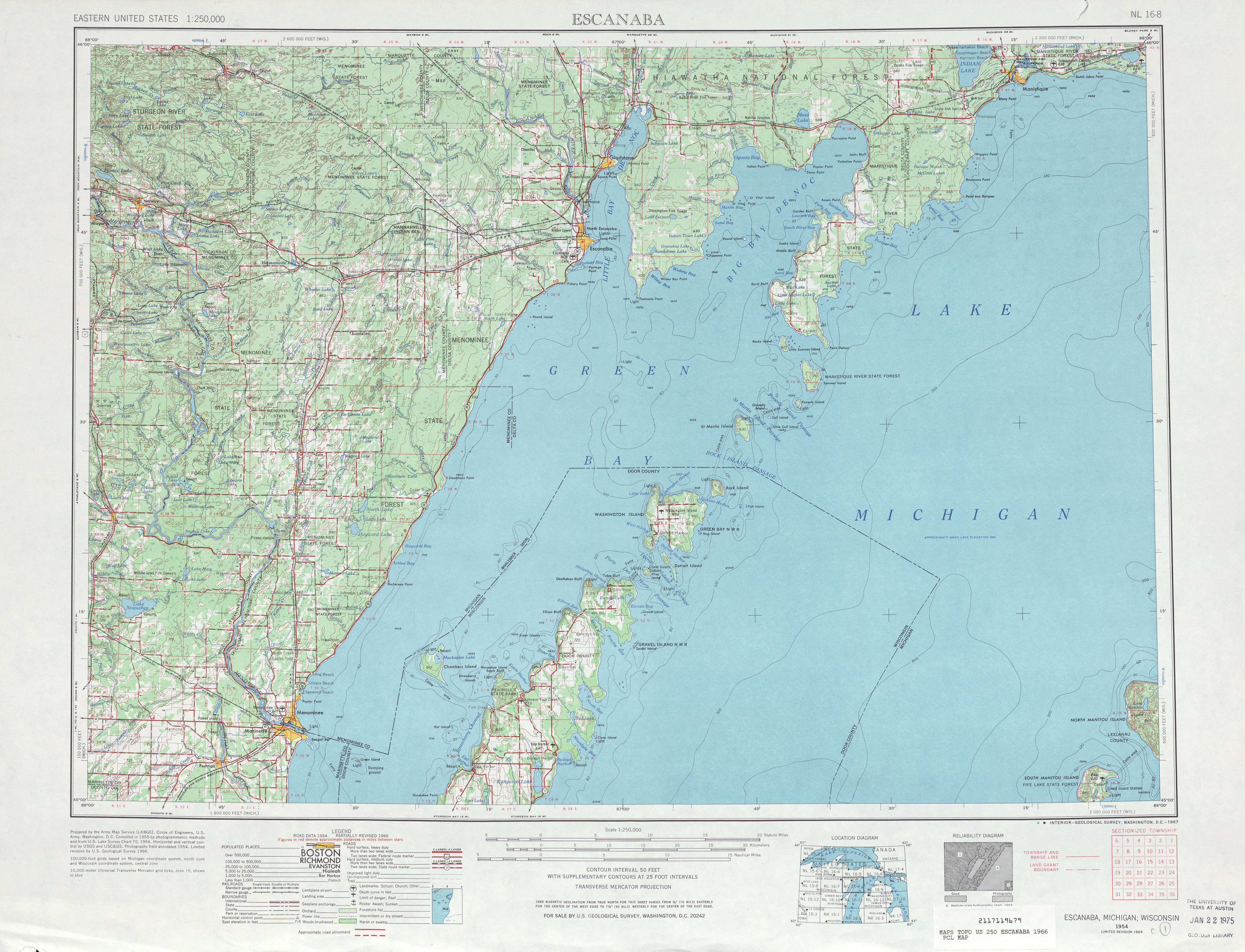 |
A map at 1:250,000 – Escanaba sheet from series V501 (1967) |
| all US Geological Survey Public Domain: US government | |
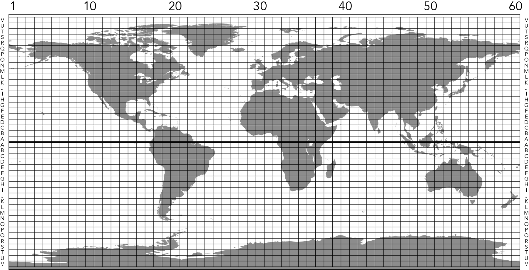
| FIGURE 1.4 |
| Grid of the International Map of the World download grid as a GIS layer | |
| William Rankin Creative Commons BY-NC-SA | |
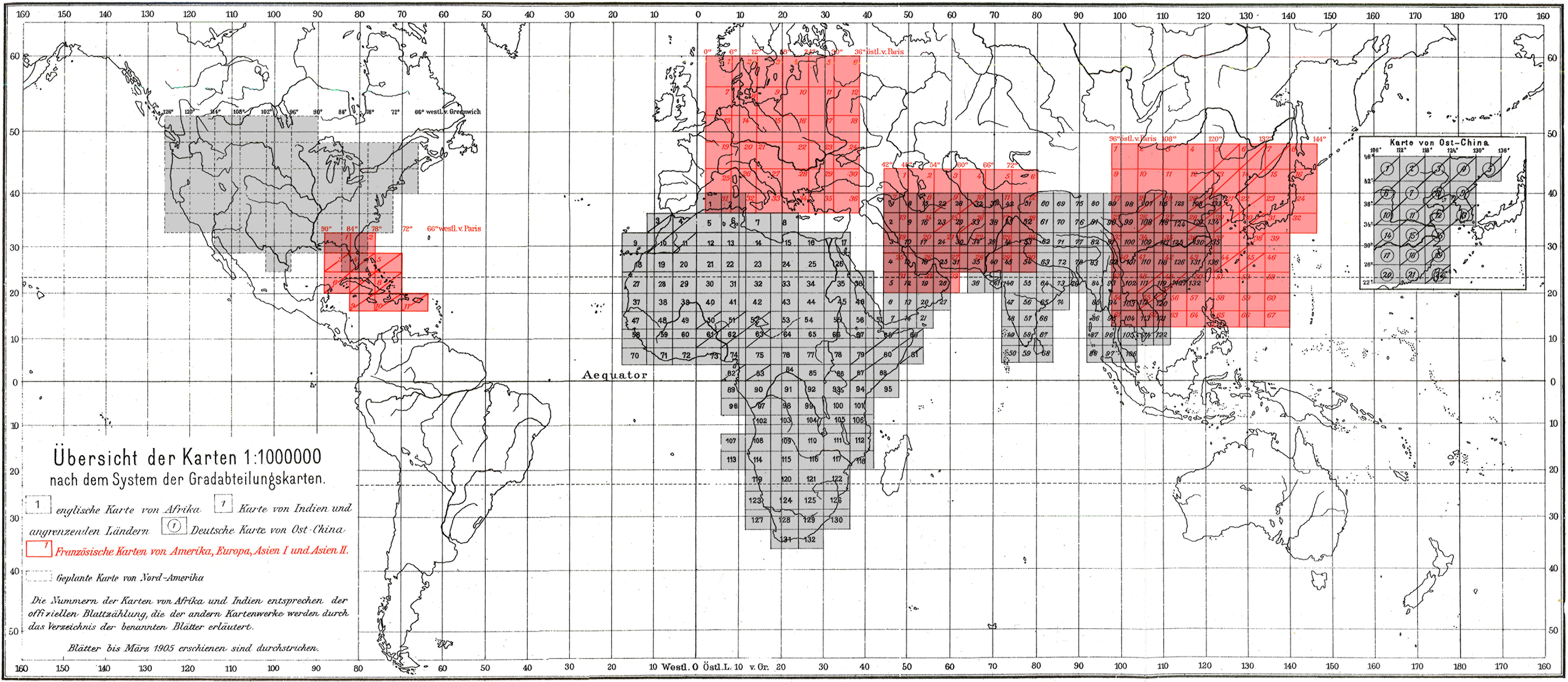
| FIGURE 1.5 |
| Mapping projects at 1:1,000,000 as of 1905 | |
| from Albrecht Penck, “Fortschritte in der Herstellung einer Erdkarte in Maßtabe 1 : 1 000 000,” Zeitschrift der Gesellschaft für Erdkunde zu Berlin (1905); shading added Public Domain: copyright expired | |
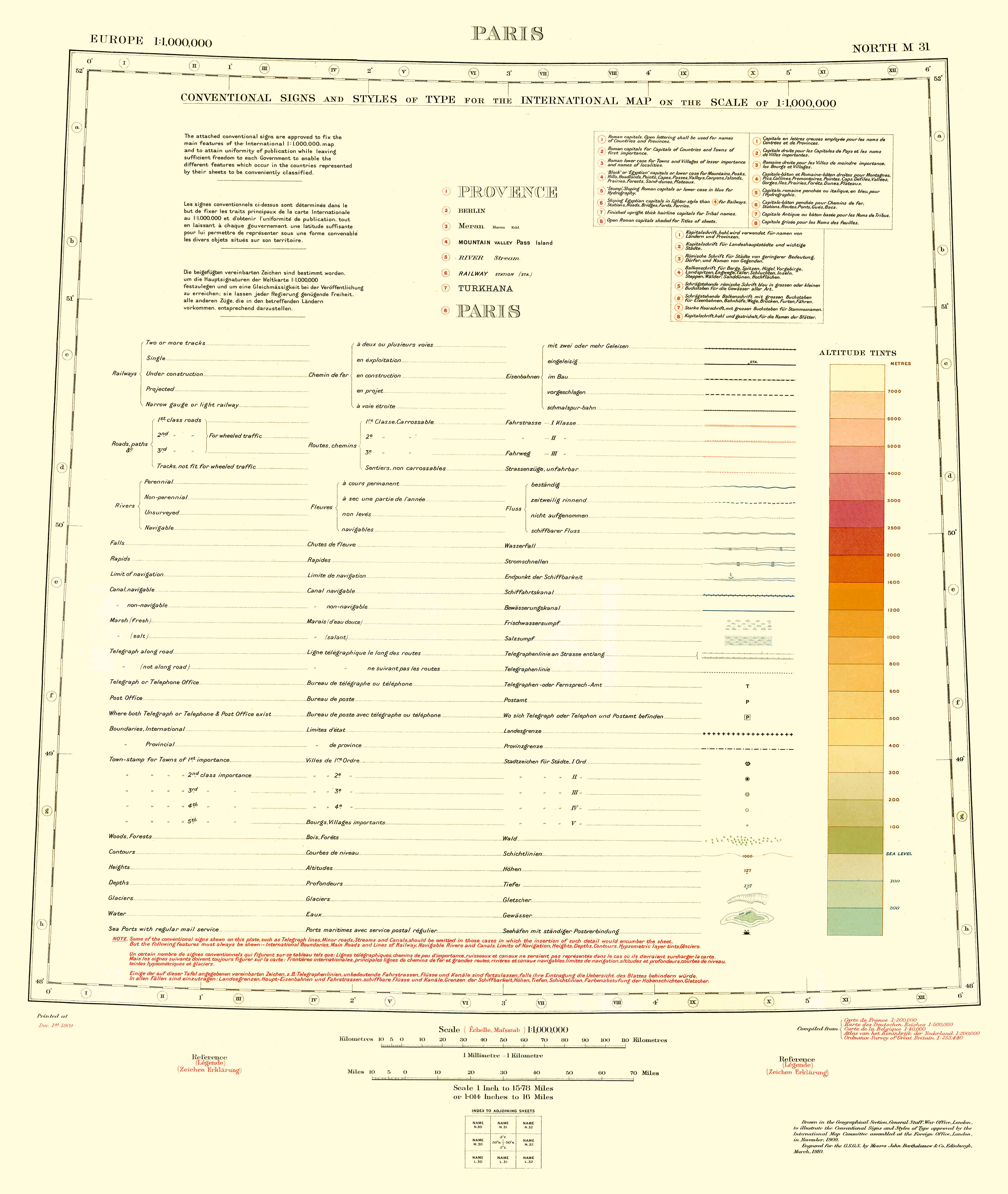
| FIGURE 1.6 |
| Symbols for the International Map of the World, as approved in 1909 | |
| from Resolutions and Proceedings of the International Map Committee assembled in London, November, 1909 (London: HMSO, 1910) Public Domain: copyright expired | |
| FIGURE 1.7 |
| Symbols for the International Map of the World, as approved in 1913 | |
| from Carte du Monde au Millionième: Comptes Rendus des séances de la deuxième conférence internationale, Paris, décembre 1913 (Paris: Service Géographique, 1914) Public Domain: copyright expired | |
| FIGURE 1.8 |
| Comparison of 1909 and 1913 elevation colors for the International Map of the World | |
| from Resolutions and Proceedings of the International Map Committee assembled in London, November, 1909 (London: HMSO, 1910) and Carte du Monde au Millionième: Comptes Rendus des séances de la deuxième conférence internationale, Paris, décembre 1913 (Paris: Service Géographique, 1914) Public Domain: copyright expired | |
| FIGURE 1.9 |
| Responsibility for the International Map of the World in Africa, as approved in 1913 | |
| William Rankin Creative Commons BY-NC-SA | |
| FIGURE 1.10 |
| Comparison of symbols for the International Map of the World with other topographic maps of the same era | |
| William Rankin Creative Commons BY-NC-SA | |

| FIGURE 1.11 |
| Typical land-cover symbols from the early twentieth century | |
| from John Clayton Tracy, Plane Surveying: A Text-book and Pocket Manual (New York: John Wiley & Sons, 1906), 521 Public Domain: copyright expired | |
| FIGURE 1.12 |
| Frontispiece to the International Map of the World annual reports | |
| from Carte du Monde au Millionième: Rapport pour 1921 (Southampton: Ordnance Survey, 1922) Public Domain: copyright expired | |
| NOTE 1.71 |
| Members of the International Commission for Air Navigation as of 1939 | |
| William Rankin Creative Commons BY-NC-SA | |
| FIGURE 1.13 |
| French aeronautical chart, Chalons (1911) | |
| from P. Pollacchi, “La carte aéronautique du service géographique de l’armée,” Annales de Géographie 20, no. 112 (1911), plate 18 Public Domain: copyright expired | |
| FIGURE 1.14 |
| Aeronautical adaptation of the International Map of the World sheet for London (1934) | |
| British War Office Public Domain: expired Crown Copyright | |
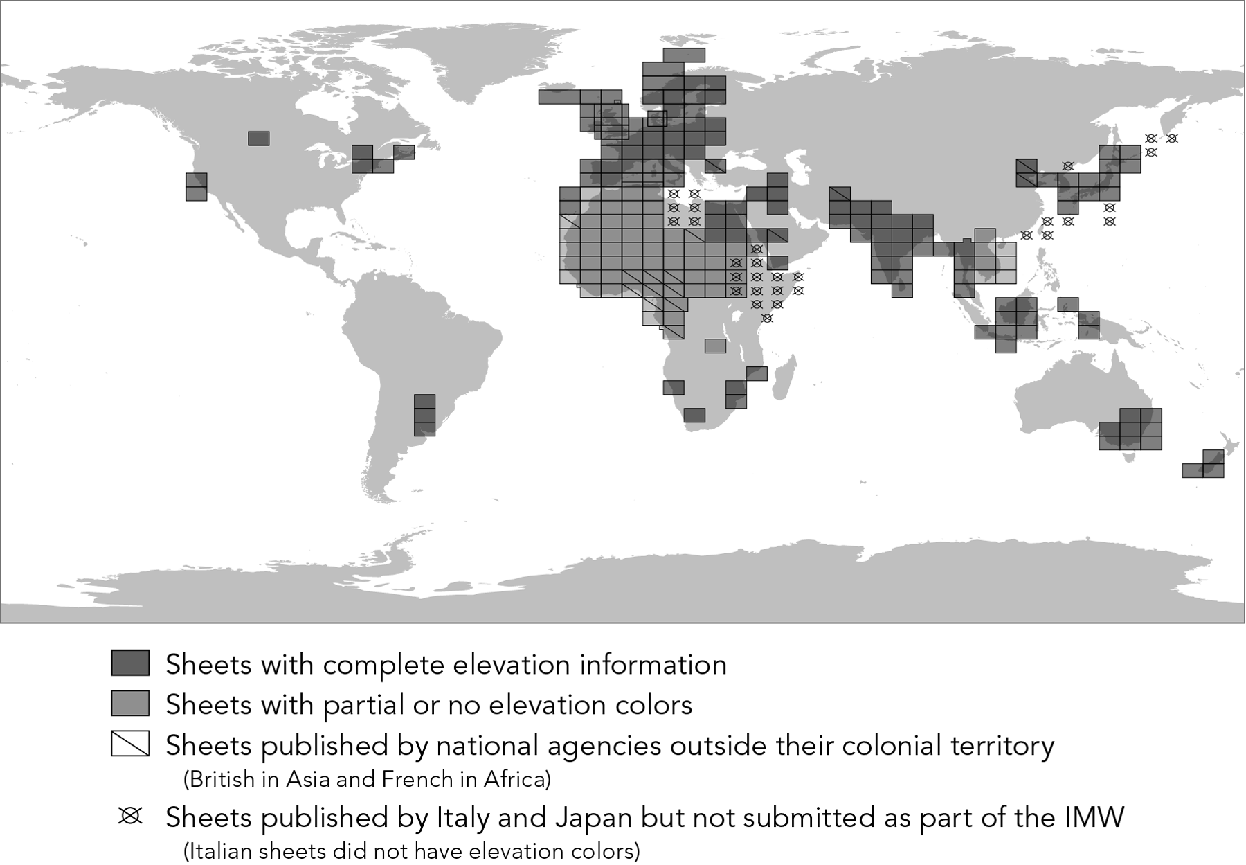
| FIGURE 1.15 |
| Official International Map of the World sheets published before 1939 | |
| William Rankin Creative Commons BY-NC-SA | |

| FIGURE 1.16 |
| Unofficial or “provisional” International Map of the World sheets published before 1939 | |
| William Rankin Creative Commons BY-NC-SA | |
| FIGURE 1.17 |
| Sources assembled at the American Geographical Society for the Map of Hispanic America. | |
| American Geographical Society Copyright 1946, renewed 1973 | |
| FIGURE 1.18 |
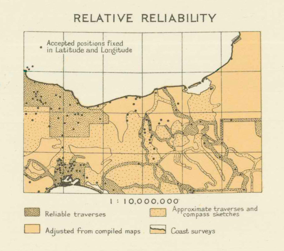
| Relative reliability diagram for The Map of Hispanic America — Istmo de Tehuantepec, 1938 | |
| American Geographical Society Public Domain: copyright not renewed | |
| FIGURE 1.19 |
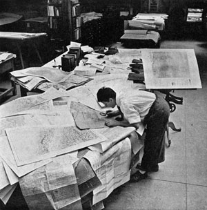
| Assembling a portion of the American Geographical Soviety's Map of Hispanic America | |
| Alfred Eisenstaedt Copyright 1941 | |
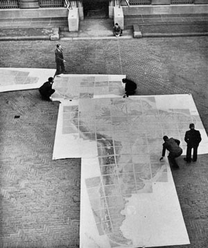
| FIGURE 1.20 |
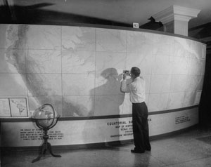
| Assembling the Map of Hispanic America in the courtyard of the American Geographical Society | |
| American Geographical Society Copyright 1946, renewed 1973 | |
| continue to chapter 2 . . . | |