International Map of the World sheet Istmo de Tehuantepec (1938)
American Geographical Society
Public Domain: copyright not renewed
|
 |
World Aeronautical Chart sheet Tehuantepec Isthmus (1946) |
| |
US Aeronautical Chart Service
Public Domain: US government |
|
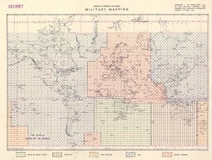
| FIGURE 2.12 |
| The division of Allied mapping responsibility in 1947: military-topographic maps, aeronautical charts, and storage of reproduction material |
Directorate of Military Survey
Copyright 1947 |
|
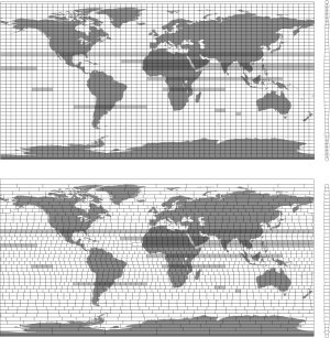
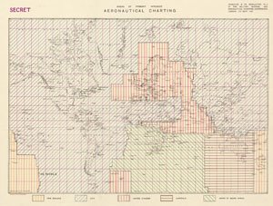
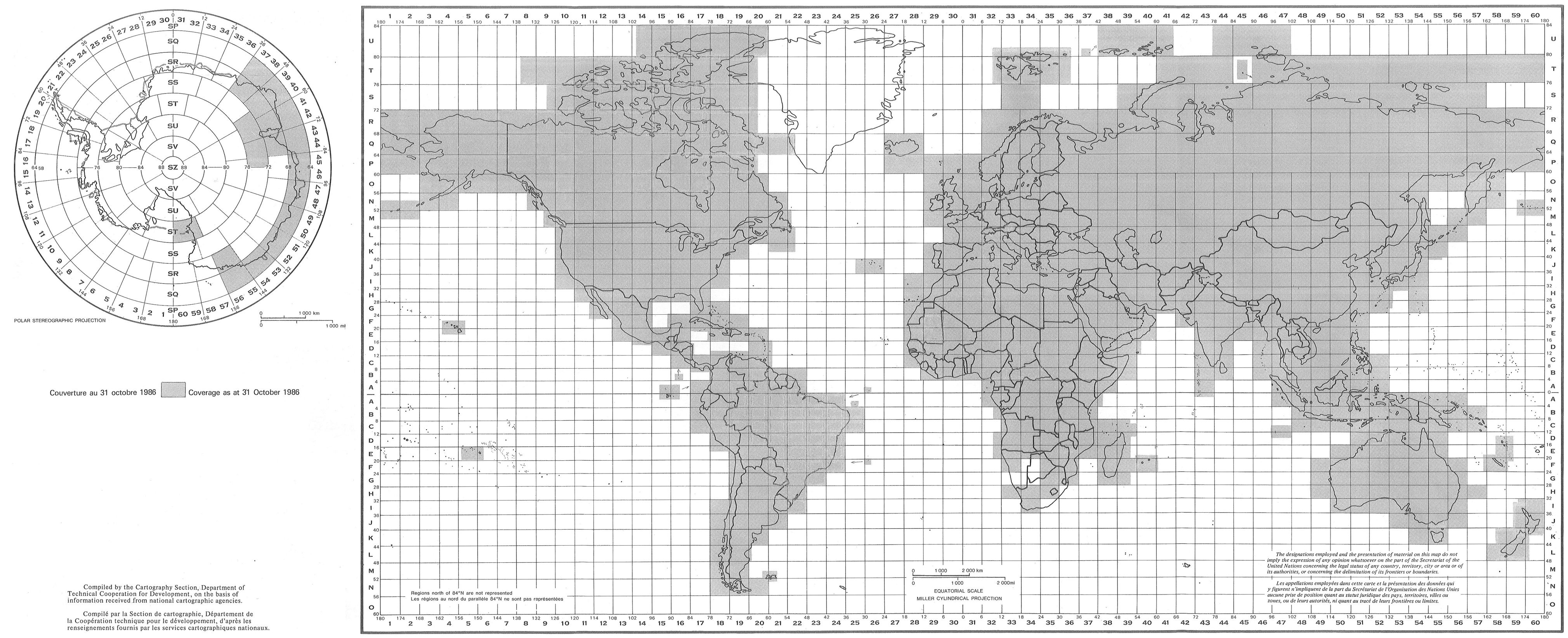
| FIGURE 2.13 |
| Comparison of sheet grids for the International Map of the World and the World Aeronautical Chart |
William Rankin
Creative Commons BY-NC-SA |
|
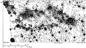
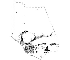
| FIGURE 2.14 |
| World Population Maps of Tuscany (top) and Ventura County, California (bottom) |
Geografiska Annaler
Copyright 1963 |
|
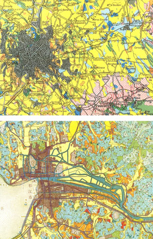
| FIGURE 2.15 |
| Comparison of World Land-Use Survey maps from central Italy (top) and western Japan (bottom) |
Internationales Jahrbuch für Kartographie
Copyright 1968 |
|

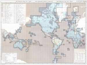 |
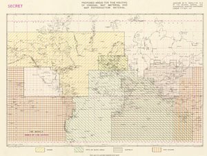
FIGURE 2.16 |
| Sheet index for the International World Aeronautical Chart: March and October 1962
|
International Civil Aviation Organization
Public Domain: UN publication |
|
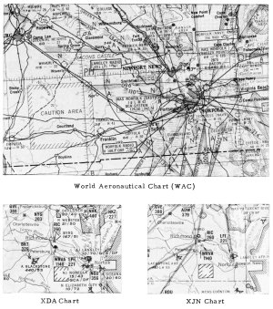 |
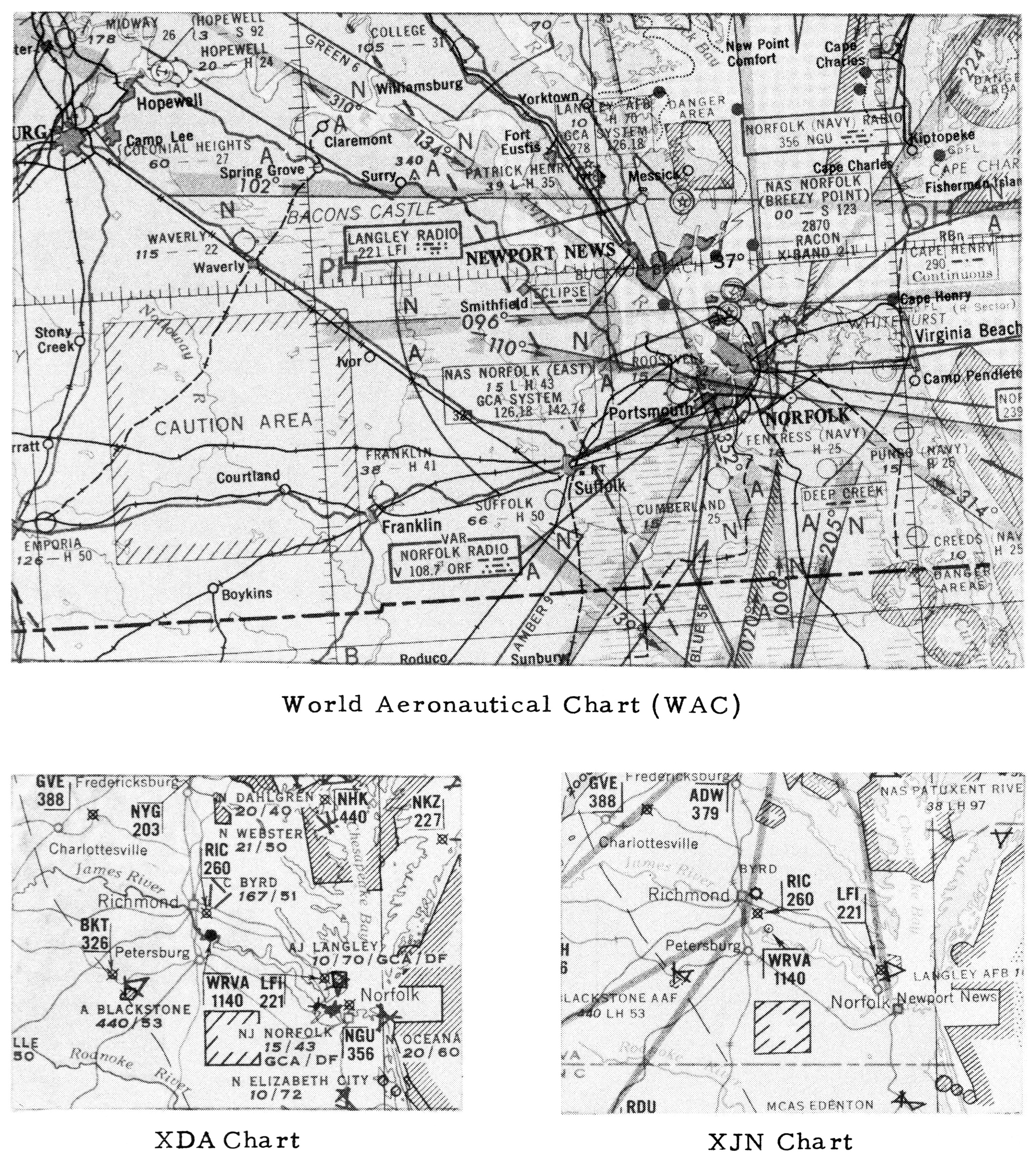
FIGURE 2.17 |
| Design alternatives for the World Aeronautical Chart tested for the US Office of Naval Research in 1952
|
from John E. Murray and Rolland H. Waters, “The Design of Aeronautical Charts II,” Navigation (US) 3 (Dec 1952), 193
Public Domain: copyright not renewed |
|
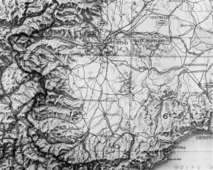 |
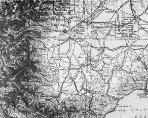
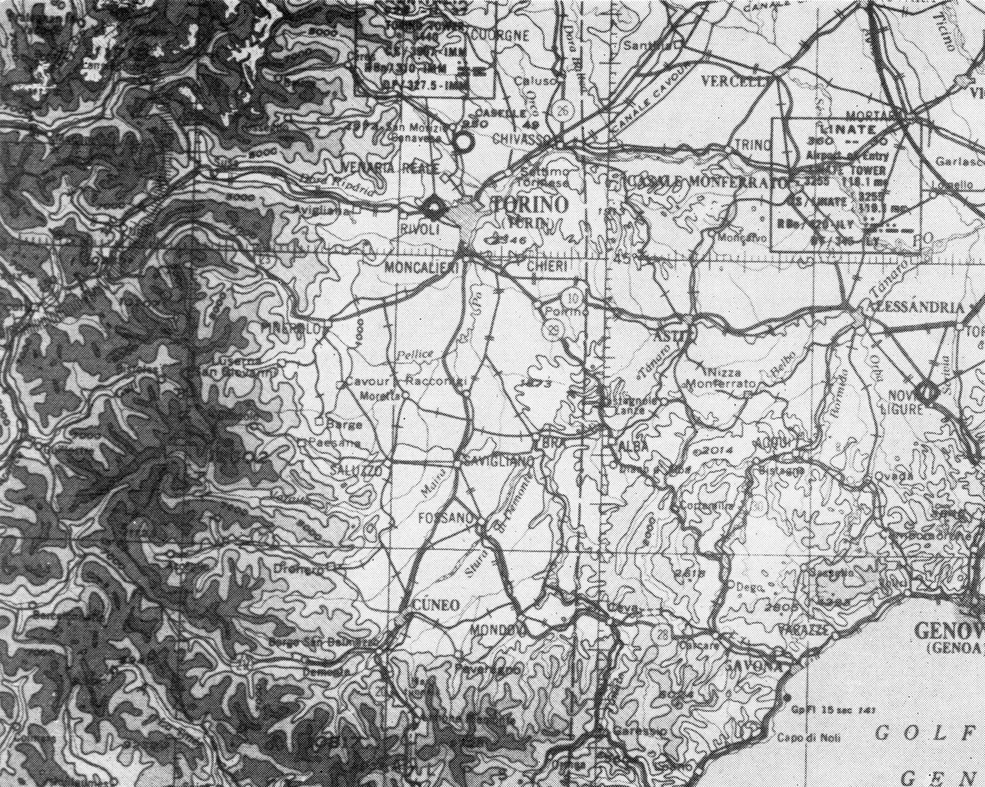
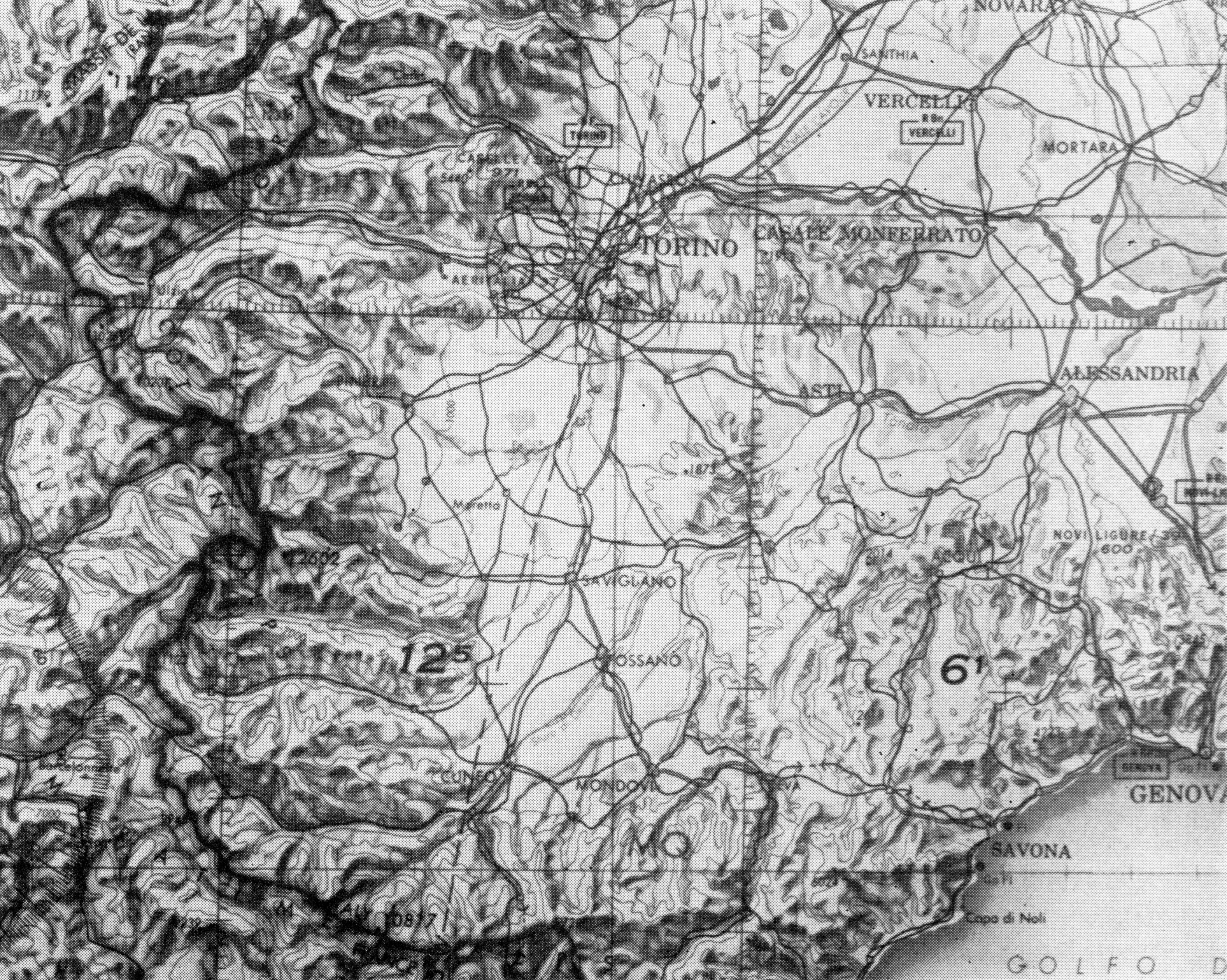
FIGURE 2.18 |
| Comparison of the design of American World Aeronautical Charts in 1948 and 1957 (both maps show the same area in northern Italy) |
from Richard W. Philbrick, “New Design Features for the World Aeronautical Chart,” Surveying and Mapping (July–Sept 1957), 303, 306
Public Domain: copyright not renewed |
|
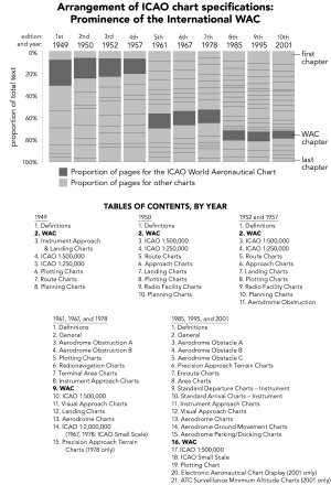
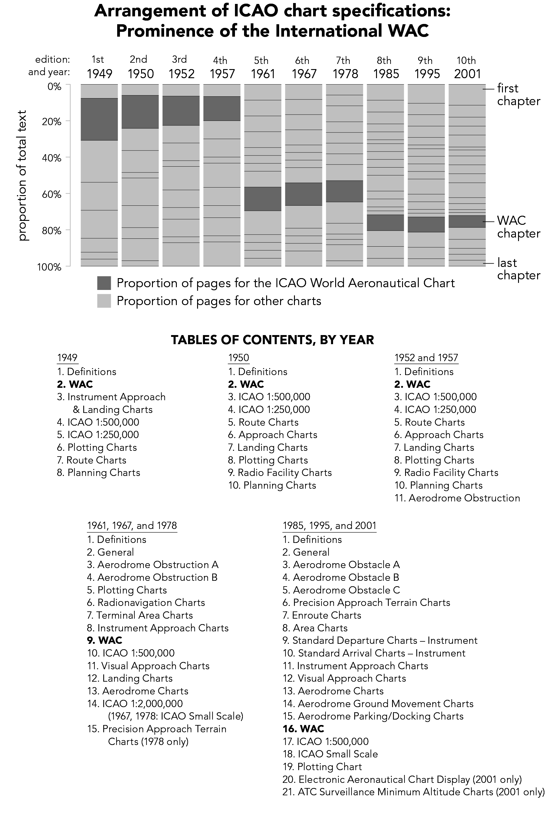
| FIGURE 2.19 |
| The place of the International World Aeronautical Chart in the official specifications of the International Civil Aviation Organization, 1949−2001 |
William Rankin
Creative Commons BY-NC-SA |
|

