IMAGES FROM CHAPTER 6
please check gray text for attribution and licensing restrictions
images in copyright are not available for download
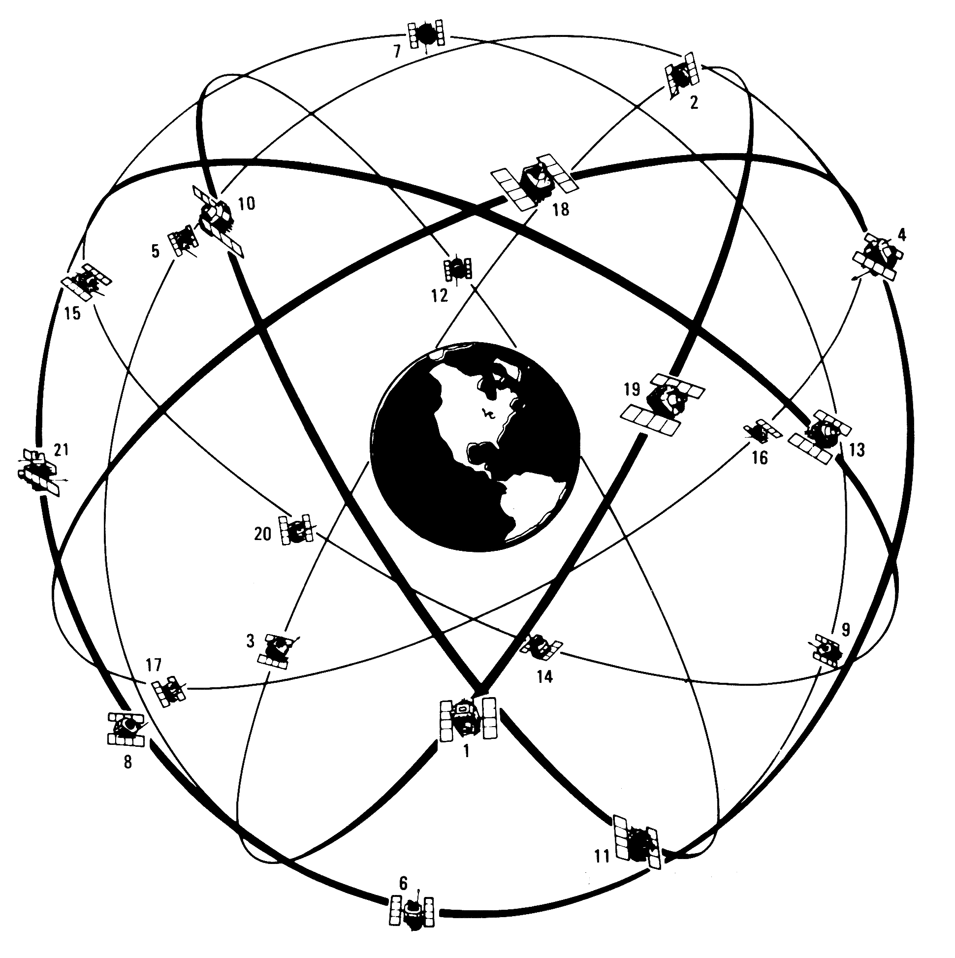
| FIGURE 6.1 |
| GPS satellite constellation design, mid-1980s | |
| from R. L. Beard, J. Murray, and J. D. White, “GPS Clock Technology and the Navy PTTI Programs at the U.S. Naval Research Laboratory,” in Proceedings of the Eighteenth Annual Precise Time and Time Interval (PTTI) Applications and Planning Meeting (1986), 50 Public Domain: US government | |

| FIGURE 6.2 |
| A GPS collar on “Floggy,” a brown hyena, in Namibia in 2006 | |
| photo by Ingrid Wiesel, from “Predicting the influence of land development on brown hyena (Parahyaena brunnea) movement and activity” used with permission | |

| FIGURE 6.3 |
| The "birdcage" of the US Navy's Transit satellites | |
| Navigation (US) Copyright 1978 | |
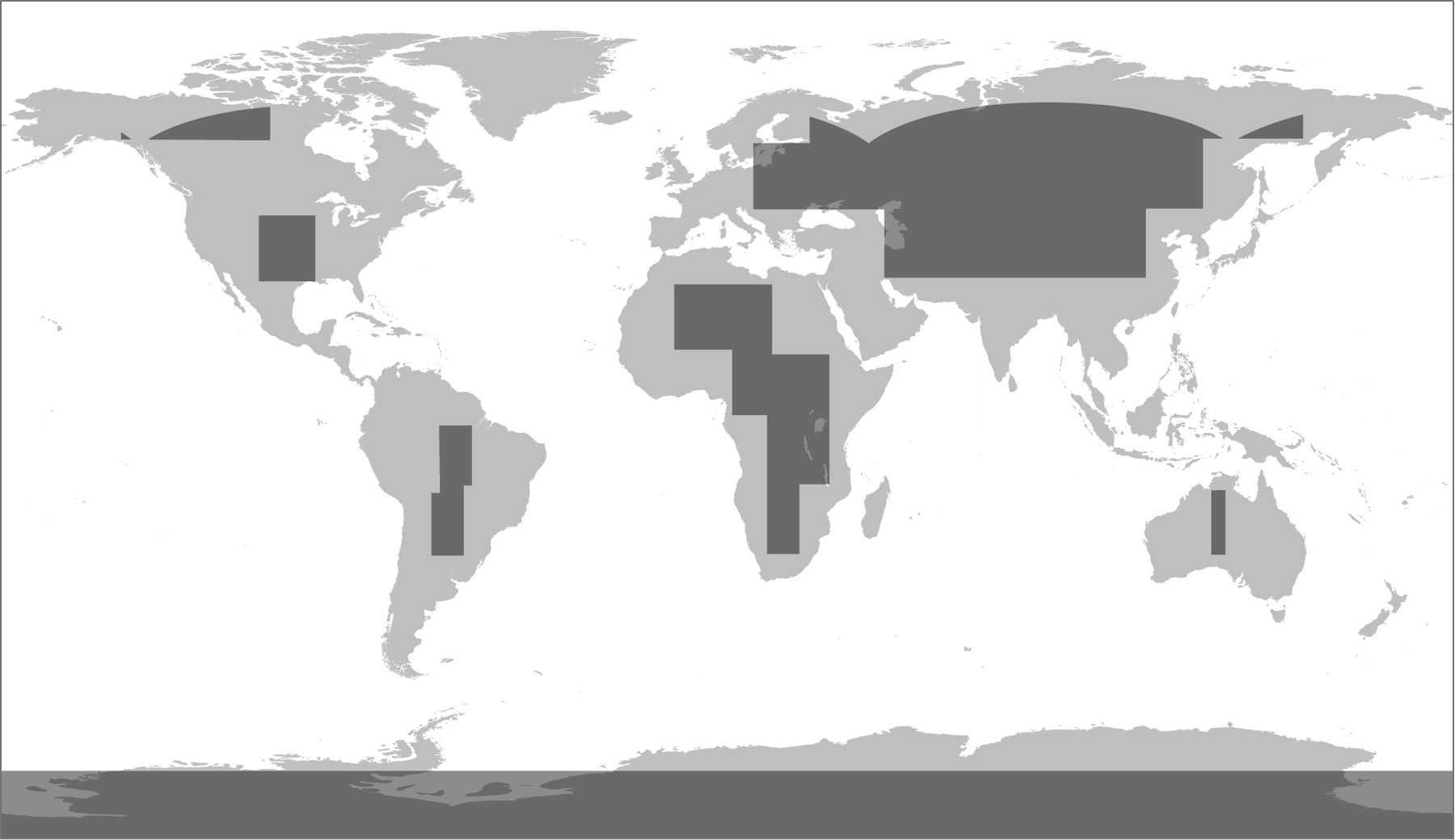
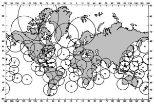
| FIGURE 6.4 |
| Coverage of Omega lattice charts in the early 1970s: maps were not available gray areas | |
| William Rankin Creative Commons BY-NC-SA | |

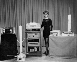
| FIGURE 6.5 |
| The US Navy's AN/UYK-1 computer for Transit satellite navigation, circa 1961 | |
| from Ramo-Woolridge (a division of TRW), AN/UYK-1: A Multiple Purpose Digital Computer, 21 Apr 1961 Public Domain: no copyright notice | |
 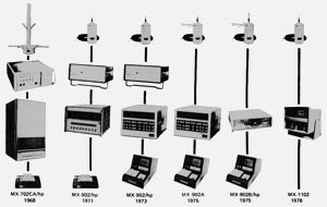
| FIGURE 6.6 |
| Shrinking Transit equipment from Magnavox, 1968 to 1976 | |
| Navigation (US) Copyright 1971, 1978 | |
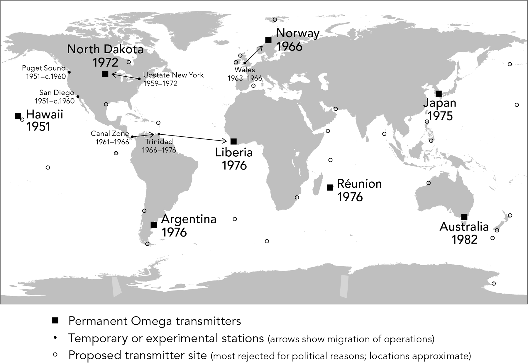
| FIGURE 6.7 |
| Omega transmitter locations, 1951–1997 download locations as a GIS layer | |
| William Rankin Creative Commons BY-NC-SA | |
| FIGURE 6.8 |
| Proposed network of Omega monitoring stations as of 1978 | |
| Navigation (US) Copyright 1978 | |
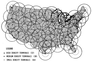
| FIGURE 6.9 |
| A 1975 proposal for “differential” Omega stations in the contiguous United States | |
| Navigation (US) Copyright 1975 | |
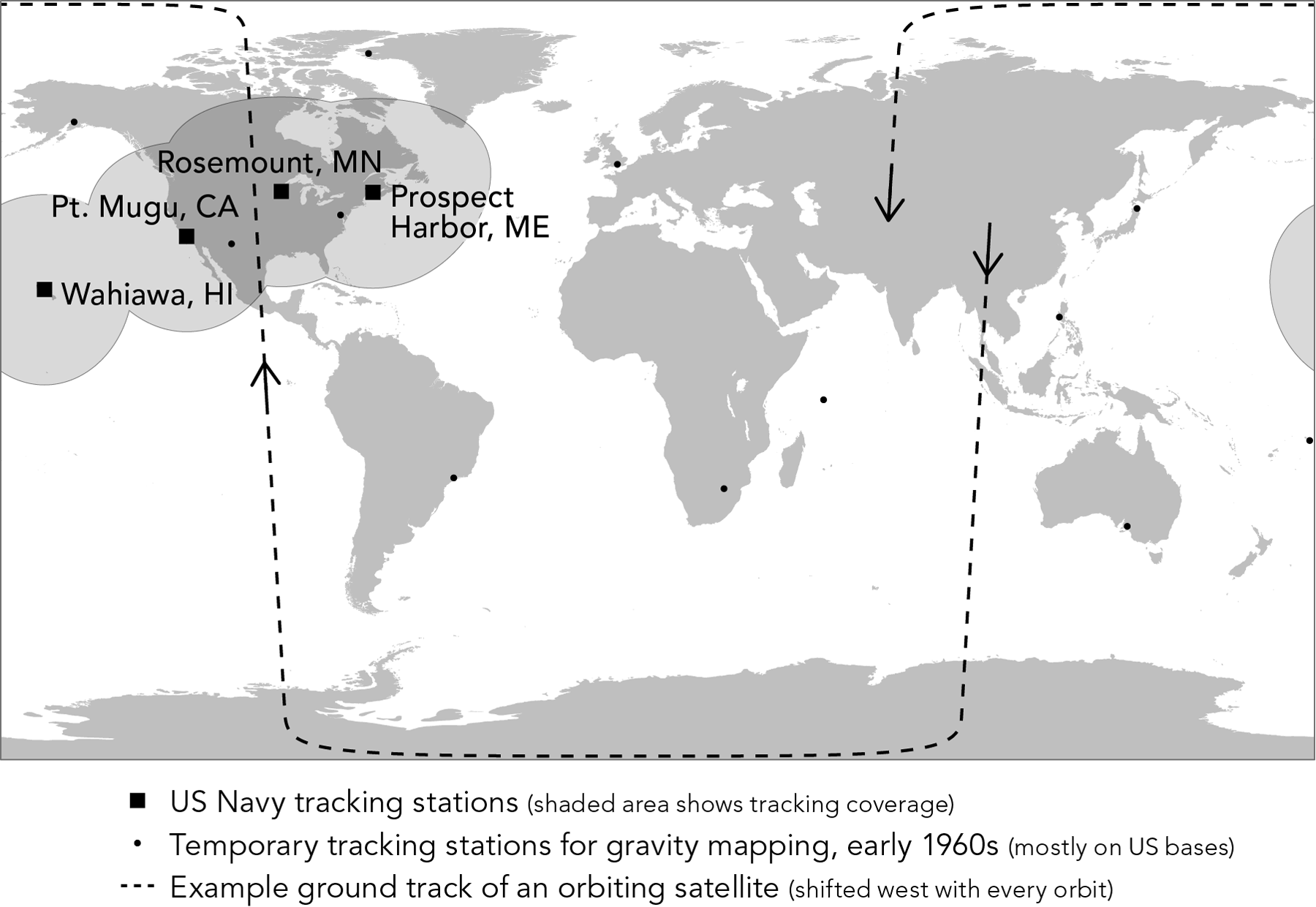
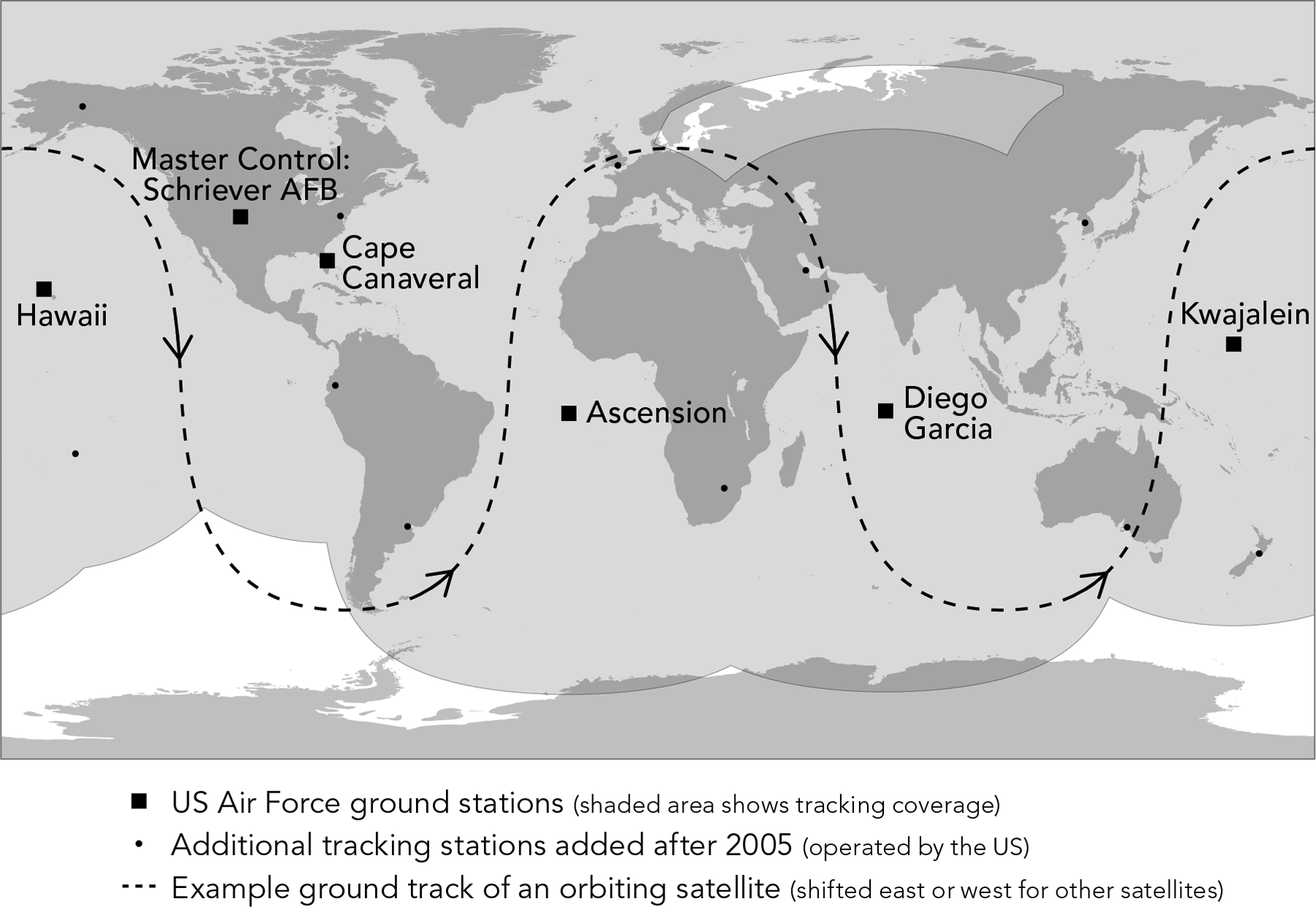
| FIGURE 6.10 |
| Ground installations for the Transit satellite system | |
| William Rankin Creative Commons BY-NC-SA | |
| FIGURE 6.11 |
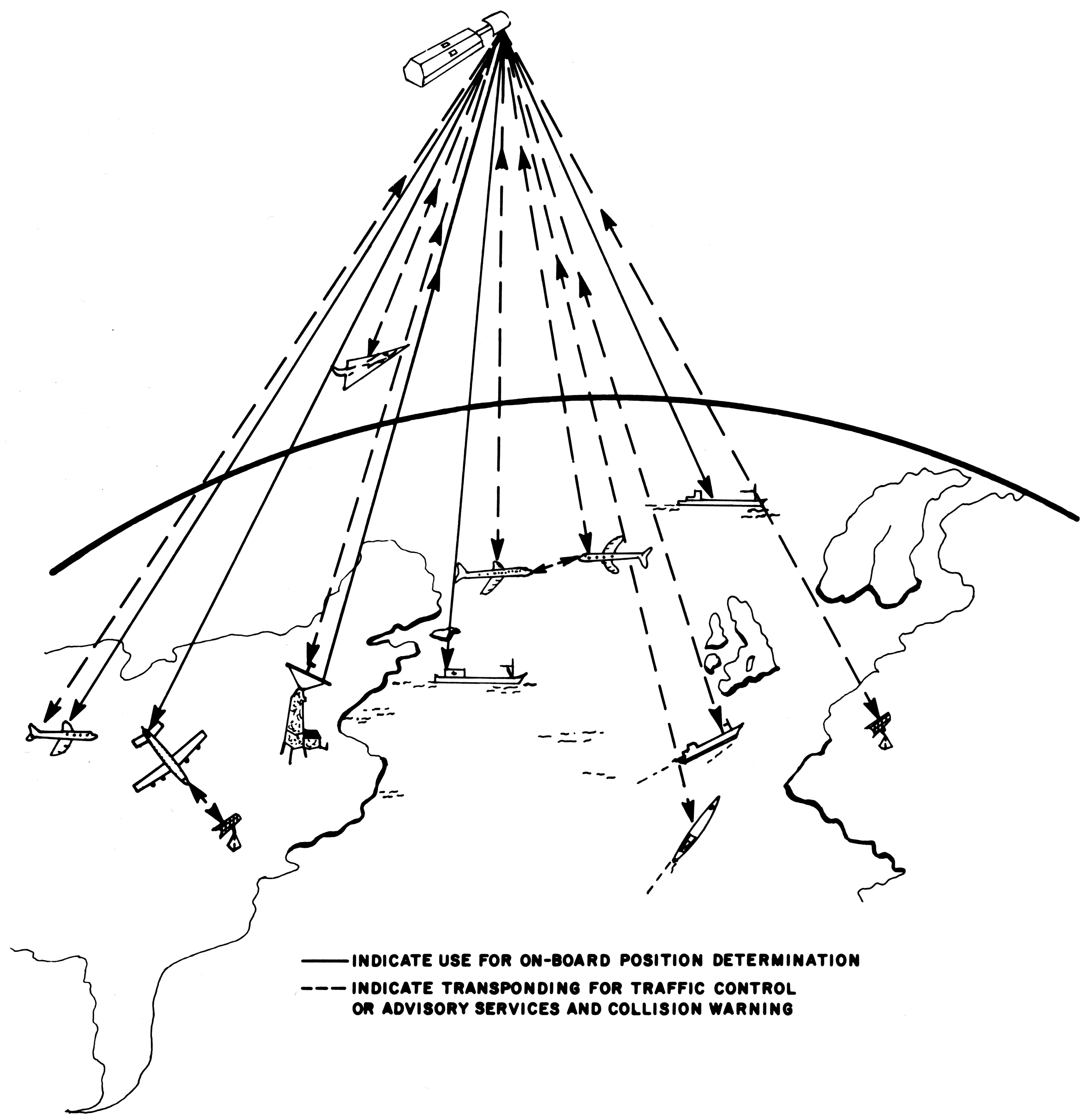
| A civilian satellite-navigation system designed for NASA, circa 1970 | |
| from Leo M. Keane et al., “Global Navigation and Traffic Control Using Satellites,” NASA Technical Report R-342, July 1970,12 Public Domain: US government | |

| FIGURE 6.12 |
| A plan for megaregional coverage for a civilian satellite navigation system in a geostationary orbit, mid-1960s | |
| Navigation (US) Copyright 1966 | |
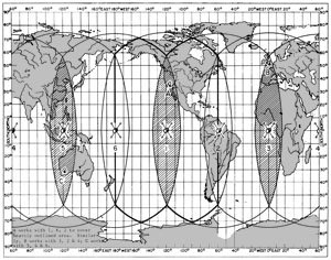
| FIGURE 6.13 |
| A plan for near-global civilian coverage from six geostationary satellites, mid-1960s | |
| Navigation (US) Copyright 1967 | |
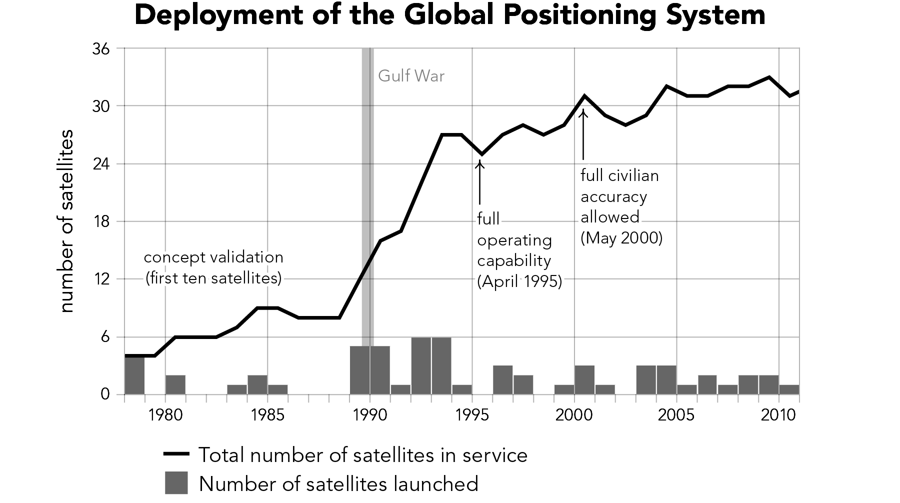
| FIGURE 6.14 |
| Launch and operational status of GPS satellites, 1978–2010 download data in a spreadsheet | |
| William Rankin Creative Commons BY-NC-SA | |
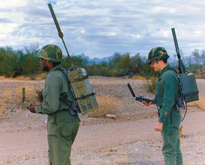 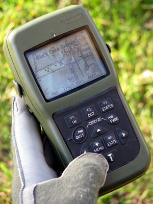
| FIGURE 6.15 |
| The shrinking size of GPS equipment: the "Manpack" of 1978 compared with the DAGR of 2004 | |
| from Steven Lazar, “Modernization and the Move to GPS III,” Crosslink 3 (Summer 2002), 45, and Rockwell Collins, Inc. Copyright 1978?, 2008? | |
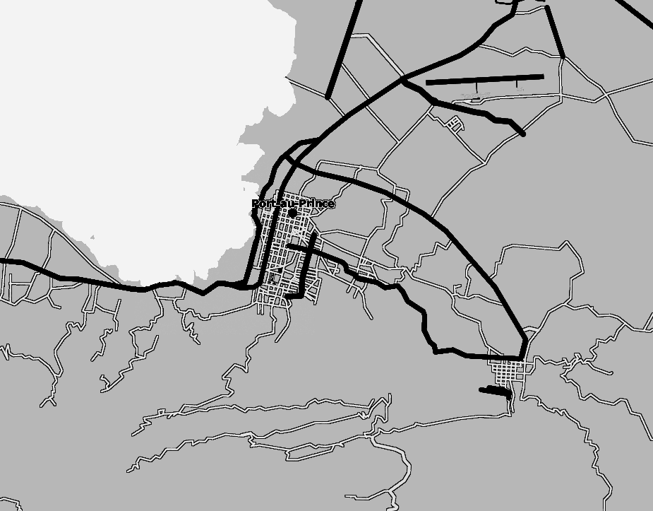 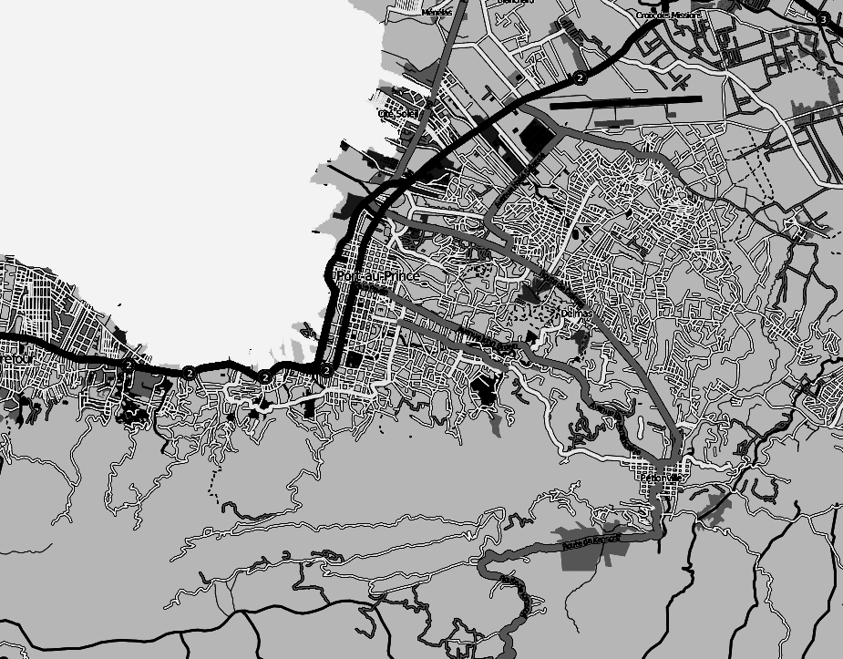
| FIGURE 6.16 |
| OpenStreetMap data, before and after the 2010 Haiti earthquake | |
| adapted from Mikel Maron's screencaptures Creative Commons BY-SA | |

| FIGURE 6.17 |
| Shindand airfield, Afghanistan, after an American GPS-guided bomb strike, October 2001 | |
| US Department of Defense Public Domain: US government | |
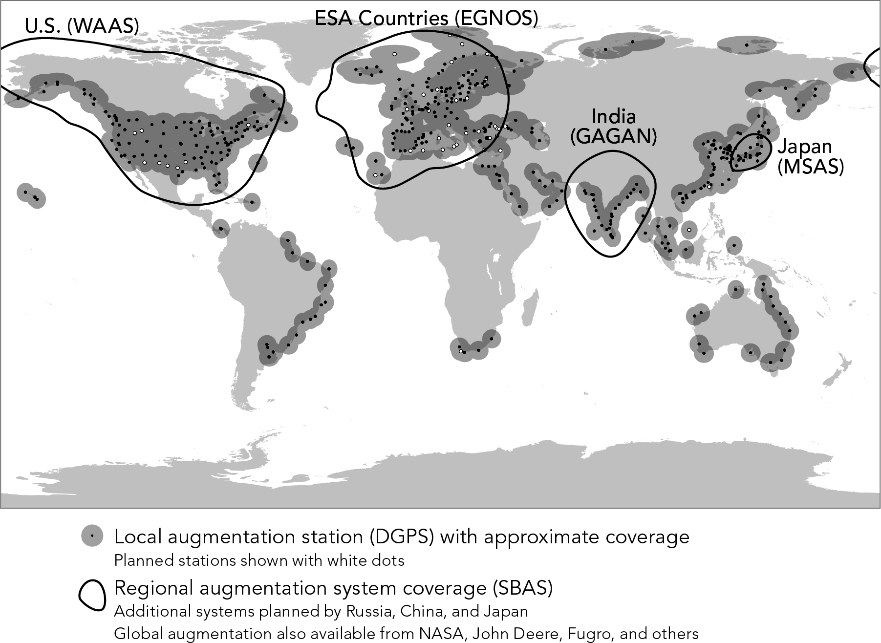
| FIGURE 6.18 |
| GPS augmentation systems as of 2015: Differential GPS (DGPS) and Satellite-Based Augmentation Systems (SBAS) download DGPS as GIS layers | |
| William Rankin Creative Commons BY-NC-SA | |
| FIGURE 6.19 |
| GPS ground installations: original US-controlled sites, with more recent stations in other countries | |
| William Rankin Creative Commons BY-NC-SA | |