All spreadsheets are in OpenDocument format.
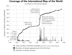
| SPREADSHEET FOR FIGURE 2.1 |
| Progress of the International Map of the World – number of sheets recorded, 1921–1986 | |
| data from IMW annual reports | |
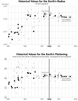
| SPREADSHEET FOR FIGURE 3.16 |
| Historical values of the size and shape of the earth – radius and flattening, 1617–1989 | |
| data citations in spreadsheet | |
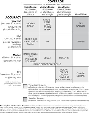
| SPREADSHEET FOR CHAPTERS 5 AND 6 |
| Radionavigation systems in the twentieth century – acronyms, sponsors, range, accuracy | |
| compiled by William Rankin | |
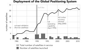
| SPREADSHEET FOR FIGURE 6.14 |
| Deployment of GPS satellites – launches and decommissioning, 1978–2010 | |
| data from US Naval Observatory | |