You can also download this file as a PDF.
|
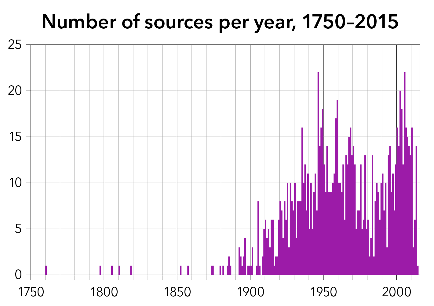
ENTIRE BOOK organized chronologically by date published sources only |
|
PRE-1800
Cassini de Thury, César-François. Verdun [map]. 1:86,400. Carte de France No. 110. Paris, 1760.
———. Index to Carte de France. Paris, 1797.
1800s
Henry, Col. “Mémoire sur la projection des cartes géographiques, adoptée au Dépôt Général de la Guerre.” Mémorial du Dépôt Général de la Guerre 2 (1803–1805 and 1810).
1810s
Puissant, Louis. Supplément au deuxième livre du traité de topographie, contenant la théorie des projections des cartes. Paris: Courcier, 1810.
Gibson, Robert et al. A treatise on practical surveying. Baltimore, 1818.
1850s
Marx, Karl. The Eighteenth Brumaire of Louis Napoleon. 1852.
Emory, William. Report on the United States and Mexican Boundary Survey. Washington DC, 1857.
1870s
Frome, Edward Charles. Outline of the Method of Conducting a Trigonometrical Survey, 4th ed. by Charles Warren. London: Lockwood, 1873.
André, George. The Draughtsman’s Handbook of Plan and Map Drawing. London, 1874.
Darwin, G. H. “On the Precession of a Viscous Spheroid, and on the Remote History of the Earth.” Philosophical Transactions of the Royal Society of London 170 (1879).
1880s
Tissot, Nicolas Auguste. Mémoire sur la représentation des surfaces et les projections des cartes géographiques. Paris: Gauthier-Villars, 1881.
Pissis, A. Mapa de la República de Chile. Santiago: P. Cadot, 1884.
Dépôt de la Guerre. Montdidier [map]. 1:80,000. Carte d’État major No. 21. Paris, 1885.
Einthoven, Willem. Stereoscopie door Kleurverschil. Utrecht, 1885.
Wheeler, George M. Report upon the Third International Geographical Congress and Exhibition at Venice, Italy, 1881, accompanied by data concerning the principal government land and marine surveys of the world. Washington, DC: USGPO, 1885.
Walling, H. F. “Topographic Surveys of States.” Journal of the Association of Engineering Societies 5 (Mar 1886).
1892
Penck, A. “Die Herstellung einer einheitlichen Erdkarte im Massstabe von 1:1 000 000.” In Compte rendu du Vme Congrès International des Sciences Géographiques tenu à Berne du 10 au 14 août 1891. Berne: Schmid, Francke, 1892.
Ravenstein, E. G. “A Proposed International Map of the World.” Proceedings of the Royal Geographical Society and Monthly Record of Geography 14 (Oct 1892).
1893
Hatt, P. Des coordonnées rectangulaires et de leur emploi dans les calculs de triangulations. Paris: Imprimerie Nationale, 1893.
Penck, A. “The Construction of a Map of the World on a Scale of 1:1,000,000.” The Geographical Journal 1 (Mar 1893).
1894
Barbier, J. V. “Le Projet de Carte de la Terre à l’échelle du 1/1,000,000e.” Bulletin, Société de Géographie de l’Est 16 (1894): 263–308.
———. “Projet de carte de la Terre à l’échelle de 1/1.000.000e.” In Compte rendu de la 23me session [Association française pour l’avancement des sciences] (Paris, 1894), 288–289.
1895
Andree, Richard. The Times Atlas. London: The Times, 1895.
“Sixth Geographical Congress.” New York Times, 25 July 1895.
1896
Brückner, Eduard. “Rapport du président de la commission pour l’établissement d’une carte de la terre à l’échelle de 1:1,000,000.” In Report of the Sixth International Geographical Congress, Held in London, 1895. London: John Murray, 1896.
“Discussion on the Projected Map of the World.” In Report of the Sixth International Geographical Congress, Held in London, 1895. London: John Murray, 1896.
Report of the Sixth International Geographical Congress, Held in London, 1895. London: John Murray, 1896.
State of Missouri v. State of Iowa, United States Supreme Court Reports 165 (1896 term).
1898
Peucker, Karl. Schattenplastik und Farbenplastik. Vienna: Artaria, 1898.
1899
Berthaut, Henri. La Carte de France, 1750–1898: Étude historique. Paris: Service Géographique, 1899.
1900
“La carte au millionième du Service Géographique de l’Armée.” Annales de Géographie 9 (1900).
1901
Morrison, Gabriel James. Maps, Their Uses and Construction. London: Edward Stanford, 1901.
Penck, Albrecht. “Über die Herstellung einer Erdkarte im Maassstab 1:1000000.” In Verhandlungen des Siebenten Internationalen Geographen-Kongresses, Berlin 1899, vol. 2. Berlin: W. H. Kühl, 1901.
Verhandlungen des Siebenten Internationalen Geographen-Kongresses, Berlin 1899, vol. 1. Berlin: W. H. Kühl, 1901.
1904
Vidal de la Blache, Paul. “La carte de France au 50000e.” Annales de géographie 13 (1904).
1905
Close, C. F. “The Ideal Topographic Map.” The Geographical Journal 25 (June 1905): 633–647.
———. Text Book of Topographical and Geographical Surveying. London: HMSO, 1905.
Hills, E. H. “Note on the Map of Africa on the Scale of 1:1,000,000, Published by the Intelligence Division of the War Office, London.” In Report of the Eighth International Geographic Congress, Held in the United States, 1904. Washington: USGPO, 1905.
“Map of the United States on a Scale of 1:1,000,000.” Bulletin of the American Geographical Society 37, no. 12 (1905).
Penck, Albrecht. “Fortschritte in der Herstellung einer Erdkarte im Maßstabe 1 : 1 000 000.” Zeitschrift der Gesellschaft für Erdkunde zu Berlin (1905).
———. “Plan of a Map of the World.” In Report of the Eighth International Geographic Congress, Held in the United States, 1904. Washington: USGPO, 1905.
Schokalsky, Jules de. “Proposition de la création d’une Association cartographique internationale.” In Report of the Eighth International Geographic Congress, Held in the United States, 1904. Washington: USGPO, 1905.
Schrader, Franz. “Note sur la commission préparatoire d’Union cartographique internationale établie par le Congrès géographique de Berlin.” In Report of the Eighth International Geographic Congress, Held in the United States, 1904, 95–102. Washington: GPO, 1905.
1906
Tracy, John Clayton. Plane Surveying: A Text-book and Pocket Manual. New York: John Wiley & Sons, 1906.
1908
Eckert, Max. “On the Nature of Maps and Map Logic.” trans. W. Joerg, Bulletin of the American Geographical Society 40, no. 6 (1908).
Hills, E. H. “The Present and Future Work of the Geographer.” The Geographical Journal 32 (Oct 1908).
1909
Brückner, Eduard and Arthur Brückner. “Zur Frage der Farbenplastik in der Kartographie.” Mitteilungen der Kaiserlich-Königlichen Geographischen Gesellschaft (1909).
Hayford, John. Geodesy: The Figure of the Earth and Isostasy from Measurements in the United States. Washington, DC: USGPO, 1909.
New York Board of Estimate and Apportionment. Report on the Triangulation of Greater New York. New York: M.B. Brown Press, 1909.
Penck, Albrecht “Die Erdkarte im Masstabe 1:1000000.” In Neuvième Congrès International de Géographie, Genève, 27 juillet – 6 août 1908: Compte rendu des travaux du congrès, vol. 1. Genève, 1909.
“Résolution relative à la préparation d’une Association cartographique internationale et à la publication d'un Répertoire graphique.” In Neuvième Congrès International de Géographie, Genève, 27 juillet – 6 août 1908: Compte rendu des travaux du congrès, vol. 1. Genève, 1909.
1910
Hayford, John. Geodesy: Supplementary Investigation in 1909 of the Figure of the Earth and Isostasy. Washington, DC: USGPO, 1910.
Kuhn, Arthur K. “The Beginnings of an Aërial Law.” The American Journal of International Law 4 (Jan 1910).
Resolutions and Proceedings of the International Map Committee assembled in London, November, 1909. London: HMSO, 1910.
Sherrill, Clarence Osborne. Military Topography for the Mobile Forces. Menasha, WI: George Banta, 1910.
Vidal de la Blache, Paul. “La carte internationale du monde au millionième.” Annales de Géographie 19 (1910).
Willis, Bailey. “The International Millionth Map of the World.” National Geographic Magazine 21 (1910).
1911
Close, Charles and Alexander Ross Clarke. “Map.” In Encyclopedia Britannica, 11th ed. (1911).
Lallemand, Charles. “Sur les déformations résultant du mode de construction de la Carte internationale du monde au millionième.” Comptes rendus de l’Académie des sciences 153 (1911): 559–567.
———. “Sur un projet de Carte internationale et de Repères aéronautiques.” Comptes rendus de l’Académie des sciences 152 (1911): 1439–1446.
Pollacchi, P. “La carte aéronautique du service géographique de l’armée.” Annales de Géographie 20, no. 112 (1911).
1912
Adams, Cyrus. “Maps and Map-Making.” Bulletin of the American Geographical Society 44, no. 3 (1912): 194–201.
Compte rendu de la XIe session du Congrès Géologique International (Stockholm 1910). Stockholm: P. A. Norstedt & Söner, 1912.
Courtier, A. “Choix d’un système de répresentation pour la rédaction des levés hydrographiques.” Annales hydrographiques 32 (1912).
Joerg, W. L. G. “Development and State of Progress of the United States Portion of the International Map of the World.” Bulletin of the American Geographical Society 44, no. 11 (1912).
Watson, C. M. “Progress in the Sudan; The International Map.” The Geographical Journal 40 (Oct 1912).
1913
“Boston on the International Map.” The Independent, 11 Sept 1913.
Hinks, Arthur. “The International One-in-a-Million Map of the World.” The Royal Engineers Journal (Feb 1913).
“A Map of the World.” Times (London), 19 Dec 1913.
1914
Carte du Monde au Millionième: Comptes rendus des séances de la deuxième conférence internationale, Paris, décembre 1913. Paris: Service Géographique, 1914.
“Carte Internationale du Monde au Millionème.” The Geographical Journal 43 (Feb 1914).
Close, C. F. “Relief in Cartography.” The Geographical Journal 43 (Mar 1914).
Lyons, H. G. “Relief in Cartography” (two parts). The Geographical Journal 43 (Mar and Apr 1914).
Margerie, Emmanuel de. “La carte internationale du monde au millionième et la conférence de Paris.” Annales de Géographie 23 (1914).
Peucker, Karl. “Die drei Weltkartenprojekte.” Petermanns geographische Mitteilungen 60, part I (1914): 68–70.
1915
Byström A. H. Report on the IMW. In Atti del X Congresso Internazionale di Geografia, Roma MCMXII. Roma: Reale Società Geografica, 1915.
Close, Charles. “International Map of the World.” In Atti del X Congresso Internazionale di Geografia, Roma MCMXII, 9–48. Roma: Reale Società Geografica, 1915.
Hinks, Arthur. “The Map on the Scale 1/1,000,000, Compiled at the Royal Geographical Society under the Direction of the General Staff, 1914–1915.” The Geographical Journal 46 (Aug 1915).
Lisboa, Miguel. “Note concerning the sheets of the World Map on the scale of 1:1,000,000 in Brazil.” In Atti del X Congresso Internazionale di Geografia, Roma MCMXII, 43–48. Roma: Reale Società Geografica, 1915.
Mason, Gregory. “The Story of the War.” The Outlook, 14 April 1915.
Penck, Albrecht. “Fortschritte der Herstellung der Einheitliche Erdkarte 1 : 1.000.000.” In Atti del X Congresso Internazionale di Geografia, Roma MCMXII. Roma: Reale Società Geografica, 1915.
1916
Courtier, A. “Exposé de la projection de Lambert.” Annales hydrographiques ser. 3, vol 17, for 1940–1945 (1946 [orig. 1916]).
1917
Manual for the Artillery Orientation Officer [translated from French original]. Washington DC: USGPO, 1917.
Whitaker, Omar B. “Aeronautical Charts.” Geographical Review 4 (July 1917).
1918
McCaw, G. T. “Resection in Survey.” The Geographical Journal 52 (Aug 1918).
Service Géographique de l’Armée. Moreuil [map], 9th ed. 1:20,000. 5 Aug 1918.
1919
Bowie, William and Oscar Adams. Grid System for Progressive Maps in the United States, US Coast and Geodetic Survey Special Publication No. 59. Washington, DC: USGPO, 1919.
Hinks, Arthur R. “German War Maps and Survey.” The Geographical Journal 53 (Jan 1919).
“Le Service Géographique de l’Armée et la cartographie de guerre.” La Géographie 32 (1919).
“War Work of the Society.” The Geographical Journal 53 (May 1919).
Weber, Max. “Politik als Beruf.” In Gesammelte Politische Schriften. Munich: Drei Masken, 1921 [orig. 1919].
Winterbotham, H. “Geographical Work with the Army in France.” The Geographical Journal 54 (July 1919).
1920
Aultman, Dwight E. “Maps and Map Firing.” The Field Artillery Journal 10 (July–Aug 1920).
“The Carte du Monde au Millionième.” The Geographical Journal 55 (Jan 1920).
Finch, James Kip. Topographic Maps and Sketch Mapping. New York: John Wiley & Sons, 1920.
[Hinks, Arthur?]. “The Carte du Monde au Millionième.” The Geographical Journal 55 (Jan 1920).
[Jack, E. M.] Report on Survey on the Western Front 1914–1918. London: HMSO, 1920.
Kuhn, Arthur K. “International Aerial Navigation and the Peace Conference.” The American Journal of International Law, 14 (July 1920).
Pallotta, Giraloma. “The Accompaniment of Infantry in the Attack.” The Field Artillery Journal 10 (July–Aug 1920).
Sykes, Frederick H. “Imperial Air Routes.” The Geographical Journal 55 (Apr 1920).
1921
Blondel la Rougery, E. “Les cartes et les repères.” In Premier Congrès International de la Navigation Aérienne, Paris 15–25 Novembre 1921, Tome II, 119–122. Paris, 1921.
Duval, A. “Cartes et procédés de navigation.” In Premier Congrès International de la Navigation Aérienne, Paris 15–25 Novembre 1921, Tome II, 150–155. Paris, 1921.
Eckert, Max. Die Kartenwissenschaft. 2 vols. Berlin: W. De Gruyter, 1921, 1925.
H[inks], A. R. “The Belgian–German Boundary Demarcation.” The Geographical Journal 57 (Jan. 1921).
———. “On the Projection Adopted for the Allied Maps on the Western Front.” The Geographical Journal 57 (June 1921).
Lees, E. F. W. “International Aeronautical Maps.” The Geographical Journal 57 (May 1921).
Mezes, Sidney Edward. “Preparations for Peace.” In What Really Happened at Paris, ed. Edward House and Charles Seymour. New York: Charles Scribner’s Sons, 1921.
1922
Bowie, William. “Propositions des États-Unis.” Bulletin géodésique [1] (May 1922).
Carte du Monde au Millionième: Rapport pour 1921. Southampton: Ordnance Survey, 1922.
“Détail des questions proposées pour l’inscription à l’ordre du jour de la section de géodésie.” In Union Géodésique et Géophysique Internationale, Première assemblée générale: Rome, mai 1922: section de géodésie. Toulouse: Édouard Privat, 1922.
Roussilhe, H. “Emploi des coordonnées rectangulaires stéréographiques pour le calcul de la triangulation dans un rayon de 560 kilomètres autour de l’origine.” Travaux de l’Association internationale de géodésie 1 (Paris, 1923 [presented 1922]).
1923
“Comptes rendus de la première assemblée générale” (Rome, 1922), Bulletin géodésique 2 (Apr 1923).
H[inks], A. R. “The I/Million Map of Spanish America.” The Geographical Journal 61 (May 1923): 369–371.
Hinks, Arthur. “The 1/M Map of Brazil.” The Geographical Journal 62 (July 1923): 38–40.
Kriegh, McK. W. “Preparation and Distribution of Maps.” The Military Engineer 15 (May–June 1923): 241–244.
Martonne, Emmanuel de. “La carte au millionième de l’Amérique du Sud.” Annales de Géographie 32 (1923): 466–468.
Service Géographique de l’Armée. La nouvelle carte de France. Paris: SGA, 1923.
Walker, Albert M. “The Military Map of the Future.” The Military Engineer 15 (Sept–Oct 1923): 391–397.
Winterbotham, H. S. L. “The International Map of the World.” The Geographical Journal 62 (July 1923).
1924
Hinks, Arthur R. “The Grid in Civil Use.” The Geographical Journal 63 (June 1924).
International Commission for Air Navigation. Official Bulletin 6 (June 1924).
Martonne, Emmanuel de. “Pour la carte de France au 50000e.” Annales de géographie 33 (1924).
McCaw, G. T. “The Proposed Adoption of a Standard Figure of the Earth.” The Geographical Journal 64 (Aug 1924).
Putnam, George R. “Radio Fog Signals for the Protection of Navigation; Recent Progress.” Proceedings of the National Academy of Sciences of the United States of America 10 (15 June 1924).
Roussilhe, H. “Rapport sur les procédés de calcul en coordonnées rectangulaires et sur les systèmes de représentation plane de l’ellipsoïde applicables à la triangulation.” Travaux de l’Association internationale de géodésie 4 (Paris, 1927 [presented 1924]).
1925
Arnaud, Georges. “L’état des travaux de la Carte internationale du monde au 1 : 1 000 000e.” Annales de Géographie 34 (1925).
C[lose], C. F. Review of Carte du Monde au millionième: Rapport de 1924. The Geographical Journal 65 (Mar 1925).
“Comptes rendus de la deuxième assemblée générale” (Madrid, 1924), Bulletin géodésique 7 (1925).
Convention portant réglementation de la navigation aérienne en date du 13 octobre 1919. Paris, June 1925.
Davis, John W. “The Status of Military Mapping.” The Military Engineer 17 (July–Aug 1925): 292–294.
International Commission for Air Navigation. Convention Relating to the Regulation of Aerial Navigation Dated 13th October 1919. Paris, 1925.
Lamotte, Col. “Réponses au questionnaire du 1er avril 1924.” Bulletin géodésique 8 (1925).
MacLeod, M. N. “The International Map.” The Geographical Journal 66, no. 5 (Nov 1925).
Responses to IUGG inquiry on the International Ellipsoid. Bulletin géodésique 8 (1925).
Willis, Edward J. The Methods of Modern Navigation. New York: D. Van Nostrand, 1925.
1926
Adams, O. S. “The Readjustment of the First-Order Triangulation in the Western Half of the United States.” Bulletin of the National Research Council 11 (Nov 1926).
Buxton, S. W. “Freedom of Transit in the Air. The Present Position and How It Has Been Reached.” Economica 16 (Mar 1926).
Henderson, Paul. “Airways and Airdromes.” Engineers and Engineering 43 (May 1926).
1927
Adams, O. S. “Loop-Closures Resulting from the Readjustment of the First-Order Triangulation in the Western Part of the United States.” Bulletin of the National Research Council (July 1927).
“Air Lines to Span Nation.” Science News-Letter 12 (2 July 1927).
Breed, Charles and George Hosmer. The Principles and Practice of Surveying, 5th ed. New York: J. Wiley & Sons, 1927.
Platt, Raye. “The Millionth Map of Hispanic America.” Geographical Review 17 (Apr 1927).
Roussilhe, H. “Rapport général sur les systèmes de représentation plane de l’ellipsoïde terrestre.” Travaux de l’Association internationale de géodésie 6 (Paris, 1928 [presented 1927]).
Satterfield, John M. “Railroads of the Air.” Buffalo Journal of Commerce 21 (July 1927).
Steers, J. A. An Introduction to the Study of Map Projections, 13th ed. London: University of London Press, 1962 [orig. 1927].
Sweeney, Stephen B. “Some Economic Aspects of Aircraft Transportation.” Annals of the American Academy of Political and Social Science 131 (May 1927).
United States Geological Survey. Hudson River [map]. International Map of the World 1:1,000,000. Washington DC: USGS, 1927.
United States Office of Assistant Secretary for Aeronautics. “Civil Aeronautics in America.” Information Bulletin No. 1, 5th ed., 1 Oct 1927.
1928
Bowie, William. Comparison of Old and New Triangulation in California. CGS Special Publication 151. Washington: USGPO, 1928.
Comptes rendus of the committee on projections from the 1927 meeting in Prague, Bulletin géodésique 18 (Apr–June 1928).
Dellinger, H. and Haraden Pratt. “Development of Radio Aids to Air Navigation.” Proceedings of the Institute of Radio Engineers 16 (July 1928).
Perrier, Georges. “Note au sujet du calcul des tables de l’ellipsoïde de référence international.” Bulletin géodésique 18 (1928): 361–369.
Report of the commission of projections. Bulletin géodésique 17 (Jan–Mar 1928).
Reynolds, J. H. “The Official Romanization of Japanese.” The Geographical Journal 72 (Oct 1928).
Williams, Roger F. “Federal Legislation Concerning Civil Aeronautics.” University of Pennsylvania Law Review and American Law Register 76 (May 1928).
Winterbotham, H. S. L. “Recent Sheets of the One-in-a-Million Map of the American Geographical Society.” The Geographical Journal 71 (Feb 1928).
1929
Carte du Monde au Millionième: Rapport pour 1928. Southampton: Ordnance Survey, 1929.
Diamond, H. “Applying the Visual Double-Modulation Type Radio Range to the Airways.” Proceedings of the Institute of Radio Engineers 17 (Dec 1929).
Groves, P. R. C. “The Influence of Aviation on International Affairs.” Journal of the Royal Institute of International Affairs 8 (July 1929).
Kear, F. G. and W. E. Jackson. “Applying the Radio Range to the Airways.” Proceedings of the Institute of Radio Engineers 17 (Dec 1929).
Kügelgen, Carlo von. “The International Geological Congress in Pretoria and a Geological Map of the World.” Science 70, no. 1806 (9 Aug 1929).
Patton, Harold S. “Canada’s Advance to Hudson Bay.” Economic Geography 5 (July 1929).
Walls, H. J. “The Civil Airways and Their Radio Facilities.” Proceedings of the Institute of Radio Engineers 17 (Dec 1929).
1930
Adams, Oscar. The Bowie Method of Triangulation Adjustment, US Coast and Geodetic Survey special publication 159. Washington, DC: USGPO, 1930.
Bowie, William. “Some International Problems in Geodesy.” Bulletin géodésique 26 (Apr–June 1930).
Carte du Monde au Millionième: Rapport pour 1929. Southampton: Ordnance Survey, 1930.
Dellinger, J. H., H. Diamond, and F. W. Dunmore. “Development of the Visual-Type Airway Radiobeacon System.” Proceedings of the Institute of Radio Engineers 18 (May 1930).
Dodds, J. S. “The Government Mapping Program in a Map-Minded Age.” Science 71, no. 1845 (9 May 1930).
Harris, W. Carlton. “Real Estate and Real Estate Problems.” Annals of the American Academy of Political and Social Science 148 (Mar 1930): 1–6.
Jackson, W. E. and S. L. Bailey. “The Development of a Visual Type of Radio Range Transmitter Having a Universal Application to the Airways.” Proceedings of the Institute of Radio Engineers 18 (Dec 1930).
Platt, Raye. “Surveys in Hispanic America: Notes on a New Map Showing the Extent and Character of Surveys in Hispanic America.” Geographical Review 20 (Jan 1930).
“Shaken Reed Shows Path through Clouds.” The Science News-Letter 17 (24 May 1930).
Young, A. E. “Conformal Map Projections.” The Geographical Journal 76 (Oct 1930).
1931
Carte du Monde au Millionième: Rapport pour 1930. Southampton: Ordnance Survey, 1931.
Gross, Gerald C. “European Aviation Radio.” Proceedings of the Institute of Radio Engineers 19 (Mar 1931).
L[ambert], W. D. “The International Geodetic and Geophysical Union.” Science 73, no. 1879 (2 Jan 1931).
Roussilhe, H. “Rapport sur les projections.” Travaux de l’Association internationale de géodésie 8 (1931).
1932
Albrecht, E. W. “First-Order Geodetic Surveys.” Civil Engineering 2 (June 1932).
Collingwood, R. G. Review of Tabula Imperii Romani. Journal of Roman Studies 22, part 2 (1932).
H[inks], A. R. Review of Physics of the Earth–II. The Figure of the Earth by the US National Research Council. The Geographical Journal 79 (Mar 1932): 239–241.
The International 1:1,000,000 Map: Report for 1931. Southampton: Ordnance Survey, 1932.
International Commission for Air Navigation. Official Bulletin 20 (Oct 1932).
Kalijarvi, Thorsten. “Scandinavian Claims to Jurisdiction over Territorial Waters.” The American Journal of International Law 26 (Jan 1932).
Martonne, Edouard de. “Le congrès d’aéronautique coloniale.” Annales de Géographie 41 (1932).
Syme, George. “Geodetic Control for North Carolina Highways.” Civil Engineering 2 (Mar 1932).
1933
Collins, C. B. “Inter-Aerodrome Navigation.” Flight, 7 Dec 1933, 1221–1222.
The International 1:1,000,000 Map: Report for 1932. Southampton: Ordnance Survey, 1933.
Mealing, R. H. S. “Air Traffic Control.” Flight, 19 Oct 1933, 1049.
Platt, Raye. “Catalogue of Maps of Hispanic America.” Geographical Review 23 (Oct 1933).
“Professor Kissam Directs Unemployed Engineers.” Princeton Herald, 29 Dec 1933.
Weigel, K. “Jonction des réseaux de triangulation des grand continents.” Bulletin géodésique 38 (1933): 198–209.
Winterbotham, H. St. J. L. “The Use of the New Grid on Ordnance Survey Maps.” The Geographical Journal 82 (July 1933).
1934
Adams, Oscar. “Plane Coordinate-Systems for Individual States.” Transactions, American Geophysical Union (1934): 36–38.
Close, Charles. “The Carte du Monde au Millionième.” The Geographical Journal 83 (Apr 1934).
Congrès des Transports Aériens. Rapports et discussions, 29 Nov – 2 Dec, 1934. Paris, 1934.
International Commission for Air Navigation. Regulations for the International Radioelectric Service of Air Navigation. Paris: ICAN, July 1934.
Kane, Frank, Jr. “Geodetic Surveys will be Extended.” New York Times, 5 Aug 1934.
Syme, George F. “North Carolina’s Geodetic Control System.” The Military Engineer 26 (Jan–Feb 1934): 20–24.
United Kingdom Geographical Section, General Staff. London [map]. International Local Aeronautical Map 1:1,000,000. London: War Office, 1934.
Winterbotham, H. St. J. L. The National Plans. London: HMSO, 1934.
1935
Adams, Oscar and Charles Claire. Manual of plane-coordinate computation. US Coast and Geodetic Survey special publication 193. Washington, DC: USGPO, 1935.
———. Manual of traverse computation on the Lambert grid. US Coast and Geodetic Survey special publication 194. Washington, DC: USGPO, 1935.
———. Manual of traverse computation on the transverse Mercator grid. US Coast and Geodetic Survey special publication 195. Washington, DC: USGPO, 1935.
Burchall, H. “The Politics of International Air Routes.” International Affairs 14 (Jan–Feb 1935): 89–107.
Callan, J. A. C. “Local Control Surveys in Alabama.” Civil Engineering 5 (Dec 1935): 790–793.
Comptes rendus of the commission on projections from the 1933 meeting in Lisbon, Bulletin géodésique 45 (Jan–Mar 1935).
Comptes rendus of the commission on the European recalculation from the 1933 meeting in Lisbon, Bulletin géodésique 45 (Jan–Mar 1935).
Dodds, John S. “State Surveying and Mapping Bureaus.” Civil Engineering 5 (Apr 1935).
Graaff Hunter, J. de. “The Figure of the Earth from Gravity Observations and the Precision Obtainable.” Philosophical Transactions of the Royal Society of London, series A 234, no. 743 (15 July 1935): 377–431.
Kissam, Philip. “Function of a State Surveying Board.” Civil Engineering 5 (July 1935).
———. “New Jersey Adopts Plane-Coordinate System.” Civil Engineering 5 (Nov 1935).
“Maps versus Charts.” The Military Engineer 27 (Sept–Oct 1935).
Martin, Jean. “Comment réaliser la nouvelle carte de France à 1:50000.” Annales de géographie 44 (1935).
“Tabvla Imperii Romani.” The Geographical Journal 86 (Dec 1935): 523–526.
“The Use of Geodetic Control for Boundary Surveys (A Symposium).” Geodetic Letter (US Coast and Geodetic Survey) 2, no. 5 (May 1935).
“Use of the American Geographical Society’s Millionth Map of Hispanic America in the Chaco and Other Territorial Disputes.” Geographical Review 25 (Jan 1935).
1936
Bowie, William. “The National Mapping Plan of the National Resources Board.” Science 83, no. 2144 (31 Jan 1936).
Handover, Dennis H. “A New Empire Link: West African Colonies Linked with Empire’s Air System.” Journal of the Royal African Society 35 (Oct 1936).
International Commission for Air Navigation. Official Bulletin 24 (Dec 1936).
Kissam, Philip. “Local Control Surveys in New Jersey.” Civil Engineering 6 (Mar 1936).
“Ordnance Survey Maps: Discussion, with special reference to the Grid System, at the Afternoon Meeting of the Society, 9 December 1935.” The Geographical Journal 87 (Apr 1936): 308–327.
Service Géographique de l’Armée. Rapport sur les travaux exécutés du 1er août 1914 au 31 décembre 1919. Paris: SGA, 1936.
Tardi, Pierre. “Étude d’un système de projection de Gauss en fuseaux de 6° d’amplitude, pouvant s’appliquer à l’ensemble du continent africain.” annex to “Rapport sur les projections.” Travaux de l’Association internationale de géodésie 14 (1938 [presented 1936]).
Taylor, H.A. “Radio and Air Traffic.” Flight, 30 Jan 1936, 120–122.
“To Press Mapping Plan.” New York Times, 10 Mar 1936.
Tombs, Laurence C. International Organization in European Air Transport. New York: Columbia University Press, 1936.
1937
Adams, Oscar. “Development of State Grid Systems.” Civil Engineering 7 (Jan 1937): 33–37.
Denman, Roderick. “Radio Air Navigation: The Trend of British Development.” Flight, 21 Jan 1937, 54–56.
Hall, Russell E. “Expanding Airways in the Far East.” Far Eastern Survey 6 (28 Apr 1937): 95–101.
Hemple, H. W. “Cooperation of the United States Coast and Geodetic Survey and the Works Progress Administration in the Conduct of Geodetic Control-Surveys.” Transactions, American Geophysical Union (1937): 63–66.
“I.C.A.N., 1937.” Flight, 8 July 1937.
The International 1:1,000,000 Map: Report for 1936. Southampton: Ordnance Survey, 1937.
Kissam, Philip. “An Illustration of the Utility of State Plane-Coordinate Systems.” Transactions of the American Geophysical Union (1937): 93–96.
———. “The United States Coast and Geodetic Survey and the Property Owner.” The Scientific Monthly 44 (Apr 1937).
———. “The Utilization of Plane Coordinates in New Jersey.” Geodetic Letter 1 (Jan 1937).
Lambert, Walter D. “Report of the Association of Geodesy.” Science 85, no. 2196 (29 Jan 1937).
Perrier, Georges. “Étude d’une compensation d’ensemble du réseau européen.” Bulletin géodésique 53 (Jan–Mar 1937).
“Short-Wave Direction Finding.” Flight, 8 July 1937.
1938
American Geographical Society. Istmo de Tehuantepec [map]. North America 1:1,000,000. Baltimore: A. Hoen, 1938.
Keen, Ronald. Wireless Direction Finding, 3rd ed. London: Iliffe & Sons, 1938.
“New Inventions Add Greatly to Safety of the Aviator.” Science News Letter 22 (Oct 1938).
New York State Planning Council. A State System of Plane Coordinates. Albany, 1938.
Rand McNally Ready-Reference Atlas of the World. Chicago: Rand McNally, 1938.
Samuelson, H. M. “The Future of Aircraft Radio.” Flight, 20 Jan 1938, 69.
Le service géographique de l’armée: son histoire, son organisation, ses travaux. Paris: SGA, 1938.
1939
“All Landings Blind When Necessary, Experts Forecast.” The Science News-Letter 35 (10 June 1939).
Brenard, Robert. “The Romance of the Air Mail to East and South Africa.” Journal of the Royal African Society 38 (Jan 1939).
Comptes rendus of the commission of projections from the 1936 meeting in Edinburgh, Bulletin géodésique 61 (Jan.–Mar 1939).
Comptes rendus of the commission on the European recalculation from the 1936 meeting in Edinburgh, Bulletin géodésique 61 (1939).
“Enquête sur l’emploi de l’ellipsoïde de référence international.” Bulletin géodésique 61 (1939).
H[inks], A. R. “The 1/Million Map of Europe.” The Geographical Journal 94 (Nov 1939).
The International 1:1,000,000 Map: Report for 1938. Southampton: Ordnance Survey, 1939.
Lebel, Paul. “La Tabula Imperii romani.” Annales de Bourgogne 11 (Mar 1939).
“Navigation – Fourth Rate.” Flight, 19 Jan 1939, 54.
Nörlund, N. E. and J. de Graaff Hunter. “Note on the Adjustment of the European Network of Triangulation.” Bulletin géodésique 61 (1939): 261–272.
[Sanceau,V. E. H.] “The Present State of the Carte Internationale du Monde au Millionième.” In The International 1:1,000,000 Map: Report for 1938. Southampton: Ordnance Survey, 1939.
1940
“An Aerial Radio Lighthouse.” Flight, 19 Sept 1940, 227.
Perrier, Georges. “Geographic Service in the French Armies during the War, 1914–1918.” The Military Engineer 32 (July–Aug 1940): 266–270.
“The Radio Range Beacon.” Science 92, no. 2376 (12 July 1940).
“Radio Ranges in America.” Flight, 16 May 1940.
United States Civil Aeronautics Authority. First Annual Report of the Civil Aeronautics Authority. Washington: USGPO, 1940.
1941
Comfort, Howard. Review of Tabula Imperii Romani sheet. American Journal of Archaeology 45 (Oct–Dec 1941): 648–649.
Hall, Melvin and Walter Peck. “Wings for the Trojan Horse.” Foreign Affairs 19 (Jan 1941): 347–369.
Hinks, A. R. “More World Maps on Oblique Mercator Projections.” The Geographical Journal 97 (Jun 1941).
Jordan, Wilhelm (with revisions by Otto Eggert), Handbuch der Vermessungskunde, 8th ed., vol. 3, book 2, Sphäroidische Berechnungen, konforme Abbildung des Erdellipsoids, und Aufgaben der Erdmessung. Stuttgart: Metzler, 1941.
Luck, David. “An Omnidirectional Radio-Range System.” RCA Review 6 and 7 (July 1941, Jan 1942, and Mar 1946).
Margerie, Emmanuel de. “L’Atlas de l’Asie centrale de Sven Hedin.” Annales de Géographie 50 (1941): 196–200.
McIntosh, C. H. Radio Range Flying. Chicago: Ringer, 1941.
“Millionth Map of Hispanic America.” Life, 8 Dec 1941, 104.
“Omni-directional Radio Range.” Flight, 8 May 1941, 328.
“Treasures of Caucasus.” Life, 13 Oct 1941, 44.
United States War Department. Orientation. Technical Manual TM 44-225. Washington DC, 15 July, 1941.
1942
“Alaska: U.S. Frontier Waits for War.” Life, 19 Jan 1942, 67.
Donoghue, John H. “Maps Must Be Made by the Millions.” The Military Engineer 34 (Sep 1942): 427–430.
Harrison, Richard Edes. “One World, One War” [map]. Fortune, Mar 1942.
“Maps: Global War Teaches Global Geography.” Life, 3 Aug 1942, 64.
Starkey, Otis P. “Maps are Liars.” New York Times Magazine, 11 Oct 1942.
1943
Burden, William A. M. The Struggle for Airways in Latin America. New York: Council on Foreign Relations, 1943.
“City’s Schools Will Use Flat ‘Globe’ Maps in Fall.” New York Times, 2 Aug 1943.
Donoghue, John H. “The Geography of Total War.” The Military Engineer 35 (July 1943).
Harrison, Richard Edes. “The War of the Maps.” Saturday Review of Literature 26 (7 Aug 1943).
Marschner, F. J. “Maps and a Mapping Program for the United States.” Annals of the Association of American Geographers 33 (Dec 1943).
United States Aeronautical Chart Service. Reconnaissance Mapping With Trimetrogon Photography. Washington, DC, 1943.
United States Army Map Service. Grids and Magnetic Declinations, 2nd ed. Memorandum No. 425. Washington DC, 1943.
Willkie, Wendell. One World. New York: Simon and Schuster, 1943.
“World Polyconic Grid.” AMS Bulletin, no. 1 (Aug 1943): 1–5.
1944
Greenhood, David. Mapping. Chicago: University of Chicago Press, 1964 [originally Down to Earth: Mapping for Everybody, 1944].
Harrison, Richard Edes. Look at the World: The Fortune Atlas of World Strategy. New York: Knopf, 1944.
“Louisiana Adopts Coordinate System.” Civil Engineering 14 (Nov 1944).
“New Table Replaces Five Five-Minute Intersection Tables.” AMS Bulletin, no. 9 (July 1944).
Ober, Beverly. “Use of Coordinates in Police Work.” Surveying and Mapping 4 (Apr 1944).
“Perspective Maps: Harrison Atlas Gives Fresh New Look to Old World.” Life, 28 Feb 1944.
Raisz, Erwin. Atlas of Global Geography. New York: Global Press Corp., 1944.
Ristow, Walter. “Air Age Geography: A Critical Appraisal and Bibliography.” Journal of Geography 43 (Dec 1944).
United Kingdom Geographical Section, General Staff. Belfast–Rugby [map], 3rd ed. 1:1,000,000. Miniature Lattice. London: War Office, 1949 [orig. 1944].
United States War Department. Orientation for Artillery. Technical Manual TM 44-225. Washington DC, 30 June 1944.
Van Zandt, J. Parker. The Geography of World Air Transport. Washington, DC: Brookings Institution, 1944.
1945
“C.E.R.C.A..” Flight, 16 Aug 1945, 182.
Cockburn, Robert. “The Radio War.” IEE Proceedings 132, part A (Oct 1985 [orig. 1945]): 423–434.
Dilloway, A. J. “Graphics of World Aviation.” Journal of the Royal Aeronautical Society 49 (1945).
Mitchell, Hugh and Lansing Simmons. The State Coordinate Systems (A Manual for Surveyors). US Coast and Geodetic Survey special publication 235. Washington, DC: USGPO, 1945.
Osterhout, Howard. “A Review of the Recent Chicago International Air Conference.” Virginia Law Review 31 (Mar 1945).
Reeves, A. H. and J. E. N. Hooper. “Oboe: History and Development.” IEE Proceedings 132, part A (Oct 1985 [orig. 1945]).
Smith, Paul A. “Surveying and Mapping at Civil Aviation Conference.” Surveying and Mapping (Apr 1945).
1946
“Arms and the Map.” Print 4 (Spring 1946).
Bovill, Charles B. “A Review of Radio Aids in Aviation.” Journal of the British Institution of Radio Engineers 6, no. 6 (1946).
Bowman, Isaiah. “The Millionth Map of Hispanic America.” Science 103, no. 2672 (15 Mar 1946).
Braden, Spruille. “Congratulatory Address.” Science 103, no. 2672 (15 Mar 1946).
Cooper, John C. “Air Transport and World Organization.” The Yale Law Journal 55 (Aug 1946).
Demonstrations of Radio Aids to Civil Aviation. London: HMSO, 1946.
“Dinner to Celebrate the Completion of the Map of Hispanic America.” Geographical Review 36 (Apr 1946).
Dippy, R. J. “Gee: A Radio Navigational Aid.” Journal of the Institution of Electrical Engineers – Part IIIA: Radiolocation 93, no. 2 (1946).
“Discussion on ‘Radar Navigation,’” Journal of the Institution of Electrical Engineers – Part IIIA: Radiolocation 93, no. 2 (1946): 511–512.
Gilfillan, S. C. “World Projections for the Air Age.” Surveying and Mapping (Jan–Mar 1946).
Hough, Floyd. “The Readjustment of European Triangulation.” Bulletin géodésique 2 (Oct 1946).
Jones, F. E. “Oboe: A Precision Ground-Controlled Blind-Bombing System.” Journal of the Institution of Electrical Engineers – Part IIIA: Radiolocation 93, no. 2 (1946): 496–511.
“The Map of Hispanic America on the Scale of 1:1,000,000.” Geographical Review 36 (Jan 1946).
Pierce, J. A. “An Introduction to Loran.” Proceedings of the IRE 34 (May 1946).
Seeley, Stuart William. “Shoran Precision Radar.” Electrical Engineering 65 (Apr 1946).
Smith, R. A. “Radar Navigation.” Journal of the Institution of Electrical Engineers – Part IIIA: Radiolocation 93, no. 1 (1946).
Tardi, Pierre. Obituary of Georges Perrier. Bulletin géodésique (1946): 18–21.
United States Aeronautical Chart Service, Specifications for World Aeronautical Charts, 5th ed. Washington, DC: ACS, 1946.
———. Tehuantepec Isthmus [map]. 1:1,000,000. World Aeronautical Chart. Washington DC: ACS, 1946.
“Virginia Legislators Don’t Understand Plane Coordinate Bill but Pass It Just the Same.” Surveying and Mapping (Jan–Mar 1946): 53.
Wilkinson, Roger I. “Short Survey of Japanese Radar.” two parts, Electrical Engineering 65 (Aug–Sep. and Oct 1946).
Wood, K. A. “200-Mc/s Radar Interrogator-Beacon Systems.” Journal of the Institution of Electrical Engineers – Part IIIA: Radiolocation 93, no. 2 (1946): 481–495.
1947
Brown, A. H. “The Consol Navigation System.” Journal of the Institution of Electrical Engineers – Part IIIA: Radiocommunication 94, no. 16 (1947).
Byrd, W. O. “The State Coordinate Systems.” Surveying and Mapping (July–Dec 1947).
Close, Charles. “The International Map of the World.” In Geographical By-Ways. London: Edward Arnold, 1947.
Colin, Robert I. “Survey of Radio Navigational Aids.” Electrical Communication 24 (June 1947).
Cooper, John C. “Some Historic Phases of British International Civil Aviation Policy.” International Affairs 23 (Apr 1947)
Edmonds, James, ed. Military Operations: France and Belgium, 1918, vol. 4. London: HMSO, 1947.
Hough, Floyd. “The Readjustment of European Triangulation.” Transactions, American Geophysical Union 28 (Feb 1947).
Jones, Reginald. “Scientific Intelligence.” Journal of the Royal United Services Institution 42 (1947): 352–369.
Marshall, Oscar J. and Myron T. Jones. “State Bureaus of Maps and Surveys Aid Planning of Engineering Projects.” Civil Engineering (Apr 1947): 40–43.
PICAO Monthly Bulletin, Mar 1947.
Skop, Jacob. “The New 1:250,000 Scale Map of the Army Map Service.” Surveying and Mapping (July–Dec 1947).
Smith, R. A. Radio Aids to Navigation. Cambridge: Cambridge University Press, 1947.
Whelpton, R. V. and P. G. Redgment. “The Development of C.W. Radio Navigation Aids, With Particular Reference to Long-Range Operation.” Journal of the Institution of Electrical Engineers – Part IIIA: Radiocommunication 94 (Mar–Apr 1947).
Willis, F. R. “Radar in Civil Aviation.” Flight, 20 Mar 1947, 242–243.
1948
Comptes rendus of a conference on the European triangulation. Bulletin géodésique 7 (1948): 1–93.
Davies, William E. “Axis War Maps.” Surveying and Mapping 8 (July–Sept 1948).
Hall, John, ed. Radar Aids to Navigation. New York: McGraw Hill, 1948.
Hammond’s New World Atlas. Garden City: Garden City Pub., 1948.
Hart, C. A. “Surveying From Air Photographs Fixed By Remote Radar Control.” In The Royal Society Empire Scientific Conference, June–July 1946: Report, vol. 2. London, 1948.
International Meeting on Marine Radio Aids to Navigation: Proceedings and Related Documents, April 28 – May 9, 1947. Washington: State Department, 1948.
Jessell, A. H. “The Range and Accuracy of Consol.” Journal of the Institute of Navigation (UK) 1 (July 1948): 241–256.
Michell, R. B. “The Second International Meeting on Radio Aids to Marine Navigation.” Journal of the Institute of Navigation (UK) 1 (Jan 1948).
Miles, Wilfrid, ed. Military Operations: France and Belgium, 1917: The Battle of Cambrai. London: HMSO, 1948.
Mills, W. H. “‘Location by Agreement,’” The Military Engineer 40 (1948).
O’Keefe, John. “The New Military Grid of the Department of the Army.” Surveying and Mapping 8 (Oct–Dec 1948).
Pierce, J. A., A. A. McKenzie, and R. H. Woodward, eds. Loran: Long Range Navigation. New York: McGraw Hill, 1948.
Proceedings of the International Civil Aviation Conference. Washington, DC: USGPO, 1948.
Stanley, Albert A. “Map Projections for Modern Charting.” The Military Engineer 40 (Feb 1948): 55–58.
Tischler, Sidney A. “Procedural Developments in Trimetrogon Compilation.” Photogrammetric Engineering 14 (Mar 1948).
United States Coast and Geodetic Survey. Loran Chart, Atlantic Coast: Cape Sable to Cape Hatteras [map]. 1:200,000. Loran Chart 1000-L. Washington DC, 1948.
1949
Biernacki, Franciszek. Theory of Representation of Surfaces for Surveyors and Cartographers, trans. from Polish. Warsaw, 1965 [orig. 1949].
Brown, Lloyd Arnold. The Story of Maps. Boston: Little, Brown, 1949.
Burmister, Clarence A. “Electronics in Hydrographic Survey.” International Hydrographic Review 26 (May 1949).
Churchill, Winston. Their Finest Hour. Boston: Houghton Mifflin, 1949.
“Comptes rendus de l’assemblée générale d’Oslo, section des triangulations” (1948), Bulletin géodésique 11 (1949).
“Consol Navigation System.” The International Hydrographic Review 26 (Nov 1949).
“Division Meetings: Communication.” ICAO Monthly Bulletin, Apr 1949: 5–8.
Dixon, Charles M. “A Practical Application of a Geodetic Control Survey and State Coordinate System.” Surveying and Mapping 9 (Apr–June 1949).
Hastings, Charles E. “The Application of Raydist to Hydrographic Surveying.” International Hydrographic Review 26 (Nov 1949).
Hough, Floyd. “European First Order Triangulation and its Adjustment.” Photogrammetric Engineering 15 (Mar 1949): 26–32.
International Civil Aviation Organization. International Standards and Recommended Practices: Aeronautical Charts: Annex 4 to the Convention on International Civil Aviation. Montreal: ICAO, various dates.
Nares, J. D. “Coordination of Geographical Grids of the World.” In J. M. Tienstra, “Comptes rendus des séances de travail de la Section des Triangulations de l’Association Internationale de Géodésie.” Bulletin géodésique 23, no. 1 (1949).
Rand McNally Cosmopolitan World Atlas. Chicago: Rand McNally, 1949.
Seismograph Service Corporation. “Lorac: A Radiolocation System Having Long Range Accuracy.” International Hydrographic Review 26 (May 1949).
Thomas, Ivor. “Civil Aviation: International Questions Outstanding.” International Affairs 25 (Jan 1949).
United Nations Department of Social Affairs. Modern Cartography: Base Maps for World Needs. Lake Success, NY: UN, 1949.
United States Army Map Service. Universal Transverse Mercator Grid Tables. Technical Manual No. 7. Washington DC, 1949?
Whitten, C. A. “Progress of the European Triangulation Adjustment.” Transactions, American Geophysical Union 30 (Dec 1949).
1950
Aslakson, Carl. “The Influence of Electronics on Surveying and Mapping.” Surveying and Mapping (July–Sept 1950).
Comptes rendus du Congrès International de Géographie, Lisbonne 1949, vol. 1. Lisbon: IGU, 1950.
Gaussen, Henri. “Projets pour diverses cartes du monde à 1/1.000.000. La Carte Ecologique du Tapis Végétal.” In Comptes rendus du Congrès International de Géographie, Lisbonne 1949, vol. 1, 224–225. Lisbon: IGU, 1950.
Heiskanen, Weikko. “The Practical Significance of the Geoid Determinations.” Geofisika pura e applicata 18 (1950): 99–102.
Kay, John D. “Capsule Charts for Universal Navigation.” Navigation (US) 2 (Sept 1950).
Ladd, J. G. “Maps for Korea.” The Military Engineer 42 (Nov–Dec 1950): 448–450.
Ogilvie, A. G. “Project for international population map on a scale of 1:1.000.000.” In Comptes rendus du Congrès International de Géographie, Lisbonne 1949, vol. 1, 267–268. Lisbon: IGU, 1950.
[Stamp, L. Dudley.] “A World Land Use Survey.” The Geographical Journal 115 (Apr–June 1950): 223–226.
United States Army Map Service. Grids and Grid References. Technical Manual No. 36. Washington DC, 1950.
Van Rossum Daum, M. “Global Maps Representing Reorientation of World Concepts.” In Comptes rendus du Congrès International de Géographie, Lisbonne 1949. Lisbon: IGU, 1950.
Weihe, Vernon I. “World-Wide Coverage Radio Navigation for Aviation and Marine Services Using Land Based Facilities in the I.T.U. [100 KC-S] Band.” Navigation (US) 2, no. 7 (1950).
Wright, John K. “Highlights in American cartography, 1939–1949.” In Comptes rendus du Congrès International de Géographie, Lisbonne 1949. Lisbon: IGU, 1950.
1951
“Better Charts for High-Speed Avigation.” Research Reviews [ONR] (Dec 1951): 13–17.
Hough, Floyd. “International Cooperation on a Geodetic Project.” Transactions, American Geophysical Union 32 (Feb 1951).
International Civil Aviation Organization Aeronautical Charts Division. Report of the Fifth Session: Montreal, 9–29 October 1951. ICAO Doc 7222-MAP/567. Montreal: ICAO, 1951.
Johnson, William E. “The World Geographic Reference System.” Air University Quarterly Review 4 (Summer 1951).
O’Keefe, John. “Some Applications of Tensor Analysis to Geodesy.” Transactions of the American Geophysical Union 32 (Apr 1951).
Peake, E. R. L. “The Activities of ICAO, With Particular Reference to Those of Its Map Division.” In Conference of British Commonwealth Survey Officers 1947: Report of Proceedings. London: HMSO, 1951.
Rugg, Dean. “The International Map of the World.” The Scientific Monthly 72 (Apr 1951).
Skop, Jacob. “The Evolution of Military Grids.” The Military Engineer 43 (Jan–Feb 1951): 15–18.
Williams, Joseph E. “Use Of Colors On Relief Maps.” The Professional Geographer 3, no. 4 (1951).
1952
Chovitz, B. “Classification of map projections in terms of the metric tensor to the second order.” Bollettino di Geodesia e Scienze Affini 11 (1952).
Clough, A. B. Maps and Survey. London: War Office, 1952.
Darby, H. C. Domesday Geography. Cambridge: Cambridge University Press, 1952–1977.
International Geographical Union Commission on World Land Use Survey. Report of the Commission on World Land Use Survey for the Period 1949–1952. Worcester: IGU, 1952.
International Geographical Union. Report of the Commission on the International Map of the World 1:1,000,000. New York: IGU and American Geographical Society, 1952.
Murray, John E. and Rolland H. Waters, “The Design of Aeronautical Charts II.” Navigation (US) 3 (Dec 1952).
O’Keefe, John. “The Universal Transverse Mercator Grid and Projection.” The Professional Geographer 4 (Sept 1952).
Pierce, J. A. “The Navigational Uses of Low Radio Frequencies.” Navigation (US) 3 (Dec 1952): 198–204.
Ross, J. E. R. “Shoran Operations in Canada.” Surveying and Mapping (Oct–Dec 1952): 363–370.
———. “Shoran Triangulation in Canada.” Bulletin géodésique 24 (1952).
Tardi, Pierre. “L’Unification des réseaux géodésiques et les problèmes de navigation.” Bulletin géodésique 26, no. 4 (1952).
United States Army Map Service. Universal Transverse Mercator Grid. Technical Manual No. 19. Washington DC, 1952.
Waters, Rolland H. and Edward W. Bishop, “The Design of Aeronautical Charts.” Navigation (US) 3 (Mar 1952).
Watson, A. G. “Radio Aids to Navigation.” Navigation (US) 3 (June 1952).
1953
Burton, Alfred H. Conquerors of the Airways: A Brief History of the USAF-ACIC and Aeronautical Charts. St. Louis: ACIC, 1953.
Finley, Cyrus G., Jr., “Military Topographic Maps of the Future.” Surveying and Mapping (Oct–Dec 1953).
Gaudillère, P. C. “Un système de base pour la radionavigation: «Radio-Mailles»” (two parts), Navigation (FR) 1 (1953), no. 1: 45–48, and no. 2: 25–43.
Hall, William C. “Reference Systems for Close Air Support,” The Military Engineer 45 (1953).
Honoré, Étienne and Émile Torcheux. “Les radionavigateurs Rana.” Navigation (FR) (Jan 1953): 38–44.
“The International Map of the World on the Millionth Scale and the International Co-operation in the Field of Cartography.” World Cartography 3 (1953).
Jenks, George. “‘Pointillism’ as a Cartographic Technique.” The Professional Geographer 5 (Sept 1953): 4–6.
Murray, John E. “An Evaluation of Two Experimental Charts as Navigational Aids to Jet Pilots.” Journal of Applied Psychology 37 (June 1953): 218–222.
Siebert, Erhardt A. and John E. Dornbach. “Chart Altitude as a Function of Hypsometric Layer Tints.” Navigation (US) 3 (June 1953).
1954
Adams, Freeman W. “Tabula Imperii Romani.” American Journal of Archaeology 58 (Jan 1954).
Berry, Ralph Moore. “Compulsory Ties to State Plane Coordinates?” Surveying and Mapping (July–Sept 1954).
Chovitz, B. “Some applications of the classification of map projections in terms of the metric tensor to the second order.” Bollettino di Geodesia e Scienze Affini 13 (1954).
Crawford, O. G. S. “Mapping the Roman Empire.” The Geographical Journal 20 (Sept 1954).
Hough, Floyd W. “A Conformal and World-Wide Military Grid System.” Transactions of the American Society of Civil Engineers (1956 [orig. 1954]).
R.C.T.A. specification. Decca Navigator News 11 (July 1954).
Ross, J. E. R. “Canadian Shoran Effort, 1949–1953” (two parts), Empire Survey Review 12 (Apr and July 1954): 242–254, 290–303.
Schreiber, Robert J. “Psychologists Test Jet Charts.” Aviation Age 22 (Sept 1954): 70–73.
“This Too Used the Navigator.” Decca Navigator News 12 (Dec 1954).
1955
“Airline Navigation: A Summary of Facilities and Procedures.” Flight, 11 Mar 1955, 333.
Goedhuis, D. “Sovereignty and Freedom in the Air Space.” Transactions of the Grotius Society 41 (1955).
Heiskanen, Weikko. “New Era of Geodesy.” Science 121 (14 Jan 1955).
Hough, Floyd. “The Universal Transverse Mercator Grid (With Particular Reference to Africa).” In Conference of Commonwealth Survey Officers, 1951: Report of Proceedings. London: HMSO, 1955.
International Civil Aviation Organization. Aeronautical Chart Catalogue. Doc-7101. Montreal: ICAO, various dates.
Liberman, Harry. “An Investigation of the Geoid in Europe.” Bulletin géodésique 37 (1955).
Powell, C. “Radio Aids to Surveying.” In Conference of Commonwealth Survey Officers: 1955 Report of Proceedings. London, 1955.
Rainsford, H. F. “The African Arc of the 30th Meridian.” In Conference of Survey Officers, 1951: Report of Proceedings. London: HMSO, 1955.
1956
Adam, J. G. “Decca for Helicopter Operations.” Journal of the Institute of Navigation (UK) 9 (Oct 1956): 385–389.
Grover, J. H. “Long-Range Navaids.” Flight, 27 Apr 1956, 495.
Hunkapiller, B. B. “Aerial Electronic Surveying.” Navigation (US) 5 (June 1956).
International Geographical Union Commission on Inventory of World Land Use. Report of the Commission on Inventory of World Land Use. New York: IGU, 1956.
“Jet Navigation Charts.” Revista Cartográfica 5 (1956): 183–187.
Laurila, Simo. “Decca in Off-Shore Survey.” Bulletin géodésique 39 (1956).
Park, James R. “Aeronautical Charts: The Role of the International Civil Aviation Organization in Cartography.” Canadian Surveyor 13 (Jan 1956).
Sandretto, Peter C. “Development of Tacan at Federal Telecommunication Laboratories.” Electrical Communication (Mar 1956): 4–10.
United States Department of the Army. Foreign Maps. Technical Manual 5-248. Washington, DC, June 1956.
Wright, E. R. “The Use of the Flight Log.” Journal of the Institute of Navigation (UK) 9 (Oct 1956): 389–393.
1957
“And Now Omega.” Flight, 25 Oct 1957, 640.
“D.I.A.N..” Flight, 23 Aug 1957, 250.
Herz, John H. “Rise and Demise of The Territorial State.” World Politics 9 (July 1957).
Johnson, Thomas D. “Status of Dectra.” Navigation (US) 5 (Summer 1957).
Philbrick, Richard W. “New Design Features for the World Aeronautical Chart.” Surveying and Mapping (July–Sept 1957).
“Radio Mailles: A French Navigation and Traffic Control System.” Flight, 19 July 1957, 87.
Ristow, Walter. “Journalistic Cartography.” Surveying and Mapping (Oct–Dec 1957).
Straßer, Georg. Ellipsoidische Parameter der Erdfigur (1800–1950). München: Bayerische Akademie der Wissenschaften, 1957.
Tull, William J. “Doppler Navigation.” Navigation (US) 5 (Summer 1957): 290–298.
Washington Bureau of Surveys and Maps. Washington’s Extended Use of State Plane Coordinates. Olympia, 1957.
Witkin, Richard. “Aviation: Congestion. Declassification of Military Radar Devices May Help Clear the Air.” New York Times, 11 Aug 1957.
1958
Aslakson, Carl I. “Geodetic Control in Jungle Areas.” Transactions of the American Geophysical Union 39 (Oct 1958).
Davis, Lavoi B. “Design Criteria for Today’s Aeronautical Charts.” Surveying and Mapping (Jan–Mar 1958).
Farmer, J. C. “Survey of Long-Range Radio Navigation Aids.” Proceedings of the IEE, Part B: Radio and Electronic Engineering 105, no. 9, part S (1958).
Garfield, W. L. “Tacan: A Navigation System for Aircraft.” Proceedings of the IEE, Part B: Radio and Electronic Engineering 105, no. 9, part S (1958): 298–306.
Guier, William H. and George C. Weiffenbach. “Theoretical Analysis of Doppler Radio Signals from Earth Satellites.” Nature 181 (31 May 1958): 1525–1526.
Horsfall, R. B. “Stellar Inertial Navigation.” IRE Transactions on Aeronautical And Navigational Electronics (June 1958).
International Map of the World On the Millionth Scale: Report for 1957. New York: UN, 1958.
Moody, Alton B. “Use of Satellites for Navigation.” Navigation (US) 6 (Summer 1958): 95–101.
“Navigation – Inertial Portents: Doppler Debut: Radio Aids Full House.” Flight, 16 May 1958, 659–665.
Official Records of the United Nations Conference on the Law of the Sea. Geneva: UN, 1958.
Philbrick, Richard W. “Charts for the Air Force.” Journal of the Surveying and Mapping Division (Nov 1958).
Powell, C. “The Decca Navigator System for Ship and Aircraft Use.” Proceedings of the IEE, Part B: Radio and Electronic Engineering 105, no. 9, part S (1958).
———. “Two-range Decca as an Aid to Hydrography.” Journal of the Institute of Navigation (UK) 11 (Jan 1958).
Sharp, Walter. “The Study of International Administration: Retrospect and Prospect.” World Politics 11 (Oct 1958).
Steel, Robert W. “The World Land Use Survey.” Nature 4645 (8 Nov 1958): 1285–1286.
Stratton, A. “The Combination of Inertial Navigation and Radio Aids.” Proceedings of the IEE, Part B: Radio and Electronic Engineering 105, no. 9, part S (1958): 266–276.
United States Department of the Army. Universal Transverse Mercator Grid. Technical Manual TM 5-241-8. Washington, DC: 1958.
1959
Alexander, Lewis M. “The Expanding Territorial Sea.” The Professional Geographer 11, no. 4 (1959): 6–8.
Blackie, W. V. “Co-ordinate Control for Legal Surveys.” The Canadian Surveyor (Oct 1959).
“Britain Opposes VOR/DMET.” Flight, 6 Mar 1959, 308–309.
Casselman, C. J., D. P. Heritage, and M. L. Tibbals. “VLF Propagation Measurements for the Radux-Omega Navigation System.” Proceedings of the IRE (May 1959): 829–839.
Diercks, Frederick O. “The Role of the Topographic Map in the Missile Age.” Surveying and Mapping (Sept 1959).
Dornbach, John E. “Design Problems in Aeronautical Charting.” The Professional Geographer 11 (Mar 1959).
Fairchild Aerial Surveys, Inc. Advertisement. Surveying and Mapping (Mar 1959): 141.
Fischer, Irene. “The Hough Ellipsoid, or the Figure of the Earth from Geoidal Heights.” Bulletin géodésique (Dec 1959).
Halliday, G. H. “Surveying for Title Purposes in South Africa.” Surveying and Mapping (Sept 1959).
International Civil Aviation Organization Aeronautical Information Services and Aeronautical Charts Division. Report of the Meeting: Montreal, 28 April–25 May 1959. ICAO Doc 7993, AIS/MAP. Montreal: ICAO.
Lilly, J. E. “New Brunswick Plane Co-ordinates.” The Canadian Surveyor (Oct 1959).
Mills, D. L. “The African Arc of the 30th Meridian: Completion of the Triangulation.” In Conference of Survey Officers, 1955: Report of Proceedings. London: HMSO, 1959.
“The Newly Discovered World Beneath the Waves.” Fortune, Nov 1959.
“Nigerian Venture.” Decca Navigator News 26 (Nov 1959).
“Short Range Aide-Memoire.” Flight, 29 May 1959, 733.
United StatesHouse Select Committee on Astronautics and Space Exploration. The Next Ten Years in Space, 1959–1969 (Washington, USGPO, 1959).
“La vie et l’œuvre de l’ingénieur général André Courtier (1877–1958).” Annales Hydrographiques ser 4, vol 12 (1963–1964 [orig. 1959]): 1–4.
Watkinson, Harold. Testimony before the House of Commons, 4 Feb 1959, Parliamentary Debates, 5th series, vol. 599, col. 383.
Watson-Watt, Robert. The Pulse of Radar. New York: Dial Press, 1959.
1960
“150 Tankers.” Decca Navigator News 28 (Sept 1960).
“Britain Accepts DMET.” Flight, 20 May 1960, 682.
“Decca Developments.” Flight, 15 Apr 1960, 525.
“DME Procedures and Implementation.” Flight, 1 Apr 1960, 441.
Küchler, A. W. “Vegetation Mapping in Africa.” Annals of the Association of American Geographers 50 (Mar 1960).
Meine, Karl-Heinz. “Problems of Coordinating the IMW with the ICAO Series 1:1,000,000 and Prospective Considerations on Smaller Scales.” Informations Relative to Cartography and Geodesy, Series II: German Contributions in Foreign Languages 10 (1960).
Ristow, Walter. Aviation Cartography, 2nd ed. Washington, 1960.
Smith, F. G. “A New Navigation System Using Artificial Earth Satellites.” Journal of the Institute of Navigation (UK) 13 (Jan 1960).
“Transit Proves System.” The Science News-Letter 77 (11 Jun 1960): 375.
Wikkenhauser, G. “A Roller Map Equipment.” Journal of the Institute of Navigation (UK), 13 (1960).
1961
Blackie, W. V. “Legal Surveys for Oil and Gas Rights in the Yukon and Northwest Territories.” The Canadian Surveyor (Nov 1961).
“Doppler in Practice.” Three papers in Journal of the Institute of Navigation (UK) 14 (Jan 1961): 34–63.
Gardiner, R. A. “A Re-Appraisal of the International Map of the World (IMW) on the Millionth Scale.” Internationales Jahrbuch für Kartographie 1 (1961).
Harrison, Richard Edes. “The Floor of the World Ocean” [map]. Annals of the Association of American Geographers 51 (Sept 1961).
Hirvonen, R. A. “The Reformation of Geodesy.” Journal of Geophysical Research 66 (May 1961).
“Legal Aspects of Reconnaissance in Airspace and Outer Space.” Columbia Law Review 61 (June 1961): 1083–1085.
Ramo-Woolridge. AN/UYK-1: A Multiple Purpose Digital Computer, 21 Apr 1961.
Seeley, Stuart William. “Shoran—A Precision Five Hundred Mile Yardstick.” Proceedings of the American Philosophical Society 105 (15 Aug 1961).
Sharp, Walter. Field Administration in the United Nations System. New York: Praeger, 1961.
Thomas, Paul D. “From Landmarks to Satellites.” The Military Engineer, no. 355 (Sept–Oct 1961): 337–340.
1962
Crone, G. R. “The Future of the International Million Map of the World.” The Geographical Journal 128 (Mar 1962).
Durbin, Edward. “Current Developments in the Loran C System.” Navigation (US) 9 (Summer 1962).
Freiesleben, H. C. “Navigational Aid from Other Satellites.” Journal of the Institute of Navigation (UK) 15 (Apr 1962): 149–154.
Hellman, H. “The Development of Inertial Navigation.” Navigation (US) 9 (Summer 1962): 83–94.
“I. M. W. Conference, Bonn 1962.” The Geographical Journal 128 (Dec 1962): 563–564.
Kershner, R. B. and R. R. Newton. “The Transit System.” Journal of the Institute of Navigation (UK) 15 (Apr 1962): 129–144.
Knorr, H. “Ideas Concerning the Coordination of the International Map of the World and the World Aeronautical Chart 1:1,000,000.” Informations Relative to Cartography and Geodesy, Series II: German Contributions in Foreign Languages 12 (1962).
[Meynen, E. and H. Schamp,] I M W / C. I. M. 1:1,000,000 Map Exhibition. Bad Godesberg: Bundesanstalt für Landeskunde und Raumforschung, 1962.
Meynen, Emil. International Bibliography of the “Carte Internationale du Monde au Millionième.” Bad Godesberg: Bundesanstalt für Landeskunde und Raumforschung, 1962.
1963
Duprez, Jean Jacques. “The Strategic Embargo: Doctrine and Practice.” The World Today 19 (Sept 1963).
Haley, Andrew G. Space Law and Government. New York: Appleton-Century-Crofts, 1963).
Kramar, Ernst. “Consol and Consolan.” In Radio Navigation Systems for Aviation and Maritime Use: A Comparative Study, ed. W. Bauss. New York: Macmillan, 1963.
Malchow, S. “Cadastral Survey and its Geodetic Foundation in Swiss Practice.” Surveying and Mapping (June 1963).
Miller, O. M. “Conference on Specification Revisions for the International Map of the World 1:1,000,000.” Geographical Review 53 (Jan 1963): 142–145.
Pearson, M. G. “The Use of an Airborne Digital Computer in a Compound Navigation System.” Journal of the Institute of Navigation (UK) 16 (Oct 1963): 472–475.
Powell, C. “An Elementary Compound System.” Journal of the Institute of Navigation (UK) 16 (Oct 1963): 467–472.
Ramsayer, Karl. “Integrated Navigation.” Journal of the Institute of Navigation (UK) 16 (Jan 1963).
Thrower, Norman J. W. “Anglo-American Population Map on the Scale of 1 to 1 Million.” Geografiska Annaler 45 (1963).
United Nations Department of Economic and Social Affairs. United Nations Technical Conference on the International Map of the World on the Millionth Scale, 2 vols. New York: UN, 1963.
William-Olsson, W. “Data on Population Mapping from the Correspondence of the Commission.” Geografiska Annaler 45 (1963).
———. “The Commission on a World Population Map: History, Activities and Recommendations.” Geografiska Annaler 45 (1963).
1964
Colin, Robert I. “Ernst L. Kramar: Pioneer Award 1964.” IEEE Transactions on Aerospace and Navigational Electronics (June 1964).
International Map of the World on the Millionth Scale: Report for 1963. New York: UN, 1964.
Keats, E. S. “A Navigation System Using Distance and Direction Measurements from a Satellite.” Navigation (US) 11 (Autumn 1964): 335–341.
Küchler, A. W. “An International Vegetation Map on the Millionth Scale.” Geographical Review 54 (July 1964).
Laurila, Simo H. “Across the Jungle by Hiran.” Surveying and Mapping (Mar 1964).
Saastamoinen, J. “A Canadian Grid System in 3° Transverse Mercator Zones.” The Canadian Surveyor (June 1964).
1965
Colin, Robert I. “Otto Scheller and the Invention and Applications of the Radio-Range Principle.” Electrical Communication 40, no. 3 (1965).
De Groot, Loren E. “Loran-Inertial Navigation Systems for Long-Range Use.” Journal of the Institute of Navigation (UK) 18 (July 1965): 319–329.
Erlich, Eugene. “Current Developments in Navigation Satellites.” Navigation (US) 12 (Winter 1965–1966).
Guttmann, Eric S. “Chart Logistics for Advanced System Requirements.” Navigation (US) 12 (Winter 1965–1966).
Imhof, Eduard. Cartographic Relief Presentation. Redlands: ESRI Press, 2007 [orig. 1965].
International Hydrographic Bureau. Radio Aids to Maritime Navigation and Hydrography, special publication 39, 2nd ed. Monaco: IHB, 1965.
International Map of the World on the Millionth Scale: Report for 1964. New York: UN, 1965.
Laurent, P. “Toran.” In Radio Aids to Maritime Navigation and Hydrography, International Hydrographic Bureau Special Publication No. 39, 2nd ed. Monaco, 1965.
Lipsey, Elmer M. “Tactical Air Navigation.” Navigation (US) 16 (Fall 1969 [orig. 1965]).
Moody, Alton ‘B.’ “The Role of Satellites in Aircraft Navigation.” Journal of the Institute of Navigation (UK) 18 (Oct 1965): 507–510.
Morgan, Robert R. and Eugene L. Maxwell. “Omega Navigational System Conductivity Map.” ONR Report No. 54-F-1, Dec 1965. Available from dtic.mil.
Robinson, Arthur. “The Future of the International Map.” Cartographic Journal 2 (June 1965).
Watts, Robert G. “Simplicity of State Plane Coordinate System in Surveying.” Surveying and Mapping (Dec 1965).
1966
Bohannon, R. R. “An International Airline Views Navigation Satellites.” Navigation (US) 13 (Spring 1966): 23–28.
Casserly, G. W. and L. D. Filkins. “The Potential Use of Satellites in Hyperbolic Position Finding.” Navigation (US) 13 (Winter 1966–1667): 353–366.
Colin, Robert I. “Robert J. Dippy: The Hyperbolic Radio Navigation System.” IEEE Transactions on Aerospace and Electronic Systems (July 1966).
Enge, Francis. J. “An OMEGA Receiver Navigation Set for High Performance Aircraft.” Navigation (US) 13 (Winter 1966–1967).
Enzensperger, James T. “The Views of Ship Operating Companies on Navigational Satellites.” Navigation (US) 13 (Spring 1966).
Laughlin, Charles, Gay Hilton, Roger Hollenbaugh, and Richard Lavigne. “Description of Experimental Omega Position Location Equipment (OPLE).” Goddard Space Flight Center report, Jan 1966. Available from ntrs.nasa.gov.
Philco Corporation. “Fan Beam Navigation Satellite Study.” WDL Technical Report 2962, 13 July 1966. Available from ntrs.nasa.gov.
Salkeld, E. M., Jr. “Development of a Precise Geodetic Survey System.” IEEE Transactions on Aerospace and Electronic Systems 2 (Jan 1966).
Sheftel, David J. “Some Considerations in Determining the Role of Satellites in Air Navigation.” Navigation (US) 13 (Summer 1966).
Stamp, Dudley. “Ten Years On.” Transactions of the Institute of British Geographers 40 (Dec 1966): 11–20.
United States Geological Survey. Escanaba [map]. 1:250,000. Series V501. Washington DC: USGS, 1966.
———. Lake Superior [map]. International Map of the World 1:1,000,000. Washington DC: USGS, 1966.
1967
Anderson, Roy E. “Satellite Navigation and Communication for Merchant Ships.” Navigation (US) 14 (Summer 1967): 127–141.
Colvocoresses, Alden. “A Unified Plane Coordinate Reference System.” Surveying and Mapping (Dec 1967).
“‘Dioscures’ pour le contrôle (tactique) des avions sur l’Atlantique Nord.” Air et Cosmos, 25 Nov 1967.
Dodington, Sven. H. “Ground-Based Radio Aids to Navigation.” Navigation (US) 14 (Winter 1967–1968).
Galigiuri, Joseph F. “SGN-10 First Commercial Inertial Navigator.” Navigation (US) 14 (Spring 1967): 85–92.
Husson, J. C. and A. Banchereau. “Les satellites géodésiques français Diadème I et II: contribution de l’expérience à la navigation par satellites.” Centre National d’Études Spatiales (France), Report No. 1151-PR/PS, Sep 1967. Available from ntrs.nasa.gov.
International Map of the World on the Millionth Scale: Report for 1966. New York: UN, 1967.
Johnson James H. Review of population maps of Scotland and California, The Geographical Journal 133 (Dec 1967): 580–581.
Laughlin, Charles, Gay Hilton, and Richard Lavigne. “OPLE Experiment.” Goddard Space Flight Center report, June 1967. Available from ntrs.nasa.gov.
Morita, Y., F. Zwas, and D. Colling. “Satellite Navigation Studies: Sixth Quarterly Progress Report.” Aug 1967. Available from ntrs.nasa.gov.
Mourad, A. G. and N. A. Frazier. “Improving Navigational Systems Through Establishment of a Marine Geodetic Range.” Navigation (US) 14 (Summer 1967).
Otten, David D. “Study of a Navigation and Traffic Control Technique Employing Satellites. Volume 1: Summary” Dec 1967. Available from ntrs.nasa.gov.
Price, Alfred. Instruments of Darkness. London: William Kimber, 1967.
Spencer, Donald F. “Navigation Satellites.” Navigation (US) 14 (Winter 1967–1968).
Spicer, Benny R. “Study of Aircraft Position Fixing Using the Navy Navigational Satellite System.” MS thesis, MIT, 1967. Available from ntrs.nasa.gov.
Trichet, Jean-Claude. “‘Dioscures’ satellites jumeaux proposés par le CNES et le SGAC pour la navigation aérienne.” Air et Cosmos, 2 Dec 1967, 16–17.
1968
Board, Christopher. “Land Use Surveys: Principles and Practice.” In Land Use and Resources: Studies in Applied Geography. London, Institute of British Geographers, 1968.
Boesch, Hans H. “The World Land Use Survey.” Internationales Jahrbuch für Kartographie 8 (1968).
Campbell, Andrew C. “Geodetic Positioning at Sea.” Navigation (US) 15 (Spring 1968).
“F.A.A. Is Criticized on Flight Delays.” New York Times, 29 June 1968.
Herz, John H. “The Territorial State Revisited: Reflections on the Future of the Nation-State.” Polity 1 (Autumn 1968).
“Hyperbolic World-Wide.” Flight International, 11 July 1968, 65–66.
International Civil Aviation Organization. International Standards and Recommended Practices: Aeronautical Telecommunications. Annex 10 to the Convention on International Civil Aviation. Montreal: ICAO, editions of 1968, 1972, 1985, 1996, and 2006.
International Map of the World on the Millionth Scale: Report for 1967. New York: UN, 1968.
Keane, L. M. “Recent Progress in Navigation Satellites.” Navigation (US) 15 (Winter 1968–1969): 415–423.
Larsen, John. “The Integration of Air Navigation Systems.” Navigation (US) 15 (Winter 1968–1969).
Martin, John W. “The Use of Coordinates in Land Surveying.” Surveying and Mapping (Sept 1968).
Nye, Joseph S. International Regionalism: Readings. Boston: Little, Brown, 1968.
RCA. “Navigation|Traffic Control Satellite Mission Study.” Dec 1968. Available from ntrs.nasa.gov.
Stansell, Thomas A., Jr. “The Navy Navigation Satellite System: Description and Status.” Navigation (US) 15 (Fall 1968): 229–243.
Wilkes, Daniel. “Conflict Avoidance in International Law—The Sparsely Peopled Areas and the Sino-Indian Dispute.” William and Mary Law Review 9 (1968).
Winick, Alexander B.“Air Navigation Trends.” Navigation (US) 15 (Spring 1968).
1969
Albrecht, Oskar. Das Kriegsvermessungswesen während des Weltkrieges 1914–18. München: Bayerische Akademie der Wissenschaften, 1969.
Chernof, Joseph. “Application of Satellite Navigation Techniques to Marine and Air Navigation.” Navigation (US) 16 (Summer 1969): 133–140.
Christopher, Nicholas S. “Marine Integrated Navigation System.” Navigation (US) 16 (Winter 1969–1970).
Colvocoresses, Alden P. “A Unified Plane Co-ordinate Reference System.” World Cartography 9 (1969).
Cutting, John E. “Simple General Purpose Marine Navigation Using Navigation Satellite Data.” Navigation (US) 18 (Summer 1969).
Edwards, Robert L. “Archaeological Use of the Universal Transverse Mercator Grid.” American Antiquity 34 (Apr 1969).
Gallagher, Edward F. “Expanded Application of Navy Navigation Satellite System in Marine and Air Navigation.” Navigation (US) 16 (Spring 1969): 56–60.
Hudson, Edward. “Use of ‘Area Navigation’ System Planned to Help the Air Traffic.” New York Times, 13 Mar 1969.
Kramar, E. “Hyperbolic Navigation – History and Outlook.” Interavia (Feb 1969): 174–177.
National Research Council, Panel 11 of the Summer Study on Space Applications. Useful Applications of Earth-Oriented Satellites, Vol 11: Navigation and Traffic Control (Washington, National Academy of Sciences, 1969).
Rørholt, Bjørn A. “Electronic Aids to Navigation for Fishing Vessels and Other Open Sea Users.” Navigation (US) 16 (Fall 1969).
Strandberg, Carl H. and Ray Tomlinson. “Photoarchaeological Analysis of Potomac River Fish Traps.” American Antiquity 34 (July 1969).
United Nations Food and Agriculture Organization Legislation Branch. “Limits and Status of the Territorial Sea, Exclusive Fishing Zones, Fishery Conservation Zones and the Continental Shelf.” International Legal Materials 8 (1969): 516–546.
1970
Dills, Charles E. “Coordinate Location of Archaeological Sites.” American Antiquity 35 (July 1970).
Finlay, Luke W. “The Outer Limit of the Continental Shelf: A Rejoinder to Professor Louis Henkin.” The American Journal of International Law 64 (Jan 1970): 42–61.
Fiore, Alfred E. and Paul Rosenberg. “Earth Satellite Systems for Marine and Transoceanic Air Navigation and Traffic Control.” Navigation (US) 17 (Fall 1970): 234–245.
Fischer, Irene, F. Ray Shirley, and Sandra Todd. “Specific Practical Applications of Satellite Geodesy.” Surveying and Mapping (Dec 1970).
Fischer, Irene. “The Development of the South American Datum 1969.” Survey Review 20 (Oct 1970).
Henkin, Louis. “The Outer Limit of the Continental Shelf: A Reply to Mr. Finlay.” The American Journal of International Law 64 (Jan 1970): 62–72.
International Map of the World on the Millionth Scale: Report for 1969. New York: UN, 1970.
Keane, Leo M. et al. “Global Navigation and Traffic Control Using Satellites.” NASA Technical Report R-342, July 1970. Available from ntrs.nasa.gov.
Lindsey, Robert. “New Air Navigator Blazes Its Own Trail.” New York Times 21 May 1970.
Richardson, R. B. “The New Reach in Navigation at Sea.” Journal of the Institute of Navigation (UK) 23 (July 1970): 359–365.
“The Status of World Topographic Mapping.” World Cartography 10 (1970).
Treaty to Resolve Pending Boundary Differences and Maintain the Rio Grande and Colorado River as the International Boundary. 23 Nov 1970. Available at http://www.ibwc.state.gov/Files/1970Treaty.pdf.
United States Geological Survey. The National Atlas of the United States of America. Washington DC: USGS, 1970.
Warwick, W. E. “The System Aboard Queen Elizabeth II.” Journal of the Institute of Navigation (UK) 23 (Oct 1970).
1971
Beck, Geoffrey Edward. Navigation Systems: A Survey of Modern Electronic Aids. New York, Van Nostrand Reinhold, 1971.
Dunlap, G. D. “Major Developments in Marine Navigation during the Last 25 Years.” Navigation (US) 18 (Spring 1971).
Gardiner, R. A. “International Map of the World at 1:1,000,000.” The Geographical Journal 137 (Sept 1971).
Hoover, W. M. “ATS-1/ATS-3 Dual Satellite Navigation Study.” Jan 1971. Report for NASA by Texas Instruments. Available at ntrs.nasa.gov.
Kevles, Daniel. “‘Into Hostile Political Camps:’ The Reorganization of International Science in World War I.” Isis 62 (1971): 47–60.
Mara, Thomas D. “Automation of Merchant Ship Navigation Systems.” Navigation (US) 18 (Summer 1971): 215–220.
Robinson, W. P. “Area Navigation.” Journal of the Institute of Navigation (UK) 24 (July 1971): 379–391.
Soja, Edward W. The Political Organization of Space. Washington: Association of American Geographers Commission on College Geography, 1971.
Stansell, Thomas A., Jr. “Transit, the Navy Navigation Satellite System.” Navigation (US) 18 (Spring 1971).
Teledyne Hastings-Radist. Advertisement. Navigation (US) 18 (Fall 1971): inside cover.
United States Naval Research Laboratory. “Timation Development Plan.” NRL Report 7227, 2 March 1971. Available from dtic.mil.
Winter, Herbert. “Optimal and Suboptimal Methods of Satellite Surveillance for Traffic Control of Transoceanic Flights.” Navigation (US) 18 (Winter 1971–1972).
1972
Asche, G. P. “Implementation Status of the Omega Navigation System.” Navigation (US) 19 (Summer 1972).
Buisson, J. A. and T. B. McCaskill. “Timation Navigation Satellite System Constellation Study.” NRL Report 7389, 27 June 1972. Available from dtic.mil.
Dean, Walter N. “How We Got to Where We Are.” Paper presented at the first Wild Goose Loran-C Association Symposium, 1972.
Granicher, John W. “The Inter American Geodetic Survey: Twenty-Five Years of Cooperation.” Paper prepared at the Army War College, 27 Dec 1972. Available at dtic.mil.
Thrower, Norman. Maps and Man. Englewood Cliffs: Prentice-Hall, 1972.
1973
Doyle, Frederick. “Federal Mapping and a National Grid.” Surveying and Mapping (Sept 1973).
Gardiner, R. A. “The International Map of the Roman Empire.” The Geographical Journal 139 (Feb 1973).
McDonald, Keith D. “A Survey of Satellite-Based Systems for Navigation, Position Surveillance, Traffic Control, and Collision Avoidance.” Navigation (US) 20 (Winter 1973–1974).
Meade, Buford. “Coordinate Systems for Surveying and Mapping.” Surveying and Mapping (Sept 1973).
Parker, R. N. “Radio Navigation Activities Within the Department of Defense.” Navigation (US) 21 (Summer 1974 [orig. Nov 1973]).
Pryor, William. “Plane Coordinates for Engineering and Cadastral Surveys.” Surveying and Mapping (Sept 1973).
Rachet, G. B. and J. L. Pieplu. “EOLE: Performances ultimes du système de localisation de balises fixes: synthèse des résultats.” Centre Spatial de Bretigny, Division Mathématiques & Traitement, Departement Calcul d’Orbites, Report GB/73.364/CB/MT/OB, 1973. Available from ntrs.nasa.gov.
1974
Elrod, Bryant D. “Aircraft Interrogation Scheduling With ASTRO-DABS.” IEEE Transactions on Aerospace and Electronic Systems AES-10, no. 5 (Sept 1974): 595–604.
Fischer, Irene. “A Continental Datum for Mapping and Engineering in South America.” Surveying and Mapping (Dec 1974).
———. “Is the Astrogeodetic Approach in Geodesy Obsolete?” Surveying and Mapping (June 1974).
Gardiner, R. A. “The International Map of the World: Australia’s Contribution.” The Geographical Journal 140 (Feb 1974).
Grindon-Ekins, P. M. “The Impact of Digital Computing.” The Journal of Navigation (UK) 27 (July 1974): 323–331.
International Map of the World on the Millionth Scale: Report for 1973. New York: UN, 1974.
Swanson, E. R., D. J. Adrian, and P. H. Levine. “Differential Omega Navigation for the U.S. Coastal Confluence Region.” Navigation (US) 21 (Fall 1974): 264–271.
1975
Cheilek, H. A. and W. R. Seymour. Impact of Navstar Global Positioning System on Military Plans for Navigation and Position Fixing Systems. WSEG Report 289. Arlington, VA: Institute for Defense Analyses, Oct 1975. Available from dtic.mil.
Fehr, Steve. “Honoring the Makers of Maps for Various Achievements.” Washington Post, 4 Sept 1975.
Fischer, Irene. “The Figure of the Earth: Changes in Concepts.” Geophysical Surveys 2 (1975): 3–54.
Harley, J. B. Ordnance Survey Maps: A Descriptive Manual. Southampton: Ordnance Survey, 1975.
Henrikson, Alan. “The Map as an ‘Idea’: The Role of Cartographic Imagery During the Second World War.” The American Cartographer 2 (Apr 1975)
Hollister, W. M. and S. M. Dodge. “An Evaluation of Differential Omega for General Aviation Area Navigation.” Navigation (US) 22 (Fall 1975): 259–273.
Jones, R. V. “Navigation and War.” The Journal of Navigation (UK) 28 (Jan 1975).
Miller, H. G. “Differential Omega in the Domestic Air Traffic Control Environment.” Navigation (US) 22 (Summer 1975): 165–172.
Ramsden, J. M. “Air Navigation.” Flight International, 18 Sept 1975.
Severwright, R. A. “The Impact of Special-Purpose Computers on Aircraft Equipment.” The Journal of Navigation (UK) 28 (July 1975): 398–405.
Stanford, Phil. “The Automated Battlefield.” New York Times, 23 Feb 1975, SM1.
Valéry, Nicholas. “Space Business Bridges the Atlantic.” New Scientist 68 (23 Oct 1975).
1976
Heindl, F. James. “Study of the Impact of the Global Positioning System on Army Survey.” DBA Systems, Inc. report ETL-0070, Sept 1976 (available from dtic.mil).
Lacoste, Yves. La Géographie, ça sert, d’abord, à faire la guerre. Paris: F. Maspero, 1976.
McGrath, Gerald. “‘From Hills to Hotine,’” The Cartographic Journal 13 (June 1976).
Obituary of Floyd Hough. ACSM Bulletin, Feb 1976, 43.
Stilgoe, John. “Jack-o’-Lanterns to Surveyors: The Secularization of Landscape Boundaries.” Environmental Review 1 (1976): 14–30.
1977
“Aerosat Postponed Again.” Flight International, 28 May 1977, 1507.
Dracup, Joseph. “The New Adjustment of the North American Datum.” ACSM Bulletin (Nov 1977): 27–28.
Drinkwater, J. F. Review of Tablua Imperii Romani sheet M31. Britannia 8 (1977): 466–468.
“FAA ‘Can’t Afford Aerosat,’” Flight International, 1 Oct 1977, 969.
Maier, Charles S. “The Politics of Productivity: Foundations of American International Economic Policy after World War II.” International Organization 31 (Autumn 1977): 607–633.
“Navigation Satellite Carries Atomic Clock.” Science News 112 (2 Jul 1977):6.
1978
Aders, Gebhard. History of the German Night Fighter Force 1917–1945. London: Jane’s, 1979 [orig. German 1978].
Castle, D. M. Review of the International Map of the World. The Geographical Journal 144 (Feb 1978): 520–521.
Dehlinger, Peter. Marine Gravity. Elsevier, 1978.
“Department of Transportation National Plan for Navigation Executive Summary.” Wild Goose Association Radionavigation Journal (1978).
Gopalapillai, G. S., G. T. Ruck, and A. G. Mourad. “Satellite Interferometer as an Advanced Navigation/Communication System.” Navigation (US) 25 (Winter 1978–1979): 405–418.
Hirst, Mike. “Airborne Navigation Systems.” Flight International, 14 Jan 1978, 113.
Jones, R. V. Most Secret War. London: Hamilton, 1978.
Parkinson, B. W. “Overview.” Navigation (US) 25 (Summer 1978).
“RCA to Build New USN Navsat.” Flight International, 1 Apr 1978, 939.
Stansell, T. A., Jr. “Civil Marine Applications of the Global Positioning System.” Navigation (US) 25 (Summer 1978): 224–235.
———. “The Many Faces of Transit.” Navigation (US) 25 (Spring 1978): 55–70.
“Third NavStar Prototype Launched.” Flight International, 4 Nov 1978, 1689.
Vass, E. R. “OMEGA Navigation System: Present Status and Plans 1977–1980.” Navigation (US) 25 (Spring 1978).
1979
Chovitz, B. “A General Theory of Map Projections.” Bollettino di Geodesia e Scienze Affini 38 (1979).
“Decca Wins $40 Million in Court.” Flight International, 21 Apr 1979, 1222.
Morgan, J. G. “The Role of Navigation Satellites in Oil Exploration.” Navigation (US) 26 (Spring 1979): 37–43.
“Nato Studies Navstar GPS.” Flight International, 29 Sept 1979, 1034.
“Satellites to Guide Air Traffic Backed.” New York Times, 2 Apr 1979.
1980
Campbell, L. W., T. M. Servaes, and E. R. Grassler. “North Atlantic Omega Navigation System Validation.” Report to US Department of Transportation, 21 Jul 1980. Available from dtic.mil.
Fales, Dan. “Use of Satellite Navigation Gains.” New York Times, 13 Jan 1980.
Gauchet, Marcel and Gladys Swain. Madness and Democracy: The Modern Psychiatric Universe, trans. Catherine Porter (Princeton: Princeton University Press, 1999 [orig. 1980]).
Jorgensen, P. S. “Navstar / Global Positioning System 18-Satellite Constellations.” Navigation (US) 27 (Summer 1980): 89–100.
Leppard, N. A. G. “Satellite Doppler Fixation and International Boundaries.” Philosophical Transactions of the Royal Society of London, Series A 294 (14 Jan 1980).
Wood, C. D. and G. E. Perry. “The Russian Satellite Navigation System.” Philosophical Transactions of the Royal Society of London, Series A 294, no. 1410 (14 Jan 1980): 307–315.
1981
Haile, T. C. “Political Aspects of the Charting of the Seas.” Journal of Navigation (UK) 34 (Jan 1981).
United States Department of the Army. Conversion of Warsaw Pact grids to UTM Grids. Washington, 1981.
1982
Dreyfus, Hubert L. and Paul Rabinow. Michel Foucault: Beyond Structuralism and Hermeneutics. Chicago: University of Chicago Press, 1982.
Frank, Robert L. “History of Loran-C.” Navigation (US) 29 (Spring 1982): 1–6.
McGann, Edward L. “The Evolution of Loran-C Coverage.” Navigation (US) 29 (Spring 1982): 89–101.
Taguchi, Kazuo and Kazuo Sao. “Errors of Decca LOP Due to the Metal Structure of a Ship.” IEEE Journal of Oceanic Engineering OE-7 (Jan 1982).
1983
Anderson, Benedict. Imagined Communities: Reflections on the Origin and Spread of Nationalism. London: Verso, 1983.
Crawford, Rodney L. “Grid Systems for Recording Specimen Collection Localities in North America.” Systematic Zoology 32 (Dec 1983).
Ehrenberg, Ralph. “Mapping Land, Sea, and Sky: Federal Cartography from 1775 to 1950.” Government Publications Review 10 (1983).
Frank, Robert L. “Current Developments in Loran-C.” Proceedings of the IEEE 71 (Oct 1983).
Hogle, Larry, Kelly Markin, and Jerry W. Bradley. “Navigation Systems Performance Versus Civil Aviation Requirements.” Proceedings of the IEEE 71 (Oct 1983).
Marshall, Eliot. “Steering Clear of Sakhalin.” Science 222, no. 4621 (21 Oct 1983): 303–304.
Parkinson Bradford W. and Stephen W. Gilbert, “NAVSTAR: Global Positioning System – Ten Years Later.” Proceedings of the IEEE 71 (Oct 1983).
Shaw, A. and R. Rolland. “Marine Application of the ARGOS System.” In Proceedings OCEANS ’83 (Piscataway, NJ: IEEE, 1983): 262–265.
Stansell, Thomas A., Jr. “Civil GPS From a Future Perspective.” Proceedings of the IEEE 71 (Oct 1983).
Survey on map projections. World Cartography 17 (1983).
Swanson, Eric R. “Omega.” Proceedings of the IEEE 71 (Oct 1983): 1140–1155.
United States Defense Mapping Agency. Geodesy for the Layman, 5th ed. Washington: DMA, 1983.
Witkin, Richard. “F.A.A. Chief Says Jet Was Beyond U.S. Radar.” New York Times, 19 Sept 1983.
1984
Euler, H. and G. Hoefgen. “Granas, a New Satellite-based Navigation System.” Journal of the Institute of Navigation (UK) 37 (Sept 1984): 354–359.
Ramsey, W. E. and J. R. Page. “Navigation Satellites: Their Future Potential.” Philosophical Transactions of the Royal Society of London, Series A 312 (26 Jul 1984): 67–73.
1985
Buckley, William F., Jr. “Precision Sailing.” New York Times Magazine, 19 May 1985.
Couper, A. D. “The Marine Boundaries of the United Kingdom and the Law of the Sea.” The Geographical Journal 151 (July 1985): 228–236.
Giddens, Anthony. A Contemporary Critique of Historical Materialism. Vol. 2. The Nation State and Violence. Cambridge: Polity, 1985.
Kerr, Richard A. “New Technology Aids Geophysicists.” Science 227, no. 4687 (8 Feb 1985): 619–620.
“Loran-A is Alive and Well... and Living in China.” Wild Goose Association Radionavigation Journal (1985–1986).
Lord Bowden of Chesterfield, “The Story of IFF.” IEE Proceedings 132, part A (Oct 1985).
Powell, Claud. “Early History of the Decca Navigator System.” Journal of the Institution of Electronic and Radio Engineers 55 (June 1985): 203–209.
Pringle, J. W. S. “The Work of TRE in the Invasion of Europe.” IEEE Proceedings 132, part A (Oct 1985).
1986
Beard, R. L., J. Murray, and J. D. White. “GPS Clock Technology and the Navy PTTI Programs at the U.S. Naval Research Laboratory.” In Proceedings of the Eighteenth Annual Precise Time and Time Interval (PTTI) Applications and Planning Meeting (1986).
Edney, Matthew. “Politics, Science, and Government Mapping Policy in the United States, 1800–1925.” The American Cartographer 13, no.4 (1986): 295–306.
Freer, Duane W. “Chicago Conference (1944).” ICAO Bulletin (Sept 1986): 42–44.
Kratochwil, Friedrich. “Of Systems, Boundaries, and Territoriality: An Inquiry into the Formation of the State System.” World Politics, 39 (Oct 1986): 27–52.
Nagel, Thomas. The View from Nowhere. New York: Oxford University Press, 1986.
Powell, C. “Radio Navigation in the 1920s.” Journal of the Institution of Electronic and Radio Engineers 56 (Aug–Sept 1986).
Sack, Robert David. Human Territoriality: Its Theory and History. Cambridge: Cambridge University Press, 1986.
Scharfe, Wolfgang. “Max Eckert’s ‘Kartenwissenschaft’: The Turning Point in German Cartography.” Imago Mundi 38 (1986).
Symmons, Clive R. “The Rockall Dispute Deepens: An Analysis of Recent Danish and Icelandic Actions.” The International and Comparative Law Quarterly 35 (Apr. 1986): 344–373.
Trenkle, Fritz. Bordfunkgeräte – Vom Funkensender zum Bordradar. Koblenz: Bernard & Graefe, 1986.
1987
Arndt, H. W. Economic Development: The History of an Idea. Chicago: University of Chicago Press, 1987.
Bowen, E. G. Radar Days. Bristol: A. Hilger, 1987.
Ehrensvärd, Ulla. “Color in Cartography: A Historical Survey.” In Art and Cartography, ed. David Woodward. Chicago: University of Chicago Press, 1987.
Guerlac, Henry E. Radar in World War II. New York: American Institute of Physics, 1987.
Harley, J. B. “The Map and the Development of the History of Cartography.” In Cartography in Prehistoric, Ancient, and Medieval Europe and the Mediterranean, ed. J. B. Harley and David Woodward. Chicago: University of Chicago Press, 1987): 1–42.
Konvitz, Josef. Cartography in France, 1660–1848. Chicago: University of Chicago Press, 1987.
Nandan, S. N. “The Exclusive Economic Zone: A Historical Perspective.” In FAO Essays in memory of Jean Carroz: The Law and the Sea. Rome: FAO, 1987.
Snyder, John. Map Projections: A Working Manual, US Geological Survey Professional Paper 1395. Washington: USGPO, 1987.
United States Geological Survey. Solomons Island [map]. 1:24,000. 7.5 Minute Series. Washington DC: USGS, 1987.
1988
Browne, Malcolm W. “Worldwide Satellite Network Promises Great Accuracy in Navigation.” New York Times, 8 Nov 1988.
Ezell, Linda Neuman. NASA Historical Data Book, Volume II: Programs and Projects 1958–1969 (Washington: NASA, 1988).
Klepczynski, W. J. and L. G. Charron. “The Civil GPS Service.” In Proceedings of the Twentieth Annual Precise Time and Time Interval (PTTI) Applications and Planning Meeting, Vienna, VA, 29 Nov – 1 Dec 1988. Available from dtic.mil.
Kretschmer, Ingrid. “The First and Second Austrian School of Layered Relief Maps in the Nineteenth and Early Twentieth Centuries.” Imago Mundi 40 (1988).
Lowenstein, George, John Phanos, and Edward Rish. “Sole Means Navigation in U.S. Navy Aircraft.” IEEE AES Magazine (August 1988).
Stone, Jeffrey. “Imperialism, Colonialism, and Cartography.” Transactions of the Institute of British Geographers 13 (1988).
1989
Harley, J. B. “Deconstructing the Map.” Cartographica 26 (Spring 1989): 1–20.
Jones, Reginald. Reflections on Intelligence. London: Heinemann, 1989.
Mitchell, Bruce. Geography and Resource Analysis, 2nd ed. New York: Wiley, 1989.
Picon, Antoine. “Naissance du territoire moderne: Génies civil et militaire à la fin du XVIIIe siècle.” Urbi 11 (1989): 100–114.
Pierce, John Alvin. “Memoirs of John Alvin Pierce” (two parts), Navigation (US) 36 (1989): 1–8, 147–155.
Prescott, William H., James L. Davis, and Jerry L. Svarc. “Global Positioning System Measurements for Crustal Deformation: Precision and Accuracy.” Science 244, no. 4910 (16 Jun 1989): 1337–1340.
Pritchard, David. The Radar War: Germany’s Pioneering Achievement 1904–45. London: Patrick Stephens, 1989.
Sahlins, Peter. Boundaries: The Making of France and Spain in the Pyrenees. Berkeley: University of California Press, 1989.
Turnbull, David. Maps are Territories. Chicago: University of Chicago Press, 1993 [orig. 1989].
Westling, Gary R. “Joint Soviet/American Loran Operations: The Bering Sea Chain.” IEEE AES Magazine, Feb 1989.
1990
Bellamy, Christopher. “The Russian Artillery and the Origins of Indirect Fire.” The Journal of Soviet Military Studies 3 (1990).
Chasseaud, Peter. “British Artillery and Trench Maps on the Western Front 1914–1918.” The Map Collector (1990).
Dottin, O. and G. Gabert. “The Commission for the Geological Map of the World (CGMW) and Small-Scale Earth-Science Cartography of Europe.” Engineering Geology 29 (1990).
Drezner, Jeffrey A. and Giles K. Smith. An Analysis of Weapon System Acquisition Schedules (Santa Monica: RAND, 1990).
Hecks, Karl. Bombing 1939–1945: The Air Offensive against Land Targets in the World War Two. London: Robert Hale, 1990.
Hobsbawm, Eric. Nations and Nationalism Since 1780: Programme, Myth, Reality. Cambridge: Cambridge University Press, 1990.
Kendal, Brian. “Air Navigation Systems Chapter 3: The Beginnings of Directional Radio Techniques for Air Navigation, 1910–1940.” The Journal of Navigation (UK) 43 (Sept 1990).
Lloret, P. “Inertial + Total Station + GPS for High Productivity Surveying.” In Proceedings of IEEE Position Location and Navigation Symposium (PLANS 1990).
MacKenzie, Donald. Inventing Accuracy: A Historical Sociology of Nuclear Missile Guidance. Cambridge: MIT Press, 1990.
McArthur, Charles W. Operations Analysis in the U.S. Army Eighth Air Force in World War II. Providence: American Mathematical Society, 1990.
Sahlins, Peter. “Natural Frontiers Revisited: France’s Boundaries since the Seventeenth Century.” The American Historical Review 95 (Dec 1990): 1423–1451.
1991
Blanchard, W. F. “Air Navigation Systems, Chapter 4: Hyperbolic Airborne Radio Navigation Aids – A Navigator’s View of their History and Development.” The Journal of Navigation (UK) 44 (Sept 1991).
International Union of Academies. Tabula Imperii Romani: Hoja K-29Porto: Conimbriga, Bracara, Lucus, Astrurica. Madrid: Instituto Geográfico Nacional, 1991.
Kiernan, Vincent. “Guidance from Above in the Gulf War.” Science 251, no. 4997 (1 Mar 1991): 1012–1014.
Pollack, Andrew. “In U.S. Technology, a Gap Between Arms and VCRs.” New York Times, 4 Mar 1991.
———. “War Spurs Navigation by Satellite.” New York Times, 6 Feb 1991.
Sassen, Saskia. The Global City: New York, London, Tokyo. Princeton: Princeton University Press, 1991.
United States Government Accountability Office. “Global Positioning System: Production Should be Limited Until Receiver Reliability Problems are Resolved.” 20 Mar 1991. Available at dtic.mil.
1992
Clarke, Adele and Joan Fujimura, eds. The Right Tools for the Job: At Work in Twentieth-Century Life Sciences. Princeton: Princeton University Press, 1992.
Jacob, Christian. L’Empire des cartes. Paris: A. Michel, 1992.
Kain, Roger and Elizabeth Baigent, The Cadastral Map in the Service of the State. Chicago: University of Chicago Press, 1992.
Kuehl, Daniel. “Refighting the Last War: Electronic Warfare and U.S. Air Force B-29 Operations in the Korean War, 1950–53.” Journal of Military History 56 (Jan 1992).
Maling, D. H. Coordinate Systems and Map Projections, 2nd ed. Oxford: Pergamon, 1992.
“Report of the Meeting of the United Nations Ad Hoc Group of Experts on the International Map of the World on the Millionth Scale, 9–11 December 1986.” In Fourth United Nations Regional Cartographic Conference for the Americas, New York, 23–27 January 1989, vol. 2. New York: UN, 1992.
Richardson, F. C. “Radionavigation in the UK in World War II.” Journal of the Institute of Navigation (UK) 45, no. 1 (1992): 60–69.
Wells, Wendlynn, David E. Wells, and Alfred Kleusberg. Global Positioning System Bibliography, Dredging Research Report DRP-92-2. Washington: US Army Corps of Engineers, 1992. Available at dtic.mil.
“What the Russians Learned from the Gulf War.” Aviation Week & Space Technology 137 (5 Oct 1992).
Wood, Denis with Jon Fels. The Power of Maps. New York: Guilford Press, 1992.
1993
Abler, Ronald F. “Everything in Its Place: GPS, GIS, and Geography in the 1990s.” The Professional Geographer 45 (May 1993).
Edney, Matthew. “Cartography Without ‘Progress’: Reinterpreting the Nature and Historical Development of Mapmaking.” Cartographica 30 (Summer/Autumn 1993): 54–68.
International Civil Aviation Organization. “Global Implementation Plan for Satellite-Based Air Traffic Management Completed.” News Release, PIO 11/93, Oct 1993. Available at http://www.icao.int/icao/en/nr/1993.
Ruggie, John Gerard. “Territoriality and Beyond: Problematizing Modernity in International Relations.” International Organization 47 (Winter 1993): 139–174.
1994
Agnew, John. “The Territorial Trap: The Geographical Assumptions of International Relations Theory.” Review of International Political Economy 1 (Spring 1994).
Dastrup, Boyd. The Field Artillery: History and Sourcebook. Westport, CT: Greenwood Press, 1994.
Hobsbawm, Eric. The Age of Extremes. New York: Pantheon, 1994.
Kurgan, Laura. “You Are Here: Information Drift.” Assemblage 25 (Dec 1994): 14–43.
Morris Peter B. et al. Omega Navigation System Course Book, Vol. 1. Alexandria: US Department of Transportation, 1994. Available from dtic.mil.
Parkinson, Bradford W. “Introduction and Heritage of NAVSTAR, the Global Positioning System.” In Global Positioning System: Theory and Applications, vol. 1, ed. Bradford W. Parkinson and James J. Spilker, Jr. (Washington, DC: American Institute of Aeronautics and Astronautics, 1996 [orig. 1994]).
Pickles, John, ed. Ground Truth: The Social Implications of Geographic Information Systems. New York: Guilford, 1994.
Rip, Michael Russel and David P. Lusch. “The Precision Revolution: The Navstar Global Positioning System in the Second Gulf War.” Intelligence and National Security 9 (April 1994): 167–241.
Stoffle, Richard W., David B. Halmo, Thomas W. Wagner, and Joseph J. Luczkovich. “Reefs from Space: Satellite Imagery, Marine Ecology, and Ethnography in the Dominican Republic.” Human Ecology 22 (Sept 1994).
Taylor, Peter. “The State as Container: Territoriality in the Modern World-System.” Progress in Human Geography 18 (1994).
Treaty of Peace Between The Hashemite Kingdom of Jordan And The State of Israel. 26 Oct 1994. Available at http://www.kinghussein.gov.jo/peacetreaty.html.
Tsafrir, Yoram et al. Tabula Imperii Romani: Iudaea-Palestina. Jerusalem: Israel Academy of Sciences and Humanities, 1994.
Winichakul, Thongchai. Siam Mapped: A History of the Geo-Body of a Nation. Honolulu: University of Hawaii Press, 1994.
1995
Akerman, James R. “The Structuring of Political Territory in Early Printed Atlases, Imago Mundi 47 (1995): 138–154.
Bartlett, Don. “A Practical Guide to GPS – UTM.” First posted to rec.backcountry 10 Feb 1995. Available at: http://www.dbartlett.com.
Enge, Per et al. “Terrestrial Radionavigation Technologies.” Navigation (US) 42, no. 1 (1995).
Epstein, Jonathan M. “Global Positioning System (GPS): Defining the Legal Issues of its Expanding Civil Use.” Journal of Air Law and Commerce 61 (1995).
Grafarend, E. W. “The Optimal Universal Transverse Mercator Projection.” Manuscripta Geodætica 20 (1995).
Greenberg, John. The Problem of the Earth’s Shape from Newton to Clairaut. Cambridge: Cambridge University Press, 1995.
Harker, Patrick T. “Services and Technology: Reengineering the Railroads.” Interfaces 25 (May–Jun 1995): 72–80.
McFarland, Stephen L. America’s Pursuit of Precision Bombing, 1910–1945. Washington: Smithsonian Institution Press, 1995.
Pace, Scott et al. The Global Positioning System: Assessing National Policies (Santa Monica: RAND, 1995).
Parkinson, Bradford W., Thomas Stansell, Ronald Beard, and Konstantine Gromov. “A History of Satellite Navigation.” Navigation (US) 42, no. 1 (1995).
Sobel, Dava. Longitude. New York: Walker, 1995.
Tilly, Charles. “Globalization Threatens Labor’s Rights.” International Labor and Working-Class History 47 (Spring 1995): 1–23.
Weinberg, Gerhard. A World at Arms: A Global History of World War II. Cambridge: Cambridge University Press, 1995.
Winchester, Simon. “Taking the World’s Measure.” Civilization 2 (Nov/Dec 1995).
1996
Andrews, J. H. “What was a map? The lexicographers reply.” Cartographica 33 (Winter 1996): 1–11.
Castells, Manuel. The Rise of The Network Society. Cambridge: Blackwell, 1996.
Clinton, Bill. Presidential Decision Directive NSTC-6, 28 March 1996. Available at http://www.fas.org/spp/military/docops/national/gps.htm.
Fawcett, Louise. “Regionalism in Historical Perspective.” In Regionalism in World Politics, ed. Louise Fawcett, Hurrell Fawcett, and Andrew Hurrell. Oxford: Oxford University Press, 1996.
“Geographical New Names of Korean Cities on the International Map of the World.” Working Paper #11 for the Eighteenth Session of the UN Group of Experts on Geographical Names, 12–23 August 1996. Available at http://unstats.un.org/unsd/geoinfo/18th-UNGEGN-Documents.htm.
Heffernan, Michael. “Geography, Cartography and Military Intelligence: The Royal Geographical Society and the First World War.” Transactions of the Institute of British Geographers 21, no. 3 (1996).
Murphy, Alexander B. “The Sovereign State System as a Political-Territorial Ideal: Historical and Contemporary Considerations.” In State Sovereignty as a Social Construct, ed. Thomas J. Biersteker and Cynthia Weber. Cambridge: Cambridge University Press, 1996.
Sassen, Saskia. Losing Control? Sovereignty in an Age of Globalization. New York: Columbia University Press, 1996.
United States Naval Observatory. “Block I Satellite Information.” 12 Apr 1996. Available at ftp://tycho.usno.navy.mil/pub/gps/gpsb1.txt.
1997
Colvocoresses, Alden P. “The Gridded Map.” Photogrammetric Engineering & Remote Sensing 63 (Apr 1997).
Desportes, Marc and Antoine Picon. De l’espace au territoire: l’aménagement en France, XVIe-XXe siècles. Paris: ENPC, 1997.
Edney, Matthew. Mapping an Empire: The Geographical Construction of British India, 1765–1843. Chicago: University of Chicago Press, 1997.
Epstein, Jonathan M. “The Role of the Global Positioning System in the Environment.” N.Y.U. Environmental Law Journal 6 (1997).
Galison, Peter. Image and Logic. Chicago: University of Chicago Press, 1997.
Lowrie, William. Fundamentals of Geophysics. Cambridge: Cambridge University Press, 1997.
Rheinberger, Hans-Jörg. Toward a History of Epistemic Things: Synthesizing Proteins in the Test Tube. Palo Alto: Stanford University Press, 1997.
Richardson, Dickie. Man Is Not Lost: The Log of a Pioneer RAF Pilot/Navigator, 1933–1946. Schrewsbury: Airlife, 1997.
Rushworth, Dennis. “Mapping in Support of Frontier Arbitration: Coordinates.” IBRU Boundary and Security Bulletin (Autumn 1997).
Snyder, John and Harry Steward. Bibliography of Map Projections, 2nd ed., US Geological Survey Bulletin 1856. Washington, 1997.
Snyder, John. Flattening the Earth: Two Thousand Years of Map Projections. Chicago: University of Chicago Press, 1997.
1998
Curry, Michael. Digital Places: Living with Geographic Information Technologies (London: Routledge, 1998).
Gavaghan, Helen. Something New Under the Sun: Satellites and the Beginning of the Space Age (New York: Copernicus, 1998).
Guier, William H. and George C. Weiffenbach. “Genesis of Satellite Navigation.” Johns Hopkins APL Technical Digest 19, no. 1 (1998).
Schulten, Susan. “Richard Edes Harrison and the Challenge to American Cartography.” Imago Mundi 50 (1998).
Scott, James. Seeing Like a State. New Haven: Yale University Press, 1998.
Soler, Tomás. “GPS/GNSS Current Bibliography.” published annually since 1998 in GPS Solutions and available at http://www.ngs.noaa.gov/CORS/GPS_Bibliography.
Teschke, Benno. “Geopolitical Relations in the European Middle Ages: History and Theory.” International Organization 52 (Spring 1998): 325–358.
1999
Beukers, John M. “Global Radionavigation: The Next 50 Years and Beyond.” Paper presented at the NAV99/ILA28 Conference, November 1999. Available at http://www.loran.org/Meetings/Meeting1999/pdffiles/papers/ 013.pdf.
Biggs, Michael. “Putting the State on the Map: Cartography, Territory, and European State Formation.” Comparative Studies in Society and History 41 (Apr. 1999): 374–405.
Brenner, Neil. “Beyond State-Centrism? Space, Territoriality, and Geographical Scale in Globalization Studies.” Theory and Society 28 (Feb 1999).
Brown, Louis. A Radar History of World War II. Philadelphia: Institute of Physics, 1999.
Chasseaud, Peter. Artillery’s Astrologers: A History of British Survey & Mapping on the Western Front, 1914–1918. Lewes: Mapbooks, 1999.
Crane, Conrad. “Raiding the Beggar’s Pantry: The Search for Airpower Strategy in the Korean War.” Journal of Military History 63 (Oct 1999).
Croxton, Derek. “The Peace of Westphalia of 1648 and the Origins of Sovereignty.” The International History Review 21 (Sept 1999).
Grant, Thomas D. “Defining Statehood: The Montevideo Convention and its Discontents.” Columbia Journal of Transnational Law 37, no. 403 (1999).
Mugnier, Clifford. “Ecuador.” Photogrammetric Engineering and Remote Sensing (May 1999).
O’Rourke, Kevin and Jeffrey Williamson. Globalization and History: The Evolution of a Nineteenth-Century Atlantic Economy. Cambridge: MIT Press, 1999.
Oreskes, Naomi. The Rejection of Continental Drift. New York: Oxford University Press, 1999.
Parkinson, Brad. Interview by Michael Geselowitz at the Center for the History of Electrical Engineering. 2 November 1999. Available at http://www.ieeeghn.org/wiki/index.php/Oral-History:Brad_Parkinson.
2000
Bond, Langhorne. “The GNSS Safety and Sovereignty Convention of 2000 AD.” Journal of Air Law and Commerce 65 (2000): 445–451.
Burnett, D. Graham. Masters of All They Surveyed: Exploration, Geography, and a British El Dorado. Chicago: University of Chicago Press, 2000.
Clayton, Daniel. “On the Colonial Genealogy of George Vancouver’s Chart of the Northwest Coast of North America.” Ecumene 7 (2000).
Cloud, John. “Hidden in Plain Sight: CORONA and the Clandestine Geography of the Cold War.” PhD diss., University of California, Santa Barbara, 2000.
Craib, Raymond B. “Cartography and Power in the Conquest and Creation of New Spain.” Latin American Research Review 35, no. 1 (2000): 7–36.
Evans, Sam. “Casio GPS Pathfinder Watch.” 21 Sept 2000. Available at http://www.geek.com/hwswrev/conel/gpswatch.
Froomkin, A. Michael “The Death of Privacy?” Stanford Law Review 52 (May 2000): 1496–1498.
International Steering Committee for Global Mapping, “Global Map Version 1.1 Specifications.” 16 Mar 2000. Available at http://www.iscgm.org.
Macdonald, A. “Two Continents, One Meridian, Two Visionaries, One Goal.” Survey Review 35 (Jan 2000).
Maier, Charles. “Consigning the Twentieth Century to History: Alternative Narratives for the Modern Era.” The American Historical Review 105 (June 2000): 807–831.
Mugnier, Clifford. “The Basics of Classical Datums.” Photogrammetric Engineering and Remote Sensing (Apr 2000).
Ó Tuathail, Gearóid. “The Postmodern Geopolitical Condition: States, Statecraft, and Security at the Millennium.” Annals of the Association of American Geographers 90 (Mar 2000): 166–178.
Radan, Peter. “Post-Secession International Borders: A Critical Analysis of the Opinions of the Badinter Arbitration Commission.” Melbourne University Law Review 24, no. 1 (Apr 2000).
Rhind, David. “Current Shortcomings of Global Mapping and the Creation of a New Geographical Framework for the World.” The Geographical Journal 166 (Dec 2000).
United StatesNational Imagery and Mapping Agency. Department of Defense World Geodetic System 1984: Its Definition and Relationships with Local Geodetic Systems, 3rd ed. NIMA TR8350.2. Washington: NIMA, 2000.
Warner, Deborah Jean. “From Tallahassee to Timbuktu: Cold War Efforts to Measure Intercontinental Distances.” Historical Studies of the Physical Sciences 30, no. 2 (2000).
2001
Beauchamp, Ken. History of Telegraphy. London: Institution of Electrical Engineers, 2001.
Blouet, Brian. Geopolitics and Globalization in the Twentieth Century. London: Reaktion, 2001.
Chasseaud, Peter. “German Maps and Survey on the Western Front, 1914–1918.” The Cartographic Journal 38 (Dec 2001).
Chovitz, Bernard. Obituary of John O’Keefe. IAG Newsletter (Jan 2001).
Conway, Erik. “The Politics of Blind Landing.” Technology and Culture 42 (2001): 81–106.
Cosgrove, Denis. Apollo’s Eye: A Cartographic Genealogy of the Earth in the Western Imagination. Baltimore: Johns Hopkins University Press, 2001.
Harley, J. B. “Maps, Knowledge, and Power.” In The New Nature of Maps. Baltimore: Johns Hopkins Press, 2001.
———. The New Nature of Maps, ed. Paul Laxton. Baltimore: Johns Hopkins University Press, 2001.
Knorr Cetina, Karin. “Objectual Practice.” In The Practice Turn in Contemporary Theory, ed. T. R. Schatzki, K. Knorr Cetina and E. von Savigny. London: Routledge, 2001.
Mugnier, Clifford. “The French Republic” [Grids and Datums], Photogrammetric Engineering and Remote Sensing (Jan 2001).
Obituary of John O’Keefe. EOS (Jan 2001).
Osiander, Andreas. “Sovereignty, International Relations, and the Westphalian Myth.” International Organization 55 (Spring 2001): 251–287.
Schulten, Susan. The Geographical Imagination in America, 1880–1950. Chicago: University of Chicago Press, 2001.
United States Department of Defense. Briefing slides for 9 Oct 2001. Available at http://www.defense.gov/news/briefingslide.aspx?briefingslideid=184.
2002
Alder, Ken. The Measure of All Things. New York: Free Press, 2002.
“Campaign Diary, October 1944.” 2002. Available at http://webarchive.nationalarchives.gov.uk/20070706011932/http://www.raf.mod.uk/bombercommand/oct44.html.
Cloud, John. “American Cartographic Transformations during the Cold War.” Cartography and Geographic Information Science 29 (2002).
Conant, Jennet. Tuxedo Park: A Wall Street Tycoon and the Secret Palace of Science that Changed the Course of World War II. New York: Simon & Schuster, 2002.
Fares, Adib. “The Cadastral System in Lebanon Comparing to the other International Systems.” Paper presented at the 22nd International Congress of the Fédération Internationale des Géomètres, Washington DC, Apr 2002.
Kumar, Sameer and Kevin B. Moore. “The Evolution of Global Positioning System (GPS) Technology.” Journal of Science Education and Technology 11 (Mar 2002).
Lazar, Steven. “Modernization and the Move to GPS III.” Crosslink: The Aerospace Corporation Magazine of Advances in Aerospace Technology 3 (Summer 2002): 42–46.
McMaster, Robert and Susanna McMaster. “A History of Twentieth-Century American Academic Cartography.” Cartography and Geographic Information Science 29, no. 3 (2002): 305–321.
Mitchell, Timothy. Rule of Experts: Egypt, Techno-Politics, Modernity. Berkeley: University of California Press, 2002.
Monmonier, Mark. “Aerial Photography at the Agricultural Adjustment Administration: Acreage Controls, Conservation Benefits, and Overhead Surveillance in the 1930s.” Photogrammetric Engineering & Remote Sensing 68 (Dec 2002): 1257–1261.
———. Spying With Maps. Chicago: University of Chicago Press, 2002.
Montello, Daniel R. “Cognitive Map-Design Research in the Twentieth Century: Theoretical and Empirical Approaches.” Cartography and Geographic Information Science 29 (2002).
Padrón, Ricardo. “Mapping Plus Ultra: Cartography, Space, and Hispanic Modernity.” Representations 79 (Summer 2002): 28–60.
Pierce, John Alvin. “Technical Extracts from the Memoirs of Dr. J. A. Pierce” (three parts), ed. Walter F. Blanchard, The Journal of Navigation (UK) 55 (2002): 1–22, 157–183, 337–362.
Postnikov, Alexey V. “Maps for Ordinary Consumers versus Maps for the Military: Double Standards of Map Accuracy in Soviet Cartography, 1917–1991.” Cartography and Geographic Information Science 29 (2002).
Renenger, Aaron. “Satellite Tracking and the Right to Privacy.” Hastings Law Journal 53 (Jan 2002): 549–565.
Rip, Michael and James Hasik. The Precision Revolution: GPS and the Future of Aerial Warfare. Annapolis: Naval Institute Press, 2002.
Terrall, Mary. The Man Who Flattened the Earth: Maupertuis and the Sciences in the Enlightenment. Chicago: University of Chicago Press, 2002.
Thao, Chun Hau and Szu Chin Chang. “Traffic Signal Control System Employing Universal Co-Ordinated Time (UTC) of GPS as Time Base.” US Patent 6,847,307. 25 Jan 2005 (filed 29 May 2002).
Warner, Deborah Jean. “Political Geodesy: the Army, the Air Force, and the World Geodetic System of 1960.” Annals of Science 59 (2002): 363–389.
2003
Braunschvig, David, Richard L. Garwin, and Jeremy C. Marwell. “Space Diplomacy.” Foreign Affairs 82 (Jul–Aug 2003).
Casanova’s Outdoor Adventure Store. 2003? Available at http://casanovasadventures.com/catalog/gps/p3034.htm.
Crawford, Neta C. “Just War Theory and the U.S. Counterterror War.” Perspectives on Politics 1 (Mar 2003).
Dobson, Jerome E. and Peter F. Fisher. “Geoslavery.” IEEE Technology and Society Magazine (Spring 2003): 47–52.
Frakes, Jennifer. “The Common Heritage of Mankind Principle and the Deep Seabed, Outer Space, and Antarctica: Will Developed and Developing Nations Reach a Compromise?” Wisconsin International Law Journal 21, no. 2 (2003).
Grier, David.“Table Making for the Relief of Labour.” In The History of Mathematical Tables, ed. M. Campbell-Kelly et al. Oxford: Oxford University Press, 2003.
Johnson-Freese, Joan. “Getting Our Bearings.” YaleGlobal Online Magazine, 23 May 2003. Available at http://yaleglobal.yale.edu/print/741.
Kimmelman, Michael. “G.P.S. Art.” New York Times, 14 Dec 2003.
Klein, Ursula. Experiments, Models, Paper Tools: Cultures of Organic Chemistry in the Nineteenth Century. Stanford: Stanford University Press, 2003.
Parkinson, Bradford. Interview by Steven R. Strom at Aerospace Headquarters. 1 Apr and 4 June, 2003. Available at http:// www.aero.org/corporation/documents/ParkinsonInterview.pdf.
Posen, Barry R. “Command of the Commons: The Military Foundation of U.S. Hegemony.” International Security 28 (Summer 2003): 5–46.
Rankin, William. Radical Cartography. www.radicalcartography.net.
Smith, Neil. American Empire: Roosevelt’s Geographer and the Prelude to Globalization. Berkeley: University of California Press, 2003.
Trimble, Charles R. “Phantom Menace.” Foreign Affairs 82 (Sep–Oct 2003).
United States Federal Aviation Administration. “Establishment of Area Navigation Routes (RNAV).” Federal Register 68 (9 May 2003): 24864–24866.
———. Roadmap for Performance-Based Navigation. 2003. Available at http://www.faa.gov/news/fact_sheets/ news_story.cfm?newsId=8768.
Yinger, C. H. et al. “GPS Accuracy versus Number of NIMA Stations.” In ION GPS/GNSS 2003: Proceedings of the 16th International Technical Meeting of the Satellite Division of the Institute of Navigation, September 9–12, 2003, Portland, Oregon (Fairfax, VA: Institute of Navigation, 2003).
Yonemoto, Marcia. Mapping Early Modern Japan: Space, Place, and Culture in the Tokugawa Period (1603–1868). Berkeley: University of California Press, 2003.
2004
Bailey, J. B. A. Field Artillery and Firepower. Annapolis: Naval Institute Press, 2004.
Beckert, Sven. “Das Reich der Baumwolle: Eine globale Geschichte.” In Das Kaiserreich transnational: Deutschland in der Welt 1871–1914, ed. Sebastian Conrad and Jürgen Osterhammel, 280–301. Göttingen: Vandenhoeck & Ruprecht, 2004.
Brenner, Neil. New State Spaces: Urban Governance and the Rescaling of Statehood. Oxford: Oxford University Press, 2004.
Crampton, Jeremy W. “Exploring the History of Cartography in the Twentieth Century.” Imago Mundi 56, part 2 (2004): 200–206.
Cruickshank, J. L. “German military maps of UK & Ireland of World War II.” Sheetlines 69 (Apr 2004).
Hoare, M. R. The Quest for the True Figure of the Earth. Burlington: Ashgate, 2004.
Latour, Bruno. “Why Has Critique Run out of Steam? From Matters of Fact to Matters of Concern.” Critical Inquiry 30 (Winter 2004): 225–248.
Monmonier, Mark. “Practical and Emblematic Roles of the American Polyconic Projection.” Wiener Schriften zur Geographie und Kartographie, Band 16 (Vienna, 2004): 93–99.
———. Rhumb Lines and Map Wars: A Social History of the Mercator Projection. Chicago: University of Chicago Press, 2004.
Reynolds, David. In Command of History: Churchill Fighting and Writing the Second World War. London: Allen Lane, 2004.
Rockwell Collins, Inc. Photograph of DAGR. 2004? From http://www3.rockwellcollins.com/news/page10585.html.
Schwartz, Paul M. “Property, Privacy, and Personal Data.” Harvard Law Review 117 (May 2004): 2056–2128.
2005
Abidin, Hasanuddin et al. “Geodetic Datum of Indonesian Maritime Boundaries: Status and Problems.” Paper presented at the 2005 General Assembly of the International Federation of Surveyors.
Agnew, John. “Sovereignty Regimes: Territoriality and State Authority in Contemporary World Politics.” Annals of the Association of American Geographers 95, no. 2 (2005): 437–461.
Aporta, Claudio and Eric Higgs. “Satellite Culture: Global Positioning Systems, Inuit Wayfinding, and the Need for a New Account of Technology.” Current Anthropology 46 (Dec 2005): 729–753.
Blanchard, Walter. “Another Look at the Great Area-Coverage Controversy of the 1950’s.” The Journal of Navigation (UK) 58 (2005).
Bright, Charles and Michael Geyer. “Regimes of World Order: Global Integration and the Production of Difference in Twentieth-Century World History.” In Interactions: Transregional Perspectives on World History, ed. Jerry H. Bentley, Renate Bridenthal, and Anand A. Yang. Honolulu, 2005.
Casti, Emanuela. “Towards a Theory of Interpretation: Cartographic Semiosis.” Cartographica 40 (2005): 1–16.
Cosgrove, Denis. “Maps, Mapping, Modernity: Art and Cartography in the Twentieth Century.” Imago Mundi 57 (2005).
Davies, John. “Uncle Joe Knew Where You Lived” (two parts), Sheetlines 72 (Apr 2005) and 73 (Aug 2005).
Delaney, David. Territory: A Short Introduction. Malden: Blackwell, 2005.
Easton, Roger. “GPS Inventor.” 29 March 2005. Available at http://gpsinventor.com/?page= memoir.
Edney, Matthew. “The Origins and Development of J. B. Harley’s Cartographic Theories.” Cartographica 40, no. 1–2 (2005): entire issue.
———. “Putting ‘Cartography’ into the History of Cartography: Arthur H. Robinson, David Woodward, and the Creation of a Discipline.” Cartographic Perspectives 51 (Spring 2005): 14–29.
Elden, Stuart. “Missing the Point: Globalization, Deterritorialization and the Space of the World.” Transactions of the Institute of British Geographers, NS 30 (2005): 8–19.
Fischer, Irene. Geodesy? What’s That? New York: iUniverse, 2005.
Kaiser, David. Drawing Theories Apart: The Dispersion of Feynman Diagrams in Postwar Physics. Chicago: University of Chicago Press, 2005.
Комаровский, Ю. А. Использование Различных Референц-Эллипсоидов в Судовождении, 2nd ed. Vladivostok, 2005.
Krauss, Clifford et al. “As Polar Ice Turns to Water, Dreams of Treasure Abound.” New York Times, 10 Oct 2005.
Landecker, Hannah. “Cellular Features: Microcinematography and Film Theory.” Critical Inquiry 31 (Summer 2005): 903–937.
Lewis, Rosalind, Michael Kennedy, Elham Ghashghai, and Gordon Bitko. Building a Multinational Global Navigation Satellite System (Santa Monica: RAND, 2005).
Smith, Monica L. “Networks, Territories, and the Cartography of Ancient States.” Annals of the Association of American Geographers 95, no. 4 (2005): 832–849.
Smith, Neil. The Endgame of Globalization. New York: Routledge, 2005.
Torge, W. “The International Association of Geodesy, 1862 to 1922: From a Regional Project to an International Organization.” Journal of Geodesy 78 (2005).
2006
Berry, Mary. Japan in Print: Information and Nation in the Early Modern Period. Berkeley: University of California Press, 2006.
Conrad, Sebastian. Globalisation and the Nation in Imperial Germany, trans. Sorcha O’Hagan. Cambridge: Cambridge University Press, 2010 [orig. 2006].
Del Casino, Vincent Jr. and Stephen Hanna. “Beyond The ‘Binaries’: A Methodological Intervention for Interrogating Maps as Representational Practices.” ACME 4, no. 1 (2006): 34–56.
Doel, Ronald E., Tanya J. Levin, and Mason K. Marker. “Extending Modern Cartography to the Ocean Depths: Military Patronage, Cold War Priorities, and the Heezen-Tharp Mapping Project, 1952–1959.” Journal of Historical Geography 32 (2006).
Easton, Richard. “Who Invented the Global Positioning System?” The Space Review, 22 May 2006. Available at http://www.thespacereview.com/article/626/1.
Herbert, William A. “No Direction Home: Will The Law Keep Pace With Human Tracking Technology to Protect Individual Privacy and Stop Geoslavery?” I/S: A Journal of Law and Policy 2, no. 2 (2006): 409–473.
Kahler, Miles and Barbara F. Walter, eds. Territoriality and Conflict in an Era of Globalization. Cambridge: Cambridge University Press, 2006.
Kaplan, Caren. “Precision Targets: GPS and the Militarization of U.S. Consumer Identity.” American Quarterly 58 (2006).
Lang, Michael. “Globalization and its History.” The Journal of Modern History 78 (Dec 2006): 899–931.
Maier, Charles. Among Empires: American Ascendancy and Its Predecessors. Cambridge: Harvard University Press, 2006.
Painter, Joe. “Territory-Network.” Paper presented at the Association of American Geographers Annual Meeting, March 2006.
Pearson, Alastair, D. R. Fraser Taylor, Karen D. Kline, and Michael Heffernan, “Cartographic Ideals and Geopolitical Realities: International Maps of the World From the 1890s to the Present.” Canadian Geographer 50 (2006).
Permanent Court of Arbitration. Eritrea–Ethiopia Boundary Commission, Annex to the Commission’s Statement of 27 November 2006, List of Boundary Points and Coordinates. Available at http://www.pca-cpa.org/upload/files/Statement%20Annex%20271106.pdf.
Release notes to Google Earth version 4.0. Available at http://ogleearth.com/2006/09/new-google-earth-beta-out-supports-wms-time-tags-utm-grid.
Sassen, Saskia. Territory, Authority, Rights: From Medieval to Global Assemblages. Princeton: Princeton University Press, 2006.
Sheehan, James. “The Problem of Sovereignty in European History.” American Historical Review (Feb 2006): 1–15.
2007
Air Force Center for Systems Engineering (AFIT/SY). Global Positioning System Systems Engineering Case Study. 4 Oct 2007. Available at http://www.afit.edu/cse/casedocs/ files/GPS%20SE%20Study%20Final%20Report%20_4%20Oct%2007.pdf.
Bright, Charles and Michael Geyer. “Late Twentieth-Century Economic Development: What’s New? What’s Different?” Paper presented at the Political Economy of Modern Capitalism workshop, Harvard University, 2 Apr 2007.
Caldwell, Donald and Richard Muller. The Luftwaffe Over Germany: Defense of the Reich. London: Greenhill, 2007.
Dobson, Jerome E. and Peter F. Fisher. “The Panopticon’s Changing Geography.” Geographical Review 97 (July 2007): 307–323.
“Drawing Lines in Melting Ice.” The Economist, 16 Apr 2007.
Edgerton, David. Shock of the Old: Technology and Global History Since 1900. Oxford: Oxford University Press, 2007.
Edney, Matthew. “Recent Trends in the History of Cartography: A Selective, Annotated Bibliography to the English-Language Literature.” Version 2.1, CoordinatesB 6 (Apr 2007). Available at http://purl.oclc.org/coordinates/b6.htm.
Kitchin, Rob and Martin Dodge. “Rethinking Maps.” Progress in Human Geography 31, no. 3 (2007).
Klinkenberg, Brian. “Geospatial Technologies and the Geographies of Hope and Fear.” Annals of the Association of American Geographers 97, no. 2 (2007): 350–360.
Knox County Historical Society. “Oscar Sherman Adams.” 2007? Available at http://www.knoxhistory.org/authors/adams.html.
Lechner, Silviya. “Sovereignty and Territoriality: An Essay in Medieval Political Theory.” Paper presented at the 6 SGIR Pan-European Conference on International Relations, Turin, 12–15 September, 2007.
Morelle, Rebecca. “Argos: Keeping Track of the Planet.” BBC News, 7 June 2007. Available at http://news.bbc.co.uk/2/hi/science/nature/6701221.stm.
Srebro, Haim and Maxim Shoshani. “The Order of Precedence of Boundary Delimitations.” Paper presented at the 2007 General Assembly of the International Federation of Surveyors. Available at http://www.fig.net/pub/fig2007/techprog.htm.
Stone, Jeffrey. “Mapping the ‘Red Menace’: British and American News Maps in the Early Cold War Period, 1945 to 1955.” Ph.D. diss., University of Texas at Arlington, 2007.
Wiesel, Ingrid. “Predicting the influence of land development on brown hyena (Parahyaena brunnea) movement and activity.” Poster at Society of Conservation Biology Conference, Port Elizabeth, South Africa, July 2007.
2008
Banner, Stuart. Who Owns the Sky? Cambridge: Harvard University Press, 2008.
Black, Jeremy. “Government, State, and Cartography: Mapping, Power, and Politics in Europe, 1650–1800.” Cartographica 43, no. 2 (2008): 95–105.
Galison, Peter and Lorraine Daston. “Scientific Coordination as Ethos and Epistemology.” In Instruments in Art and Science, ed. Helmar Schramm, Ludger Schwarte, and Jan Lazardzig. Berlin: Walter de Gruyter, 2008.
Gallei, Francisco. “American and German Fighter Control Through 1945.” Master’s thesis, Air University, 2008.
Han, Sang Wook Daniel. “Global Administrative Law: Global Governance of the Global Positioning System and Galileo.” ILSA Journal of International and Comparative Law 14 (2008): 571–593.
Maier, Charles. “The End of Empire and the Transformations of the International System.” In History of Humanity: Scientific and Cultural Development, vol. VII, The Twentieth Century, ed. Sarvepalli Gopal and Sergei Tikhvinsky. London: Routledge and Paris: UNESCO, 2008.
Marti, Harold W., III and Walter Petrofski “Controlling GPS: Architecture Evolution Plan and Beyond.” High Frontier 4 (May 2008): 38–41.
Monmonier, Mark. Coast Lines. Chicago: University of Chicago Press, 2008.
Pran, Sven. Letter to Jerry Proc. Dec 2008? Available at http://jproc.ca/hyperbolic/consol.html
Strandsbjerg, Jeppe. “The Cartographic Production of Territorial Space: Mapping and State Formation in Early Modern Denmark.” Geopolitics 13, no. 2 (2008): 335–358.
Sturdevant, Rick W. “Tracing Connections—Vanguard to NAVSPASUR to GPS: An Interview with Roger Lee Easton, Sr..” High Frontier 4 (May 2008): 52–55.
Thompson, Nato, ed. Experimental Geography (New York: iCI, 2008).
Wong, Alice A. and Ray E. Clore. “Promoting International Civil GNSS Cooperation Through Diplomacy.” High Frontier 4 (May 2008).
Wood, Denis and Jon Fels. The Natures of Maps: Cartographic Constructions of the Natural World. Chicago: University of Chicago Press, 2008.
2009
Agnew, John. Globalization and Sovereignty. Lanham, MD: Rowman and Littlefield, 2009.
“Arctic Land Grab.” National Geographic, May 2009.
Hasper, Tracy J. and Gordon F. Lull. “Where on Earth: GPS tracking devices raise Fourth Amendment issues for civil and criminal law practitioners alike.” Los Angeles Lawyer (Sept 2009): 30–37.
Hostetler, Laura. “Contending Cartographic Claims? The Qing Empire in Manchu, Chinese, and European Maps.” In The Imperial Map, ed. James Akerman. Chicago: University of Chicago Press, 2009.
Orford, Anne. “Jurisdiction Without Territory: From the Holy Roman Empire to the Responsibility to Protect.” Michigan Journal of International Law 30 (2009).
Parkinson, Brad. “True Origins and Major Original Challenges for GPS Success (1962–1978).” Presentation at Stanford Center for Position, Navigation, and Time, Oct 2009. Available at http://scpnt.stanford.edu/pnt/PNT09/presentation_slides/13_Parkinson_Creating_GPS.pdf.
Pearson Alastair W. and Michael Heffernan. “The American Geographical Society’s Map of Hispanic America: Million-Scale Mapping between the Wars.” Imago Mundi 61 (2009).
TeleGeography. Global Internet Map 2009. Available at https://www.telegeography.com/telecom-resources/map-gallery/global-internet-map-2009/index.html.
Whitlock, Robert R. and Thomas B. McCaskill. NRL GPS Bibliography. Washington, Naval Research Laboratory, 2009.
Wood, Denis and John Krygier. “Critical Cartography.” In The Encyclopedia of Human Geography. New York: Elsevier, 2009.
———. “Map Types.” In Encyclopedia of Human Geography. New York: Elsevier, 2009.
———. “Maps.” In The Encyclopedia of Human Geography. New York: Elsevier, 2009.
———. “Protest Maps.” In The Encyclopedia of Human Geography. New York: Elsevier, 2009.
2010
Crampton, Jeremy W. “Cartographic Calculations of Territory.” Progress in Human Geography (2010): 1–12.
Dey, Anind, Jeffrey Hightower, Eyal de Lara, and Nigel Davies. “Location-Based Services.” IEEE Pervasive Computing 9 (Jan–Mar 2010): 11–12.
Easton, Richard. Letter to the editor. Inside GNSS 5 (May 2010), 12–17.
Edgerton, David. “Innovation, Technology, or History: What is the Historiography of Technology About?” Technology and Culture 51 (July 2010): 680–697.
Frenzel, Louis E. “Chips Improve GPS, Wi-Fi Performance.” Mobile Dev & Design, 22 Jan 2010. Available at http://mobiledevdesign.com/ hardware_design/chips-improve-gps-wifi-performance-012210.
Hagen, Erica. “Putting Nairobi’s Slums on the Map.” Development Outreach (July 2010): 41–43.
Maron, Mikel. “Haiti OpenStreetMap Response.” 14 Jan 2010. Available at http://brainoff.com/weblog/2010/01/14/1518.
Museum of Air Traffic Control. “Four-Course Radio Range.” 2010? Available at http://www.atcmuseum.org/navigation/nav_sis/nav_sis_lfr.asp.
Painter, Joe. “Rethinking Territory.” Antipode 42 (2010).
Parkinson, Bradford W. and Stephen T. Powers. “Fighting to Survive.” GPS World (June 2010).
———. “Origins of GPS.” GPS World (May 2010).
Parkinson, Bradford. Letter to the editor. Inside GNSS 5 (May 2010), 12–17.
Ramaswamy, Sumathi. The Goddess and the Nation: Mapping Mother India. Durham: Duke University Press, 2010.
Robbins, Jeff. “GPS Navigation … But What is it Doing To Us?” In Proceedings of the 2010 IEEE International Symposium on Technology and Society, ed. Katina Michael. Piscataway, NJ: IEEE, 2010.
United States Naval Research Laboratory. “Father of GPS and Pioneer of Satellite Telemetry and Timing Inducted into National Inventors Hall of Fame.” Press Release 34-10r. 31 March 2010. Available at http://www.nrl.navy.mil/media/news-releases/34-10r.
Walter, Todd, Juan Blanch, and Per Enge. “Future Augmented: Coverage Improvement for Dual-Frequency SBAS.” GPS World (Mar 2010): 36–41.
2011
Kelley, Matthew James. “The Emergent Urban Imaginaries of Geosocial Media.” GeoJournal 78 (2011): 181–203.
Kramer, Paul. “Power and Connection: Imperial Histories of the United States in the World.” American Historical Review (Dec 2011).
Mugnier, Clifford. “Kingdom of Thailand.” Photogrammetric Engineering & Remote Sensing (Feb 2011).
2012
Asdal, Kristin and Ingunn Moser. “Experiments in Context and Contexting.” Science Technology & Human Values 37 (2012).
Edney, Matthew. “Cartography’s ‘Scientific Reformation’ and the Study of Topographical Mapping in the Modern Era.” In History of Cartography: International Symposium of the ICA Commission, 2010, ed. Elri Liebenberg and Imre Josef Demhardt. Berlin: Springer, 2012.
Schulten, Susan. Mapping the Nation. Chicago: University of Chicago Press, 2012.
United States Department of Defense, Department of Homeland Security, and Department of Transportation, 2012 Federal Radionavigation Plan. 2012. Available at ntl.bts.gov.
United States v. Jones, 132 S. Ct. 945 (2012).
Wilson, Matthew. “Location-Based Services, Conspicuous Mobility, and the Location-Aware Future.” Geoforum 43 (2012): 1266–1275.
2013
Agnew, John. “Territory, Politics, Governance.” Territory, Politics, Governance 1 (2013).
Brotton, Jerry. A History of the World in 12 Maps. Viking, 2013.
Cox, Kevin. “Territory, Scale, and Why Capitalism Matters.” Territory, Politics, Governance 1 (2013).
Easton,Richard D. GPS Declassified: From Smart Bombs to Smartphones (Lincoln, NE: Potomac Books, 2013).
Elden, Stuart. “How Should We Do the History of Territory?” Territory, Politics, Governance 1 (2013).
Elden, Stuart. The Birth of Territory. Chicago: University of Chicago Press, 2013.
Graham, Mark, Matthew Zook, and Andrew Boulton. “Augmented Reality in Urban Places: Contested Content and the Duplicity of Code.” Transactions of the Institute of British Geographers 38 (2013): 464–479.
Haffner, Jeanne. The View From Above: The Science of Social Space. Cambridge: MIT Press, 2013.
Kurgan, Laura. Close Up at a Distance: Mapping, Technology, and Politics. New York: Zone, 2013.
Nolan, Mike. “The Introduction of Universal Transverse Mercator (UTM) Grid on Military Maps: A Sixty Year Retrospect.” Sheetlines 96 (2013).
Radin, Joanna. “Latent Life: Concepts and Practices of Human Tissue Preservation in the International Biological Program.” Social Studies of Science 43 (2013).
Sassen, Saskia. “When Territory Deborders Territoriality.” Territory, Politics, Governance 1 (2013).
Thatcher, Jim. “Avoiding the Ghetto through Hope and Fear: An Analysis of Immanent Technology Using Ideal Types.” GeoJournal 78 (2013): 967–980.
Van Vleck, Jenfier. Empire of the Air: Aviation and the American Ascendancy. Cambridge: Harvard University Press, 2013.
2014
United States Naval Observatory. “Block II Satellite Information.” 16 Jun 2014. Available at ftp://tycho.usno.navy.mil/pub/gps/gpsb2.txt.
2015
Cruickshank, John. “Military Mapping by Russia and the Soviet Union.” In Cartography in the Twentieth Century, ed. Mark Monmonier, 932–942. Chicago: University of Chicago Press, 2015.